
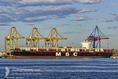
MSC MELINE
Cargo A
Current Trip
| Time Travelled | 12 h, 48 mins |
|---|---|
| Remaining Time | 1 h, 22 mins |
| Distance Travelled | 147.02 nm |
| Remaining Distance | 27.14 nm |
| AVG Speed | 11.7 Knopen |
| MAX Speed | 13.1 Knopen |
| AVG Wind | 5 knots |
| MAX Wind | 9 knots |
| MIN Temp | 24.9°C / 76.82°F |
| MAX Temp | 26.2°C / 79.16°F |
| Diepgang | 9.8 M |
| Positie ontvangen | 34 m geleden |
Current Position
| Lengtegraad | --- |
|---|---|
| Breedtegraat | --- |
| Status | Under way using engine |
| Snelheid | 1.7 Knopen |
| Koers | 270° |
| Gebied | South Atlantic Ocean |
| Station | T-AIS |
| Positie ontvangen | 34 m geleden |
Info
Information
The current position of MSC MELINE is in South Atlantic Ocean with coordinates -25.74589° / -48.14333° as reported on 2026-01-08 14:15 by AIS to our vessel tracker app. The vessel's current speed is 1.7 Knopen and is heading at the port of PARANAGUA. The estimated time of arrival as calculated by MyShipTracking vessel tracking app is 2026-01-08 13:12 LT
The vessel MSC MELINE (IMO: 9702077, MMSI: 255806497) is a Cargo A It's sailing under the flag of [PT] Portugal.
In this page you can find informations about the vessels current position, last detected port calls, and current voyage information. If the vessels is not in coverage by AIS you will find the latest position.
The current position of MSC MELINE is detected by our AIS receivers and we are not responsible for the reliability of the data. The last position was recorded while the vessel was in Coverage by the Ais receivers of our vessel tracking app.
The current draught of MSC MELINE as reported by AIS is 9.8 meters
Weather
| Temperature | 25.4°C / 77.72°F |
|---|---|
| Wind Speed | 2 knots |
| Direction | 118° ESE |
| Pressure | 1014.2 hPa |
| Humidity | 78.6 % |
| Cloud Coverage | 48 % |
Featured Company
Last Port Calls
| Port | Arrival | Departure | Time In Port |
|---|---|---|---|
| 2026-01-07 03:22 | 2026-01-07 23:02 | 19 h | |
| 2026-01-05 23:07 | 2026-01-05 23:13 | 6 m | |
| 2026-01-02 16:29 | 2026-01-03 11:58 | 19 h | |
| 2025-12-22 22:02 | 2025-12-24 17:27 | 1 d | |
| 2025-12-18 20:05 | 2025-12-21 06:38 | 2 d | |
| 2025-12-15 10:28 | 2025-12-17 09:04 | 1 d | |
| 2025-12-13 08:42 | 2025-12-14 06:10 | 21 h | |
| 2025-12-10 10:45 | 2025-12-12 13:56 | 2 d | |
| 2025-12-05 15:14 | 2025-12-07 19:41 | 2 d | |
| 2025-11-29 12:46 | 2025-11-29 22:23 | 9 h |
Most Visited Ports (Last year)
| Port | Arrivals | |
|---|---|---|
| 12 | ||
| 10 | ||
| 7 | ||
| 5 | ||
| 5 | ||
| 5 |
Last Trips
| Origin | Departure | Destination | Arrival | Distance | |
|---|---|---|---|---|---|
| 2026-01-05 23:13 | 2026-01-07 03:22 | 227.56 nm | |||
| 2026-01-03 11:58 | 2026-01-05 23:07 | 1077.49 nm | |||
| 2025-12-24 17:27 | 2026-01-02 16:29 | 3584.08 nm | |||
| 2025-12-21 06:38 | 2025-12-22 22:02 | 530.99 nm | |||
| 2025-12-17 09:04 | 2025-12-18 20:05 | 106.27 nm | |||
| 2025-12-14 06:10 | 2025-12-15 10:28 | 389.99 nm | |||
| 2025-12-12 13:56 | 2025-12-13 08:42 | 199.24 nm | |||
| 2025-12-07 19:41 | 2025-12-10 10:45 | 1120.94 nm | |||
| 2025-11-29 22:23 | 2025-12-05 15:14 | 2348.93 nm | |||
| 2025-11-25 05:57 | 2025-11-29 12:46 | 1551.65 nm |
Events
| Tijd | Evenement | Details | Positie / Bestemming | Info |
|---|---|---|---|---|
| 2026-01-08 14:22 | Status Changed | Default Under way using engine |
-25.74530 / -48.14666
BRPNG
|
Snelheid: 1.7 kn Koers: 270° |
| 2026-01-08 14:15 | Status Changed | Under way using engine Default |
-25.74589 / -48.14333
BRPNG
|
Snelheid: 1.7 kn Koers: 272° |
| 2026-01-08 13:53 | Status Changed | Default Under way using engine |
-25.74516 / -48.12832
BRPNG
|
Snelheid: 5.3 kn Koers: 217.9° |
| 2026-01-08 13:43 | Status Changed | Under way using engine Default |
-25.73376 / -48.11745
BRPNG
|
Snelheid: 8 kn Koers: 228° |
| 2026-01-08 13:06 | Status Changed | Default Under way using engine |
-25.66023 / -48.02955
BRPNG
|
Snelheid: 12.3 kn Koers: 230.7° |
| 2026-01-08 12:30 | Status Changed | Under way using engine Default |
-25.58122 / -47.92624
BRPNG
|
Snelheid: 12.2 kn Koers: 230° |
| 2026-01-08 12:22 | Binnenbereik |
-25.58122 / -47.92624
South Atlantic Ocean
BRPNG
|
Snelheid: 12.2 kn Koers: 230.5° |
|
| 2026-01-08 09:30 | Status Changed | Default Under way using engine |
-25.17529 / -47.40083
BRPNG
|
Snelheid: 12.6 kn Koers: 229.2° |
| 2026-01-08 09:25 | Buitenbereik |
-25.16451 / -47.38723
South Atlantic Ocean
BRPNG
|
Snelheid: 12.6 kn Koers: 229.2° |
|
| 2026-01-08 09:23 | Status Changed | Under way using engine Default |
-25.15752 / -47.37844
BRPNG
|
Snelheid: 12.6 kn Koers: 230° |