
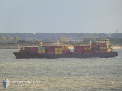
MSC KAYLA
Container Ship
Current Trip
| Time Travelled | 3 days |
|---|---|
| Remaining Time | 21 h, 15 mins |
| Distance Travelled | 1185.69 nm |
| Remaining Distance | 347.92 nm |
| AVG Speed | 15.6 Knopen |
| MAX Speed | 19.1 Knopen |
| AVG Wind | 6.7 knots |
| MAX Wind | 20 knots |
| MIN Temp | 6.2°C / 43.16°F |
| MAX Temp | 13°C / 55.4°F |
| Diepgang | 10.4 M |
| Positie ontvangen | 9 h, 30 m geleden |
Current Position
| Lengtegraad | 17.22735° |
|---|---|
| Breedtegraat | 56.24318° |
| Status | Under way using engine |
| Snelheid | 16.2 Knopen |
| Koers | 51.3° |
| Gebied | Baltic Sea |
| Station | T-AIS |
| Positie ontvangen | 9 h, 30 m geleden |
Info
Information
The current position of MSC KAYLA is in Baltic Sea with coordinates 56.24318° / 17.22735° as reported on 2024-05-11 16:59 by AIS to our vessel tracker app. The vessel's current speed is 16.2 Knopen and is heading at the port of ST PETERSBURG. The estimated time of arrival as calculated by MyShipTracking vessel tracking app is 2024-05-12 23:44 LT
The vessel MSC KAYLA (IMO: 9242637, MMSI: 636018491) is a Container Ship that was built in 2002 ( 22 Jaar oud ). It's sailing under the flag of [LR] Liberia.
In this page you can find informations about the vessels current position, last detected port calls, and current voyage information. If the vessels is not in coverage by AIS you will find the latest position.
The current position of MSC KAYLA is detected by our AIS receivers and we are not responsible for the reliability of the data. The last position was recorded while the vessel was in Coverage by the Ais receivers of our vessel tracking app.
The current draught of MSC KAYLA as reported by AIS is 10.4 meters
Weather
| Temperature | 6.4°C / 43.52°F |
|---|---|
| Wind Speed | 6 knots |
| Direction | 318° NW |
| Pressure | 1025.7 hPa |
| Humidity | 79.3 % |
| Cloud Coverage | 6 % |
Featured Company
Last Port Calls
| Port | Arrival | Departure | Time In Port |
|---|---|---|---|
| 2024-05-07 13:45 | 2024-05-09 01:08 | 1 d | |
| 2024-04-28 21:51 | 2024-04-29 14:28 | 16 h | |
| 2024-04-23 04:31 | 2024-04-24 10:01 | 1 d | |
| 2024-04-17 09:31 | 2024-04-18 13:14 | 1 d | |
| 2024-04-08 04:55 | 2024-04-09 11:39 | 1 d | |
| 2024-04-05 15:33 | 2024-04-06 19:12 | 1 d | |
| 2024-03-29 11:37 | 2024-04-01 09:53 | 2 d | |
| 2024-03-20 04:49 | 2024-03-21 09:22 | 1 d | |
| 2024-03-14 19:31 | 2024-03-15 19:51 | 1 d | |
| 2024-03-08 17:21 | 2024-03-10 11:05 | 1 d |
Most Visited Ports (Last year)
| Port | Arrivals | |
|---|---|---|
| 19 | ||
| 15 | ||
| 15 | ||
| 3 | ||
| 3 | ||
| 2 |
Last Trips
| Origin | Departure | Destination | Arrival | Distance | |
|---|---|---|---|---|---|
| 2024-04-29 17:28 | 2024-05-07 15:45 | 1858.07 nm | |||
| 2024-04-24 13:01 | 2024-04-29 00:51 | 573.75 nm | |||
| 2024-04-18 15:14 | 2024-04-23 07:31 | 1533.01 nm | |||
| 2024-04-09 14:39 | 2024-04-17 11:31 | 1896.15 nm | |||
| 2024-04-06 22:12 | 2024-04-08 07:55 | 498.57 nm | |||
| 2024-04-01 11:53 | 2024-04-05 18:33 | 1532.25 nm | |||
| 2024-03-21 12:22 | 2024-03-29 12:37 | 1744.16 nm | |||
| 2024-03-15 20:51 | 2024-03-20 07:49 | 1529.72 nm | |||
| 2024-03-10 14:05 | 2024-03-14 20:31 | 1522.03 nm | |||
| 2024-03-04 08:19 | 2024-03-08 20:21 | 1530.96 nm |
Events
| Tijd | Evenement | Details | Positie / Bestemming | Info |
|---|---|---|---|---|
| 2024-05-11 17:04 | Status Changed | Default Under way using engine |
56.25941 / 17.26399
RULED
|
Snelheid: 16.2 kn Koers: 51.3° |
| 2024-05-11 16:59 | Status Changed | Under way using engine Default |
56.24318 / 17.22735
RULED
|
Snelheid: 16.2 kn Koers: 51° |
| 2024-05-11 16:59 | Buitenbereik |
56.24318 / 17.22735
Baltic Sea
RULED
|
Snelheid: 16.2 kn Koers: 51.3° |
|
| 2024-05-11 16:40 | Status Changed | Default Under way using engine |
56.19161 / 17.11182
RULED
|
Snelheid: 16.5 kn Koers: 51.4° |
| 2024-05-11 12:34 | Wijzig zee gebeid | Swedish part of the Baltic Sea Danish part of the Kattegat |
55.61020 / 15.43822
Baltic Sea
RULED
|
Snelheid: 16.2 kn Koers: 52.2° |
| 2024-05-11 08:44 | Wijzig zee gebeid | Danish part of the Kattegat Swedish part of the Baltic Sea |
54.99027 / 14.03402
Kattegat
RULED
|
Snelheid: 16 kn Koers: 70.5° |
| 2024-05-11 08:34 | Wijzig zee gebeid | Swedish part of the Baltic Sea German part of the Baltic Sea |
54.97616 / 13.96000
Baltic Sea
RULED
|
Snelheid: 16.2 kn Koers: 72.1° |
| 2024-05-11 07:27 | Status Changed | Under way using engine Default |
54.88838 / 13.46008
RULED
|
Snelheid: 16.3 kn Koers: 75° |
| 2024-05-11 07:17 | Status Changed | Default Under way using engine |
54.87579 / 13.38021
RULED
|
Snelheid: 16.1 kn Koers: 73.2° |
| 2024-05-11 07:09 | Status Changed | Under way using engine Default |
54.86663 / 13.32497
RULED
|
Snelheid: 16.1 kn Koers: 73° |