
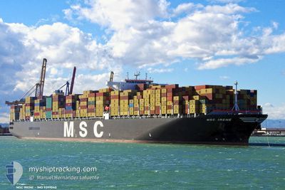
MSC IRENE
Container Ship
Current Trip
| Time Travelled | 26 days |
|---|---|
| Remaining Time | 2 days |
| Distance Travelled | 8921.21 nm |
| Remaining Distance | 879.08 nm |
| AVG Speed | 13.8 Knopen |
| MAX Speed | 18.4 Knopen |
| AVG Wind | 11.4 knots |
| MAX Wind | 33 knots |
| MIN Temp | 14.9°C / 58.82°F |
| MAX Temp | 30.1°C / 86.18°F |
| Diepgang | 16.1 M |
| Positie ontvangen | 21 h, 23 m geleden |
Current Position
| Lengtegraad | -18.04256° |
|---|---|
| Breedtegraat | 20.31492° |
| Status | Under way using engine |
| Snelheid | 13.9 Knopen |
| Koers | 0.6° |
| Gebied | North Atlantic Ocean |
| Station | T-AIS |
| Positie ontvangen | 21 h, 23 m geleden |
Info
Information
The current position of MSC IRENE is in North Atlantic Ocean with coordinates 20.31492° / -18.04256° as reported on 2024-05-10 00:51 by AIS to our vessel tracker app. The vessel's current speed is 13.9 Knopen and is heading at the port of SINES. The estimated time of arrival as calculated by MyShipTracking vessel tracking app is 2024-05-13 14:49 LT
The vessel MSC IRENE (IMO: 9399040, MMSI: 355233000) is a Container Ship that was built in 2010 ( 14 Jaar oud ). It's sailing under the flag of [PA] Panama.
In this page you can find informations about the vessels current position, last detected port calls, and current voyage information. If the vessels is not in coverage by AIS you will find the latest position.
The current position of MSC IRENE is detected by our AIS receivers and we are not responsible for the reliability of the data. The last position was recorded while the vessel was in Coverage by the Ais receivers of our vessel tracking app.
The current draught of MSC IRENE as reported by AIS is 16.1 meters
Weather
| Temperature | 19.6°C / 67.28°F |
|---|---|
| Wind Speed | 19 knots |
| Direction | 31° NNE |
| Pressure | 1014.6 hPa |
| Humidity | 89.4 % |
| Cloud Coverage | --- |
Featured Company
Last Port Calls
| Port | Arrival | Departure | Time In Port |
|---|---|---|---|
| 2024-04-12 23:42 | 2024-04-14 13:34 | 1 d | |
| 2024-04-06 09:29 | 2024-04-07 05:13 | 19 h | |
| 2024-04-01 20:09 | 2024-04-02 11:23 | 15 h | |
| 2024-03-31 10:18 | 2024-03-31 23:30 | 13 h | |
| 2024-03-29 06:05 | 2024-03-31 04:30 | 1 d | |
| 2024-03-25 03:13 | 2024-03-27 12:15 | 2 d | |
| 2024-03-22 05:53 | 2024-03-24 00:51 | 1 d | |
| 2024-03-14 08:57 | 2024-03-15 07:42 | 22 h | |
| 2024-03-10 10:19 | 2024-03-12 02:16 | 1 d |
Most Visited Ports (Last year)
| Port | Arrivals | |
|---|---|---|
| 5 | ||
| 5 | ||
| 5 | ||
| 4 | ||
| 3 | ||
| 3 |
Last Trips
| Origin | Departure | Destination | Arrival | Distance | |
|---|---|---|---|---|---|
| 2024-04-07 10:43 | 2024-04-13 05:12 | 542.12 nm | |||
| 2024-04-02 15:23 | 2024-04-06 14:59 | 1261.01 nm | |||
| 2024-04-01 02:30 | 2024-04-02 00:09 | 327.43 nm | |||
| 2024-03-31 07:30 | 2024-03-31 13:18 | 79.31 nm | |||
| 2024-03-27 16:15 | 2024-03-29 09:05 | 341.71 nm | |||
| 2024-03-24 04:51 | 2024-03-25 07:13 | 49.73 nm | |||
| 2024-03-15 13:12 | 2024-03-22 09:53 | 1326.82 nm | |||
| 2024-03-12 07:46 | 2024-03-14 14:27 | 918.74 nm | |||
| 2024-02-08 22:10 | 2024-03-10 15:49 | 10565.04 nm |
Events
| Tijd | Evenement | Details | Positie / Bestemming | Info |
|---|---|---|---|---|
| 2024-05-10 00:58 | Status Changed | Default Under way using engine |
20.34333 / -18.04167
PTSIE
|
Snelheid: 13.9 kn Koers: 0.6° |
| 2024-05-10 00:51 | Buitenbereik |
20.31492 / -18.04256
North Atlantic Ocean
PTSIE
|
Snelheid: 13.9 kn Koers: 0.6° |
|
| 2024-05-10 00:34 | Gevonden in zee | Western Saharan part of the North Atlantic Ocean |
20.25089 / -18.04422
North Atlantic Ocean
PTSIE
|
Snelheid: 13.9 kn Koers: 0.7° |
| 2024-05-10 00:33 | Status Changed | Under way using engine Default |
20.24652 / -18.04428
PTSIE
|
Snelheid: 13.9 kn Koers: 2° |
| 2024-05-10 00:33 | Binnenbereik |
20.25089 / -18.04422
North Atlantic Ocean
PTSIE
|
Snelheid: 13.9 kn Koers: 0.7° |
|
| 2024-05-09 19:34 | Status Changed | Default Under way using engine |
19.07796 / -18.02486
PTSIE
|
Snelheid: 13.8 kn Koers: 359.2° |
| 2024-05-09 19:28 | Buitenbereik |
19.05355 / -18.02404
North Atlantic Ocean
PTSIE
|
Snelheid: 13.8 kn Koers: 359.2° |
|
| 2024-05-09 19:25 | Status Changed | Under way using engine Default |
19.04264 / -18.02375
PTSIE
|
Snelheid: 13.6 kn Koers: 358° |
| 2024-05-09 19:22 | Status Changed | Default Under way using engine |
19.03180 / -18.02347
PTSIE
|
Snelheid: 13.7 kn Koers: 358.3° |
| 2024-05-09 19:14 | Status Changed | Under way using engine Default |
19.00137 / -18.02288
PTSIE
|
Snelheid: 14.3 kn Koers: 359° |