
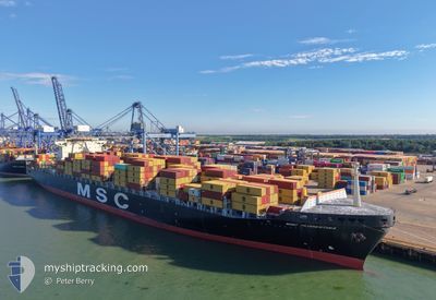
MSC FLORENTINA
Container Ship
Current Trip
| Time Travelled | 2 days |
|---|---|
| Remaining Time | 1 day |
| Distance Travelled | 598.93 nm |
| Remaining Distance | 866.68 nm |
| AVG Speed | 12.6 Knopen |
| MAX Speed | 20.2 Knopen |
| AVG Wind | 15.1 knots |
| MAX Wind | 38 knots |
| MIN Temp | 5.1°C / 41.18°F |
| MAX Temp | 13°C / 55.4°F |
| Diepgang | 14 M |
| Positie ontvangen | 3 h, 17 m geleden |
Current Position
| Lengtegraad | --- |
|---|---|
| Breedtegraat | --- |
| Status | Under way using engine |
| Snelheid | 20 Knopen |
| Koers | 252.1° |
| Gebied | English Channel |
| Station | T-AIS |
| Positie ontvangen | 3 h, 17 m geleden |
Info
Information
The current position of MSC FLORENTINA is in English Channel with coordinates 50.27251° / -1.33708° as reported on 2025-12-06 02:21 by AIS to our vessel tracker app. The vessel's current speed is 20 Knopen and is heading at the port of SINES. The estimated time of arrival as calculated by MyShipTracking vessel tracking app is 2025-12-08 02:15 LT
The vessel MSC FLORENTINA (IMO: 9251705, MMSI: 352870000) is a Container Ship that was built in 2003 ( 22 Jaar oud ). It's sailing under the flag of [PA] Panama.
In this page you can find informations about the vessels current position, last detected port calls, and current voyage information. If the vessels is not in coverage by AIS you will find the latest position.
The current position of MSC FLORENTINA is detected by our AIS receivers and we are not responsible for the reliability of the data. The last position was recorded while the vessel was in Coverage by the Ais receivers of our vessel tracking app.
The current draught of MSC FLORENTINA as reported by AIS is 14 meters
Weather
| Temperature | 12°C / 53.6°F |
|---|---|
| Wind Speed | 32 knots |
| Direction | 249° WSW |
| Pressure | 996.3 hPa |
| Humidity | 80.9 % |
| Cloud Coverage | 88 % |
Featured Company
Last Port Calls
| Port | Arrival | Departure | Time In Port |
|---|---|---|---|
| 2025-12-01 07:58 | 2025-12-04 01:45 | 2 d | |
| 2025-11-29 13:11 | 2025-11-30 07:46 | 18 h | |
| 2025-11-26 22:35 | 2025-11-28 01:39 | 1 d | |
| 2025-11-24 23:10 | 2025-11-25 20:49 | 21 h | |
| 2025-11-21 13:40 | 2025-11-22 12:25 | 22 h | |
| 2025-11-18 10:34 | 2025-11-19 01:51 | 15 h | |
| 2025-11-13 07:08 | 2025-11-14 03:09 | 20 h | |
| 2025-11-12 04:52 | 2025-11-12 16:28 | 11 h | |
| 2025-11-11 14:21 | 2025-11-12 00:12 | 9 h | |
| 2025-11-10 10:03 | 2025-11-11 10:51 | 1 d |
Last Trips
| Origin | Departure | Destination | Arrival | Distance | |
|---|---|---|---|---|---|
| 2025-11-30 07:46 | 2025-12-01 07:58 | 160.31 nm | |||
| 2025-11-28 01:39 | 2025-11-29 13:11 | 393.19 nm | |||
| 2025-11-25 20:49 | 2025-11-26 22:35 | 188.73 nm | |||
| 2025-11-22 12:25 | 2025-11-24 23:10 | 330.40 nm | |||
| 2025-11-19 01:51 | 2025-11-21 13:40 | 969.83 nm | |||
| 2025-11-14 03:09 | 2025-11-18 10:34 | 1918.68 nm | |||
| 2025-11-12 16:28 | 2025-11-13 07:08 | 208.71 nm | |||
| 2025-11-12 00:12 | 2025-11-12 04:52 | 59.10 nm | |||
| 2025-11-11 10:51 | 2025-11-11 14:21 | 47.36 nm | |||
| 2025-11-09 07:46 | 2025-11-10 10:03 | 372.51 nm |
Events
| Tijd | Evenement | Details | Positie / Bestemming | Info |
|---|---|---|---|---|
| 2025-12-06 02:27 | Status Changed | Default Under way using engine |
50.26209 / -1.38906
PTSIE
|
Snelheid: 20 kn Koers: 252.1° |
| 2025-12-06 02:21 | Status Changed | Under way using engine Default |
50.27251 / -1.33708
PTSIE
|
Snelheid: 20 kn Koers: 253° |
| 2025-12-06 02:21 | Buitenbereik |
50.27251 / -1.33708
English Channel
PTSIE
|
Snelheid: 20 kn Koers: 252.1° |
|
| 2025-12-06 01:31 | Status Changed | Default Under way using engine |
50.34980 / -.92688
PTSIE
|
Snelheid: 19 kn Koers: 252° |
| 2025-12-05 23:09 | Status Changed | Under way using engine Default |
50.54612 / .09343
PTSIE
|
Snelheid: 14.9 kn Koers: 260° |
| 2025-12-05 22:53 | Binnenbereik |
50.54612 / .09343
English Channel
PTSIE
|
Snelheid: 15.1 kn Koers: 261.3° |
|
| 2025-12-05 20:09 | Status Changed | Default Under way using engine |
50.87004 / 1.06619
PTSIE
|
Snelheid: 16.1 kn Koers: 228.1° |
| 2025-12-05 20:00 | Buitenbereik |
50.89506 / 1.11074
English Channel
PTSIE
|
Snelheid: 16.1 kn Koers: 228.1° |
|
| 2025-12-05 19:05 | Wijzig zee gebeid | United Kingdom part of the English Channel United Kingdom part of the North Sea |
51.07018 / 1.45253
English Channel
PTSIE
|
Snelheid: 18.9 kn Koers: 234.4° |
| 2025-12-05 14:14 | Gevonden in zee | United Kingdom part of the North Sea |
51.81649 / 2.48956
North Sea
PTSIE
|
Snelheid: 9.1 kn Koers: 221.9° |