
MORNING CAROL
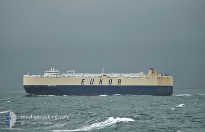
Vehicles Carrier
Current Trip
KR KUV
| Time Travelled | 1 day |
|---|---|
| Remaining Time | --- |
| Distance Travelled | 434.23 nm |
| Remaining Distance | --- |
| AVG Speed | 16.6 Knopen |
| MAX Speed | 19 Knopen |
| AVG Wind | 15.2 knots |
| MAX Wind | 26 knots |
| MIN Temp | 11.1°C / 51.98°F |
| MAX Temp | 14.8°C / 58.64°F |
| Diepgang | 8.4 M |
| Positie ontvangen | 36 m geleden |
Current Position
| Lengtegraad | 118.74881° |
|---|---|
| Breedtegraat | 38.79999° |
| Status | Under way using engine |
| Snelheid | 16.9 Knopen |
| Koers | 284.6° |
| Gebied | Yellow Sea |
| Station | T-AIS |
| Positie ontvangen | 36 m geleden |
Info
Information
The current position of MORNING CAROL is in Yellow Sea with coordinates 38.79999° / 118.74881° as reported on 2024-05-06 15:11 by AIS to our vessel tracker app. The vessel's current speed is 16.9 Knopen
The vessel MORNING CAROL (IMO: 9336086, MMSI: 311000685) is a Vehicles Carrier that was built in 2008 ( 16 Jaar oud ). It's sailing under the flag of [BS] Bahamas.
In this page you can find informations about the vessels current position, last detected port calls, and current voyage information. If the vessels is not in coverage by AIS you will find the latest position.
The current position of MORNING CAROL is detected by our AIS receivers and we are not responsible for the reliability of the data. The last position was recorded while the vessel was in Coverage by the Ais receivers of our vessel tracking app.
The current draught of MORNING CAROL as reported by AIS is 8.4 meters
Weather
| Temperature | 14.8°C / 58.64°F |
|---|---|
| Wind Speed | 11 knots |
| Direction | 324° NW |
| Pressure | 1014.1 hPa |
| Humidity | 68.1 % |
| Cloud Coverage | 76 % |
Featured Company
Last Port Calls
| Port | Arrival | Departure | Time In Port |
|---|---|---|---|
| 2024-05-04 16:34 | 2024-05-05 14:13 | 21 h | |
| 2024-05-03 20:16 | 2024-05-04 07:48 | 11 h | |
| 2024-04-29 22:06 | 2024-04-30 05:22 | 7 h | |
| 2024-04-18 12:20 | 2024-04-19 01:39 | 13 h | |
| 2024-04-14 12:11 | 2024-04-15 09:21 | 21 h | |
| 2024-04-04 18:12 | 2024-04-04 21:35 | 3 h | |
| 2024-04-04 18:06 | |||
| 2024-04-04 10:30 | |||
| 2024-03-30 03:38 | 2024-03-31 04:02 | 1 d | |
| 2024-03-17 18:46 | 2024-03-18 21:53 | 1 d |
Most Visited Ports (Last year)
| Port | Arrivals | |
|---|---|---|
| 4 | ||
| 3 | ||
| 3 | ||
| 2 | ||
| 2 | ||
| 2 |
Last Trips
| Origin | Departure | Destination | Arrival | Distance | |
|---|---|---|---|---|---|
| 2024-05-04 16:48 | 2024-05-05 01:34 | 132.06 nm | |||
| 2024-04-30 14:22 | 2024-05-04 05:16 | 1269.34 nm | |||
| 2024-04-18 18:39 | 2024-04-30 07:06 | 4399.87 nm | |||
| 2024-04-15 02:21 | 2024-04-18 05:20 | 1148.87 nm | |||
| 2024-04-04 16:35 | 2024-04-14 05:11 | 3112.82 nm | |||
| 2024-03-31 00:02 | 2024-04-04 13:12 | 1572.64 nm | |||
| 2024-03-31 00:02 | 2024-04-04 13:06 | 1572.63 nm | |||
| 2024-03-31 00:02 | 2024-04-04 05:30 | 1572.47 nm | |||
| 2024-03-18 21:53 | 2024-03-29 23:38 | 3878.54 nm | |||
| 2024-03-15 21:28 | 2024-03-17 18:46 | 726.45 nm |
Events
| Tijd | Evenement | Details | Positie / Bestemming | Info |
|---|---|---|---|---|
| 2024-05-06 15:20 | Status Changed | Default Under way using engine |
38.81291 / 118.69467
KR KUV
|
Snelheid: 16.9 kn Koers: 284.6° |
| 2024-05-06 15:05 | Wijzig zee gebeid | Chinese part of the Yellow Sea South Korean part of the Yellow Sea |
38.79357 / 118.78400
Yellow Sea
|
Snelheid: 16.9 kn Koers: 282° |
| 2024-05-06 15:02 | Status Changed | Under way using engine Default |
38.79111 / 118.79877
KR KUV
|
Snelheid: 16.9 kn Koers: 282° |
| 2024-05-06 14:52 | Binnenbereik |
38.79357 / 118.78400
Yellow Sea
|
Snelheid: 16.9 kn Koers: 282° |
|
| 2024-05-05 14:13 | Start beweging | 0.95 nm, West of GUNSAN |
35.98000 / 126.57166
KR KUV
|
Snelheid: 5 kn Koers: -1° |
| 2024-05-05 14:13 | Vertrekhaven |
|
35.98000 / 126.57166
KR KUV
|
Snelheid: 1 kn Koers: -1° |
| 2024-05-04 16:34 | Stop beweging |
35.97500 / 126.57500
[KR] GUNSAN
|
Snelheid: Koers: -1° |
|
| 2024-05-04 16:34 | Aankomsthaven |
|
35.97500 / 126.57500
[KR] GUNSAN
|
Snelheid: 4 kn Koers: -1° |
| 2024-05-04 13:31 | Status Changed | Default Under way using engine |
36.06833 / 125.82166
KR KUV
|
Snelheid: 16.5 kn Koers: 167.1° |
| 2024-05-04 13:17 | Buitenbereik |
36.13333 / 125.81301
Yellow Sea
KR KUV
|
Snelheid: 16.5 kn Koers: 167.1° |