
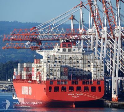
MONTE TAMARO
Container Ship
Current Trip
| Time Travelled | 8 days |
|---|---|
| Remaining Time | 1 day |
| Distance Travelled | 4085.87 nm |
| Remaining Distance | 651.17 nm |
| AVG Speed | 19.4 Knopen |
| MAX Speed | 21.8 Knopen |
| AVG Wind | 11.8 knots |
| MAX Wind | 19 knots |
| MIN Temp | 23.7°C / 74.66°F |
| MAX Temp | 29°C / 84.2°F |
| Diepgang | 10 M |
| Positie ontvangen | 6 d geleden |
Current Position
| Lengtegraad | -64.40394° |
|---|---|
| Breedtegraat | 19.55762° |
| Status | Under way using engine |
| Snelheid | 19 Knopen |
| Koers | 119° |
| Gebied | North Atlantic Ocean |
| Station | T-AIS |
| Positie ontvangen | 6 d geleden |
Info
Information
The current position of MONTE TAMARO is in North Atlantic Ocean with coordinates 19.55762° / -64.40394° as reported on 2024-05-07 01:11 by AIS to our vessel tracker app. The vessel's current speed is 19 Knopen and is heading at the port of SANTOS. The estimated time of arrival as calculated by MyShipTracking vessel tracking app is 2024-05-14 15:56 LT
The vessel MONTE TAMARO (IMO: 9357949, MMSI: 563052100) is a Container Ship that was built in 2007 ( 17 Jaar oud ). It's sailing under the flag of [SG] Singapore.
In this page you can find informations about the vessels current position, last detected port calls, and current voyage information. If the vessels is not in coverage by AIS you will find the latest position.
The current position of MONTE TAMARO is detected by our AIS receivers and we are not responsible for the reliability of the data. The last position was recorded while the vessel was in Coverage by the Ais receivers of our vessel tracking app.
The current draught of MONTE TAMARO as reported by AIS is 10 meters
Weather
| Temperature | 26.5°C / 79.7°F |
|---|---|
| Wind Speed | 8 knots |
| Direction | 17° NNE |
| Pressure | 1015.2 hPa |
| Humidity | 72.2 % |
| Cloud Coverage | 5 % |
Featured Company
Last Port Calls
| Port | Arrival | Departure | Time In Port |
|---|---|---|---|
| 2024-05-04 01:32 | 2024-05-04 19:14 | 17 h | |
| 2024-04-30 22:24 | 2024-05-01 13:18 | 14 h | |
| 2024-04-28 05:11 | 2024-04-28 19:37 | 14 h | |
| 2024-04-26 15:30 | 2024-04-27 06:01 | 14 h | |
| 2024-04-24 08:32 | 2024-04-25 07:31 | 22 h | |
| 2024-04-15 18:32 | 2024-04-16 03:12 | 8 h | |
| 2024-04-13 04:51 | 2024-04-13 11:19 | 6 h | |
| 2024-04-09 20:37 | 2024-04-10 22:11 | 1 d | |
| 2024-04-05 13:06 | 2024-04-06 06:26 | 17 h | |
| 2024-03-31 00:35 | 2024-03-31 19:48 | 19 h |
Most Visited Ports (Last year)
| Port | Arrivals | |
|---|---|---|
| 9 | ||
| 6 | ||
| 6 | ||
| 5 | ||
| 5 | ||
| 5 |
Last Trips
| Origin | Departure | Destination | Arrival | Distance | |
|---|---|---|---|---|---|
| 2024-05-01 13:18 | 2024-05-04 01:32 | 549.29 nm | |||
| 2024-04-28 19:37 | 2024-04-30 22:24 | 426.83 nm | |||
| 2024-04-27 06:01 | 2024-04-28 05:11 | 265.94 nm | |||
| 2024-04-25 07:31 | 2024-04-26 15:30 | 287.38 nm | |||
| 2024-04-16 03:12 | 2024-04-24 08:32 | 3344.47 nm | |||
| 2024-04-13 11:19 | 2024-04-15 18:32 | 850.05 nm | |||
| 2024-04-10 22:11 | 2024-04-13 04:51 | 957.29 nm | |||
| 2024-04-06 06:26 | 2024-04-09 20:37 | 211.45 nm | |||
| 2024-03-31 19:48 | 2024-04-05 13:06 | 920.16 nm | |||
| 2024-03-27 21:05 | 2024-03-31 00:35 | 1005.89 nm |
Events
| Tijd | Evenement | Details | Positie / Bestemming | Info |
|---|---|---|---|---|
| 2024-05-07 01:11 | Buitenbereik |
19.55762 / -64.40394
North Atlantic Ocean
USPEV > BRSSZ
|
Snelheid: 19 kn Koers: 119° |
|
| 2024-05-06 22:58 | Wijzig zee gebeid | British Virgin Islands part of the North Atlantic Ocean Bahamas part of the North Atlantic Ocean |
19.91132 / -65.06820
North Atlantic Ocean
USPEV > BRSSZ
|
Snelheid: 19 kn Koers: 116° |
| 2024-05-06 22:58 | Status Changed | Under way using engine Default |
19.91132 / -65.06820
USPEV > BRSSZ
|
Snelheid: 19 kn Koers: 117° |
| 2024-05-06 22:45 | Binnenbereik |
19.91132 / -65.06820
North Atlantic Ocean
USPEV > BRSSZ
|
Snelheid: 19 kn Koers: 116° |
|
| 2024-05-05 11:42 | Status Changed | Default Under way using engine |
25.49000 / -76.02666
USPEV > BRSSZ
|
Snelheid: 20.5 kn Koers: 118.3° |
| 2024-05-05 11:41 | Buitenbereik |
25.49413 / -76.03223
North Atlantic Ocean
USPEV > BRSSZ
|
Snelheid: 20.5 kn Koers: 118.3° |
|
| 2024-05-05 11:29 | Status Changed | Under way using engine Default |
25.52970 / -76.10354
USPEV > BRSSZ
|
Snelheid: 20.5 kn Koers: 116° |
| 2024-05-05 11:21 | Status Changed | Default Under way using engine |
25.54667 / -76.14333
USPEV > BRSSZ
|
Snelheid: 20.5 kn Koers: 116.4° |
| 2024-05-05 11:18 | Status Changed | Under way using engine Default |
25.55753 / -76.16535
USPEV > BRSSZ
|
Snelheid: 20 kn Koers: 116° |
| 2024-05-05 10:54 | Status Changed | Default Under way using engine |
25.61946 / -76.30098
USPEV > BRSSZ
|
Snelheid: 20.3 kn Koers: 117.6° |