
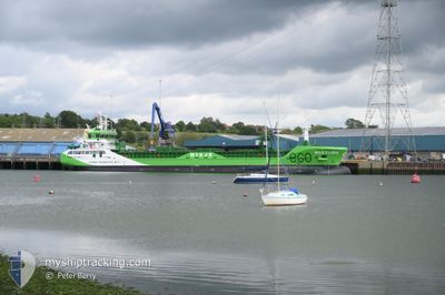
MISJE FLORA
Cargo
Current Trip
| Time Travelled | 2 days |
|---|---|
| Remaining Time | 8 h, 14 mins |
| Distance Travelled | 587.59 nm |
| Remaining Distance | 84.10 nm |
| AVG Speed | 8 Knopen |
| MAX Speed | 11.2 Knopen |
| AVG Wind | 17.9 knots |
| MAX Wind | 27 knots |
| MIN Temp | -0.4°C / 31.28°F |
| MAX Temp | 9.6°C / 49.28°F |
| Diepgang | 6.7 M |
| Positie ontvangen | 1 h, 33 m geleden |
Current Position
| Lengtegraad | --- |
|---|---|
| Breedtegraat | --- |
| Status | Under way using engine |
| Snelheid | 9.9 Knopen |
| Koers | 228.5° |
| Gebied | North Sea |
| Station | T-AIS |
| Positie ontvangen | 1 h, 33 m geleden |
Info
Information
The current position of MISJE FLORA is in North Sea with coordinates 53.11654° / 4.31316° as reported on 2025-12-05 13:12 by AIS to our vessel tracker app. The vessel's current speed is 9.9 Knopen and is heading at the port of DORDRECHT. The estimated time of arrival as calculated by MyShipTracking vessel tracking app is 2025-12-06 00:00 LT
The vessel MISJE FLORA (IMO: 9950698, MMSI: 257537000) is a Cargo It's sailing under the flag of [NO] Norway.
In this page you can find informations about the vessels current position, last detected port calls, and current voyage information. If the vessels is not in coverage by AIS you will find the latest position.
The current position of MISJE FLORA is detected by our AIS receivers and we are not responsible for the reliability of the data. The last position was recorded while the vessel was in Coverage by the Ais receivers of our vessel tracking app.
The current draught of MISJE FLORA as reported by AIS is 6.7 meters
Weather
| Temperature | 8.7°C / 47.66°F |
|---|---|
| Wind Speed | 17 knots |
| Direction | 186° S |
| Pressure | 1008.1 hPa |
| Humidity | 82.4 % |
| Cloud Coverage | 95 % |
Featured Company
Last Port Calls
| Port | Arrival | Departure | Time In Port |
|---|---|---|---|
| 2025-12-02 00:32 | 2025-12-02 17:14 | 16 h | |
| 2025-11-27 18:57 | 2025-11-28 18:23 | 23 h | |
| 2025-11-18 10:21 | 2025-11-19 18:36 | 1 d | |
| 2025-11-11 08:26 | 2025-11-14 00:14 | 2 d | |
| 2025-11-03 17:42 | 2025-11-04 12:59 | 19 h | |
| 2025-10-30 23:49 | 2025-11-01 23:26 | 1 d | |
| 2025-10-19 22:25 | 2025-10-21 20:00 | 1 d |
Last Trips
| Origin | Departure | Destination | Arrival | Distance | |
|---|---|---|---|---|---|
| 2025-11-28 18:23 | 2025-12-02 00:32 | 718.78 nm | |||
| 2025-11-19 18:36 | 2025-11-27 18:57 | 1721.53 nm | |||
| 2025-11-14 00:14 | 2025-11-18 10:21 | 1019.38 nm | |||
| 2025-11-04 12:59 | 2025-11-11 08:26 | 616.73 nm | |||
| 2025-11-01 23:26 | 2025-11-03 17:42 | 434.01 nm | |||
| 2025-10-21 20:00 | 2025-10-30 23:49 | 1940.70 nm | |||
| 2025-09-26 21:21 | 2025-10-19 22:25 | 479.16 nm |
Events
| Tijd | Evenement | Details | Positie / Bestemming | Info |
|---|---|---|---|---|
| 2025-12-05 13:13 | Status Changed | Default Under way using engine |
53.11471 / 4.30976
NLDOR
|
Snelheid: 9.9 kn Koers: 228.5° |
| 2025-12-05 13:12 | Buitenbereik |
53.11654 / 4.31316
North Sea
NLDOR
|
Snelheid: 9.9 kn Koers: 228.5° |
|
| 2025-12-05 11:25 | ETA Changed | 2025/12/05 21:00 2025/12/05 11:00 |
53.38046 / 4.52648
NLDOR
|
Snelheid: 10.1 kn Koers: 199.6° |
| 2025-12-05 11:15 | Status Changed | Under way using engine Default |
53.40577 / 4.54093
NLDOR
|
Snelheid: 10.1 kn Koers: 201° |
| 2025-12-05 11:15 | Binnenbereik |
53.40523 / 4.54065
North Sea
NLDOR
|
Snelheid: 10.3 kn Koers: 194.3° |
|
| 2025-12-05 10:00 | Status Changed | Default Under way using engine |
53.60254 / 4.65375
NLDOR
|
Snelheid: 9.8 kn Koers: 196° |
| 2025-12-05 09:59 | Buitenbereik |
53.60302 / 4.65402
North Sea
NLDOR
|
Snelheid: 9.8 kn Koers: 196° |
|
| 2025-12-05 09:49 | Gevonden in zee | Dutch part of the North Sea |
53.62968 / 4.67145
North Sea
NLDOR
|
Snelheid: 9.5 kn Koers: 203.1° |
| 2025-12-05 09:49 | Status Changed | Under way using engine Default |
53.62968 / 4.67145
NLDOR
|
Snelheid: 9.6 kn Koers: 201° |
| 2025-12-05 09:38 | Binnenbereik |
53.62968 / 4.67145
North Sea
NLDOR
|
Snelheid: 9.5 kn Koers: 203.1° |