
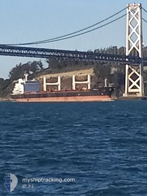
MDS ARIADNE
Bulk Carrier
Current Trip
| Time Travelled | 18 days |
|---|---|
| Remaining Time | 1 day |
| Distance Travelled | 4571.90 nm |
| Remaining Distance | 529.75 nm |
| AVG Speed | 10.7 Knopen |
| MAX Speed | 13.7 Knopen |
| AVG Wind | 17.8 knots |
| MAX Wind | 32 knots |
| MIN Temp | 7.2°C / 44.96°F |
| MAX Temp | 21.6°C / 70.88°F |
| Diepgang | 10 M |
| Positie ontvangen | 1 d geleden |
Current Position
| Lengtegraad | --- |
|---|---|
| Breedtegraat | --- |
| Status | Under way using engine |
| Snelheid | 10.4 Knopen |
| Koers | 106.3° |
| Gebied | Mediterranean Sea - Eastern Basin |
| Station | T-AIS |
| Positie ontvangen | 1 d geleden |
Info
Information
The current position of MDS ARIADNE is in Mediterranean Sea - Eastern Basin with coordinates 35.70806° / 14.96342° as reported on 2025-12-07 03:54 by AIS to our vessel tracker app. The vessel's current speed is 10.4 Knopen and is heading at the port of ALEXANDRIA. The estimated time of arrival as calculated by MyShipTracking vessel tracking app is 2025-12-10 06:32 LT
The vessel MDS ARIADNE (IMO: 9482770, MMSI: 538003692) is a Bulk Carrier that was built in 2012 ( 13 Jaar oud ). It's sailing under the flag of [MH] Marshall Is.
In this page you can find informations about the vessels current position, last detected port calls, and current voyage information. If the vessels is not in coverage by AIS you will find the latest position.
The current position of MDS ARIADNE is detected by our AIS receivers and we are not responsible for the reliability of the data. The last position was recorded while the vessel was in Coverage by the Ais receivers of our vessel tracking app.
The current draught of MDS ARIADNE as reported by AIS is 10 meters
Weather
| Temperature | 17.9°C / 64.22°F |
|---|---|
| Wind Speed | 18 knots |
| Direction | 338° NNW |
| Pressure | 1014.5 hPa |
| Humidity | 64.2 % |
| Cloud Coverage | 4 % |
Featured Company
Last Port Calls
| Port | Arrival | Departure | Time In Port |
|---|---|---|---|
| 2025-11-15 15:15 | 2025-11-19 19:37 | 4 d | |
| 2025-10-31 17:58 | 2025-11-06 08:37 | 5 d | |
| 2025-10-02 12:48 |
Last Trips
| Origin | Departure | Destination | Arrival | Distance | |
|---|---|---|---|---|---|
| 2025-11-06 08:37 | 2025-11-15 15:15 | 2158.79 nm | |||
| 2025-10-02 12:48 | 2025-10-31 17:58 | 6616.47 nm |
Events
| Tijd | Evenement | Details | Positie / Bestemming | Info |
|---|---|---|---|---|
| 2025-12-07 03:58 | Status Changed | Default Under way using engine |
35.70408 / 14.97758
EGALY
|
Snelheid: 10.4 kn Koers: 106.3° |
| 2025-12-07 03:54 | Buitenbereik |
35.70806 / 14.96342
Mediterranean Sea - Eastern Basin
EGALY
|
Snelheid: 10.4 kn Koers: 106.3° |
|
| 2025-12-07 03:53 | Status Changed | Under way using engine Default |
35.70878 / 14.96063
EGALY
|
Snelheid: 10.5 kn Koers: 112° |
| 2025-12-07 03:49 | Status Changed | Default Under way using engine |
35.71343 / 14.94470
EGALY
|
Snelheid: 10.6 kn Koers: 108.1° |
| 2025-12-07 03:43 | Status Changed | Under way using engine Default |
35.71921 / 14.92411
EGALY
|
Snelheid: 10.6 kn Koers: 112° |
| 2025-12-07 03:37 | Status Changed | Default Under way using engine |
35.72513 / 14.90537
EGALY
|
Snelheid: 10.7 kn Koers: 110° |
| 2025-12-07 01:54 | Start beweging | 2.17 nm, East of MARSAXLOKK |
35.82424 / 14.59135
EGALY
|
Snelheid: 3.1 kn Koers: 105° |
| 2025-12-07 01:45 | Status Changed | Under way using engine At anchor |
35.82278 / 14.58831
EGALY
|
Snelheid: 0.4 kn Koers: 9° |
| 2025-12-07 00:58 | Status Changed | At anchor Default |
35.82059 / 14.58953
EGALY
|
Snelheid: 0.1 kn Koers: 329° |
| 2025-12-07 00:55 | Status Changed | Default At anchor |
35.82055 / 14.58954
EGALY
|
Snelheid: 0.1 kn Koers: 329° |