
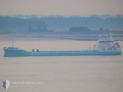
MARIETJE ANDREA
General Cargo
Current Trip
| Time Travelled | 2 days |
|---|---|
| Remaining Time | 4 h, 57 mins |
| Distance Travelled | 724.04 nm |
| Remaining Distance | 89.04 nm |
| AVG Speed | 11.1 Knopen |
| MAX Speed | 13.8 Knopen |
| AVG Wind | 13.5 knots |
| MAX Wind | 31.2 knots |
| MIN Temp | 10°C / 50°F |
| MAX Temp | 19.1°C / 66.38°F |
| Diepgang | 4.4 M |
| Positie ontvangen | 20 h, 8 m geleden |
Current Position
| Lengtegraad | --- |
|---|---|
| Breedtegraat | --- |
| Status | Under way using engine |
| Snelheid | 11.7 Knopen |
| Koers | 93.1° |
| Gebied | Mediterranean Sea - Eastern Basin |
| Station | T-AIS |
| Positie ontvangen | 20 h, 8 m geleden |
Info
Information
The current position of MARIETJE ANDREA is in Mediterranean Sea - Eastern Basin with coordinates 36.07331° / 29.72945° as reported on 2025-12-06 13:02 by AIS to our vessel tracker app. The vessel's current speed is 11.7 Knopen and is heading at the port of MERSIN. The estimated time of arrival as calculated by MyShipTracking vessel tracking app is 2025-12-07 17:08 LT
The vessel MARIETJE ANDREA (IMO: 9361134, MMSI: 246649000) is a General Cargo that was built in 2009 ( 16 Jaar oud ). It's sailing under the flag of [NL] Netherlands.
In this page you can find informations about the vessels current position, last detected port calls, and current voyage information. If the vessels is not in coverage by AIS you will find the latest position.
The current position of MARIETJE ANDREA is detected by our AIS receivers and we are not responsible for the reliability of the data. The last position was recorded while the vessel was in Coverage by the Ais receivers of our vessel tracking app.
The current draught of MARIETJE ANDREA as reported by AIS is 4.4 meters
Weather
| Temperature | 19.2°C / 66.56°F |
|---|---|
| Wind Speed | 10 knots |
| Direction | 178° S |
| Pressure | 1009.8 hPa |
| Humidity | 56.4 % |
| Cloud Coverage | 53 % |
Featured Company
Last Port Calls
| Port | Arrival | Departure | Time In Port |
|---|---|---|---|
| 2025-12-02 23:55 | 2025-12-04 14:06 | 1 d | |
| 2025-12-01 12:21 | 2025-12-02 23:10 | 1 d | |
| 2025-11-24 02:04 | 2025-11-24 06:27 | 4 h | |
| 2025-11-14 09:24 | 2025-11-18 17:58 | 4 d | |
| 2025-11-09 15:31 | 2025-11-13 19:06 | 4 d | |
| 2025-11-08 06:28 | 2025-11-08 07:14 | 45 m | |
| 2025-11-08 03:32 | 2025-11-08 06:01 | 2 h | |
| 2025-11-07 17:21 | 2025-11-07 18:29 | 1 h | |
| 2025-10-29 21:31 | 2025-11-04 13:14 | 5 d | |
| 2025-10-15 06:22 | 2025-10-18 14:20 | 3 d |
Last Trips
| Origin | Departure | Destination | Arrival | Distance | |
|---|---|---|---|---|---|
| 2025-12-02 23:10 | 2025-12-02 23:55 | 8.65 nm | |||
| 2025-11-24 06:27 | 2025-12-01 12:21 | 1843.43 nm | |||
| 2025-11-18 17:58 | 2025-11-24 02:04 | 1392.18 nm | |||
| 2025-11-13 19:06 | 2025-11-14 09:24 | 143.89 nm | |||
| 2025-11-08 07:14 | 2025-11-09 15:31 | 347.31 nm | |||
| 2025-11-08 06:01 | 2025-11-08 06:28 | 0.50 nm | |||
| 2025-11-07 18:29 | 2025-11-08 03:32 | 50.16 nm | |||
| 2025-11-04 13:14 | 2025-11-07 17:21 | 830.30 nm | |||
| 2025-10-18 14:20 | 2025-10-29 21:31 | 2479.04 nm | |||
| 2025-10-08 17:11 | 2025-10-15 06:22 | 1604.48 nm |
Events
| Tijd | Evenement | Details | Positie / Bestemming | Info |
|---|---|---|---|---|
| 2025-12-06 13:07 | Status Changed | Default Under way using engine |
36.07251 / 29.74992
TRMER
|
Snelheid: 11.7 kn Koers: 93.1° |
| 2025-12-06 13:02 | Buitenbereik |
36.07331 / 29.72945
Mediterranean Sea - Eastern Basin
TRMER
|
Snelheid: 11.7 kn Koers: 93.1° |
|
| 2025-12-06 12:37 | Wijzig zee gebeid | Turkish part of the Mediterranean Sea - Eastern Basin Greek part of the Mediterranean Sea - Eastern Basin |
36.07798 / 29.62816
Mediterranean Sea - Eastern Basin
TRMER
|
Snelheid: 11.6 kn Koers: 92.2° |
| 2025-12-06 12:24 | Wijzig zee gebeid | Greek part of the Mediterranean Sea - Eastern Basin Greek part of the Aegean Sea |
36.08084 / 29.58006
Mediterranean Sea - Eastern Basin
TRMER
|
Snelheid: 10.5 kn Koers: 91.4° |
| 2025-12-06 12:23 | Status Changed | Under way using engine Default |
36.08109 / 29.57581
TRMER
|
Snelheid: 10.2 kn Koers: 110° |
| 2025-12-06 12:23 | Binnenbereik |
36.08084 / 29.58006
Mediterranean Sea - Eastern Basin
TRMER
|
Snelheid: 10.5 kn Koers: 91.4° |
|
| 2025-12-05 23:57 | Status Changed | Default Under way using engine |
36.60333 / 26.89667
TRMER
|
Snelheid: 10.9 kn Koers: 125.4° |
| 2025-12-05 23:56 | Buitenbereik |
36.60657 / 26.89476
Aegean Sea
TRMER
|
Snelheid: 10.9 kn Koers: 125.4° |
|
| 2025-12-05 20:24 | Status Changed | Under way using engine Default |
36.96149 / 26.26114
TRMER
|
Snelheid: 9.4 kn Koers: 159° |
| 2025-12-05 20:06 | Status Changed | Default Under way using engine |
36.99333 / 26.21666
TRMER
|
Snelheid: 9.6 kn Koers: 159.4° |