
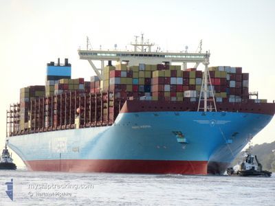
MARIE MAERSK
Container Ship
Current Trip
| Time Travelled | 18 days |
|---|---|
| Remaining Time | --- |
| Distance Travelled | 8473.55 nm |
| Remaining Distance | --- |
| AVG Speed | 19.4 Knopen |
| MAX Speed | 23.3 Knopen |
| AVG Wind | 12.2 knots |
| MAX Wind | 26 knots |
| MIN Temp | 16.5°C / 61.7°F |
| MAX Temp | 30.4°C / 86.72°F |
| Diepgang | 17 M |
| Positie ontvangen | 6 d geleden |
Current Position
| Lengtegraad | 17.64588° |
|---|---|
| Breedtegraat | -34.17613° |
| Status | Under way using engine |
| Snelheid | 18.8 Knopen |
| Koers | 321.5° |
| Gebied | South Atlantic Ocean |
| Station | T-AIS |
| Positie ontvangen | 6 d geleden |
Info
Information
The current position of MARIE MAERSK is in South Atlantic Ocean with coordinates -34.17613° / 17.64588° as reported on 2024-04-22 03:05 by AIS to our vessel tracker app. The vessel's current speed is 18.8 Knopen and is heading at the port of ALGECIRAS. The estimated time of arrival as calculated by MyShipTracking vessel tracking app is 2024-05-03 04:00 LT
The vessel MARIE MAERSK (IMO: 9619933, MMSI: 219018765) is a Container Ship that was built in 2013 ( 11 Jaar oud ). It's sailing under the flag of [DK] Denmark.
In this page you can find informations about the vessels current position, last detected port calls, and current voyage information. If the vessels is not in coverage by AIS you will find the latest position.
The current position of MARIE MAERSK is detected by our AIS receivers and we are not responsible for the reliability of the data. The last position was recorded while the vessel was in Coverage by the Ais receivers of our vessel tracking app.
The current draught of MARIE MAERSK as reported by AIS is 17 meters
Weather
| Temperature | 28.8°C / 83.84°F |
|---|---|
| Wind Speed | 7 knots |
| Direction | 254° WSW |
| Pressure | 1008 hPa |
| Humidity | 76.6 % |
| Cloud Coverage | 100 % |
Featured Company
Last Port Calls
| Port | Arrival | Departure | Time In Port |
|---|---|---|---|
| 2024-04-08 14:37 | 2024-04-10 02:21 | 1 d | |
| 2024-04-03 20:41 | 2024-04-04 16:33 | 19 h | |
| 2024-03-26 10:23 | 2024-03-27 05:59 | 19 h | |
| 2024-03-06 17:21 | 2024-03-13 02:53 | 6 d | |
| 2024-02-29 18:12 | 2024-03-02 02:44 | 1 d | |
| 2024-02-05 15:30 | 2024-02-06 20:57 | 1 d | |
| 2024-02-02 22:08 |
Most Visited Ports (Last year)
| Port | Arrivals | |
|---|---|---|
| 5 | ||
| 4 | ||
| 3 | ||
| 3 | ||
| 2 | ||
| 2 |
Last Trips
| Origin | Departure | Destination | Arrival | Distance | |
|---|---|---|---|---|---|
| 2024-04-05 00:33 | 2024-04-08 22:37 | 1498.09 nm | |||
| 2024-03-27 13:59 | 2024-04-04 04:41 | 882.84 nm | |||
| 2024-03-13 06:53 | 2024-03-26 18:23 | 5563.68 nm | |||
| 2024-03-02 06:44 | 2024-03-06 21:21 | 95.55 nm | |||
| 2024-02-06 21:57 | 2024-02-29 22:12 | 10133.66 nm | |||
| 2024-02-02 23:08 | 2024-02-05 16:30 | 1246.26 nm |
Events
| Tijd | Evenement | Details | Positie / Bestemming | Info |
|---|---|---|---|---|
| 2024-04-22 03:10 | Status Changed | Default Under way using engine |
-34.15533 / 17.62712
MYTPP>ESALG
|
Snelheid: 18.8 kn Koers: 321.5° |
| 2024-04-22 03:05 | Buitenbereik |
-34.17613 / 17.64588
South Atlantic Ocean
MYTPP>ESALG
|
Snelheid: 18.8 kn Koers: 321.5° |
|
| 2024-04-22 02:23 | Status Changed | Under way using engine Default |
-34.35360 / 17.80802
MYTPP>ESALG
|
Snelheid: 20 kn Koers: 321° |
| 2024-04-22 02:10 | Status Changed | Default Under way using engine |
-34.40717 / 17.86113
MYTPP>ESALG
|
Snelheid: 19.9 kn Koers: 319.8° |
| 2024-04-22 02:03 | Status Changed | Under way using engine Default |
-34.43800 / 17.89273
MYTPP>ESALG
|
Snelheid: 19.9 kn Koers: 323° |
| 2024-04-22 01:57 | Status Changed | Default Under way using engine |
-34.46240 / 17.91698
MYTPP>ESALG
|
Snelheid: 19.8 kn Koers: 321.3° |
| 2024-04-21 23:58 | Status Changed | Under way using engine Default |
-34.79915 / 18.57598
MYTPP>ESALG
|
Snelheid: 19 kn Koers: 283° |
| 2024-04-21 23:54 | Status Changed | Default Under way using engine |
-34.80420 / 18.59932
MYTPP>ESALG
|
Snelheid: 19.3 kn Koers: 284.5° |
| 2024-04-21 23:38 | Status Changed | Under way using engine Default |
-34.82618 / 18.70055
MYTPP>ESALG
|
Snelheid: 19.4 kn Koers: 284° |
| 2024-04-21 23:30 | Status Changed | Default Under way using engine |
-34.83738 / 18.75233
MYTPP>ESALG
|
Snelheid: 19.2 kn Koers: 286.2° |