
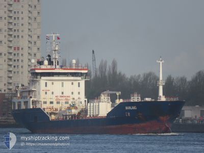
MAINLAND
Oil/Chemical Tanker
Current Trip
| Time Travelled | 18 h, 42 mins |
|---|---|
| Remaining Time | 4 days |
| Distance Travelled | 164.43 nm |
| Remaining Distance | 1033.47 nm |
| AVG Speed | 10.4 Knopen |
| MAX Speed | 11.9 Knopen |
| AVG Wind | 8.6 knots |
| MAX Wind | 14.6 knots |
| MIN Temp | 3°C / 37.4°F |
| MAX Temp | 7.4°C / 45.32°F |
| Diepgang | 6.5 M |
| Positie ontvangen | 6 h, 53 m geleden |
Current Position
| Lengtegraad | 21.50609° |
|---|---|
| Breedtegraat | 59.09424° |
| Status | Under way using engine |
| Snelheid | 10.4 Knopen |
| Koers | 220° |
| Gebied | Baltic Sea |
| Station | T-AIS |
| Positie ontvangen | 6 h, 53 m geleden |
Info
Information
The current position of MAINLAND is in Baltic Sea with coordinates 59.09424° / 21.50609° as reported on 2024-04-28 14:51 by AIS to our vessel tracker app. The vessel's current speed is 10.4 Knopen and is heading at the port of ANTWERP. The estimated time of arrival as calculated by MyShipTracking vessel tracking app is 2024-05-02 23:15 LT
The vessel MAINLAND (IMO: 9431056, MMSI: 249446000) is a Oil/Chemical Tanker that was built in 2008 ( 16 Jaar oud ). It's sailing under the flag of [MT] Malta.
In this page you can find informations about the vessels current position, last detected port calls, and current voyage information. If the vessels is not in coverage by AIS you will find the latest position.
The current position of MAINLAND is detected by our AIS receivers and we are not responsible for the reliability of the data. The last position was recorded while the vessel was in Coverage by the Ais receivers of our vessel tracking app.
The current draught of MAINLAND as reported by AIS is 6.5 meters
Weather
| Temperature | 7.3°C / 45.14°F |
|---|---|
| Wind Speed | 14 knots |
| Direction | 142° SE |
| Pressure | 1021.3 hPa |
| Humidity | 76.2 % |
| Cloud Coverage | 64 % |
Featured Company
Last Port Calls
| Port | Arrival | Departure | Time In Port |
|---|---|---|---|
| 2024-04-27 11:04 | 2024-04-28 03:02 | 15 h | |
| 2024-04-22 08:44 | 2024-04-23 13:19 | 1 d | |
| 2024-04-19 16:39 | 2024-04-20 13:25 | 20 h | |
| 2024-04-15 03:06 | 2024-04-16 05:36 | 1 d | |
| 2024-04-12 03:52 | 2024-04-13 12:15 | 1 d | |
| 2024-04-10 15:58 | 2024-04-10 16:41 | 43 m | |
| 2024-04-07 17:39 | 2024-04-10 08:39 | 2 d | |
| 2024-04-04 17:22 | 2024-04-06 02:36 | 1 d | |
| 2024-03-30 17:15 | 2024-03-31 18:17 | 1 d | |
| 2024-03-28 05:53 | 2024-03-28 18:04 | 12 h |
Most Visited Ports (Last year)
| Port | Arrivals | |
|---|---|---|
| 8 | ||
| 7 | ||
| 6 | ||
| 6 | ||
| 5 | ||
| 5 |
Last Trips
| Origin | Departure | Destination | Arrival | Distance | |
|---|---|---|---|---|---|
| 2024-04-23 15:19 | 2024-04-27 14:04 | 680.12 nm | |||
| 2024-04-20 15:25 | 2024-04-22 10:44 | 349.53 nm | |||
| 2024-04-16 07:36 | 2024-04-19 18:39 | 787.14 nm | |||
| 2024-04-13 14:15 | 2024-04-15 05:06 | 366.63 nm | |||
| 2024-04-10 18:41 | 2024-04-12 05:52 | 311.98 nm | |||
| 2024-04-10 10:39 | 2024-04-10 17:58 | 85.06 nm | |||
| 2024-04-06 04:36 | 2024-04-07 19:39 | 388.62 nm | |||
| 2024-03-31 20:17 | 2024-04-04 19:22 | 505.89 nm | |||
| 2024-03-28 18:04 | 2024-03-30 18:15 | 533.89 nm | |||
| 2024-03-26 22:25 | 2024-03-28 05:53 | 259.52 nm |
Events
| Tijd | Evenement | Details | Positie / Bestemming | Info |
|---|---|---|---|---|
| 2024-04-28 14:56 | Status Changed | Default Under way using engine |
59.08333 / 21.48667
BEANR
|
Snelheid: 10.4 kn Koers: 220° |
| 2024-04-28 14:51 | Buitenbereik |
59.09424 / 21.50609
Baltic Sea
BEANR
|
Snelheid: 10.4 kn Koers: 220° |
|
| 2024-04-28 14:13 | Status Changed | Under way using engine Default |
59.17773 / 21.63805
BEANR
|
Snelheid: 10.3 kn Koers: 234° |
| 2024-04-28 13:45 | Status Changed | Default Under way using engine |
59.22562 / 21.76469
BEANR
|
Snelheid: 10.3 kn Koers: 234° |
| 2024-04-28 13:21 | Status Changed | Under way using engine Default |
59.26669 / 21.87420
BEANR
|
Snelheid: 10.5 kn Koers: 235° |
| 2024-04-28 13:11 | Status Changed | Default Under way using engine |
59.28340 / 21.91997
BEANR
|
Snelheid: 10.5 kn Koers: 234.6° |
| 2024-04-28 12:22 | Gevonden in zee | Estonian part of the Baltic Sea |
59.36323 / 22.15490
Baltic Sea
BEANR
|
Snelheid: 10.5 kn Koers: 235.7° |
| 2024-04-28 12:00 | Status Changed | Under way using engine Default |
59.40022 / 22.25834
BEANR
|
Snelheid: 10.4 kn Koers: 235° |
| 2024-04-28 11:14 | Status Changed | Default Under way using engine |
59.47666 / 22.47667
BEANR
|
Snelheid: 10.4 kn Koers: 238.2° |
| 2024-04-28 10:12 | Status Changed | Under way using engine Default |
59.53620 / 22.80525
BEANR
|
Snelheid: 10.5 kn Koers: 253° |