
SOLA GRATIA
Other Type
Current Trip
230002DBD
| Time Travelled | 3 days |
|---|---|
| Remaining Time | --- |
| Distance Travelled | 255.62 nm |
| Remaining Distance | --- |
| AVG Speed | 6.9 Knopen |
| MAX Speed | 9.6 Knopen |
| AVG Wind | 14.2 knots |
| MAX Wind | 24 knots |
| MIN Temp | 4.4°C / 39.92°F |
| MAX Temp | 10.4°C / 50.72°F |
| Diepgang | 0.1 M |
| Positie ontvangen | 1 m geleden |
Current Position
| Lengtegraad | 5.78845° |
|---|---|
| Breedtegraat | 53.05485° |
| Status | Moored |
| Snelheid | |
| Koers | --- |
| Gebied | North Sea |
| Station | T-AIS |
| Positie ontvangen | 1 m geleden |
Info
Information
The current position of SOLA GRATIA is in North Sea with coordinates 53.05485° / 5.78845° as reported on 2024-04-26 21:12 by AIS to our vessel tracker app. The vessel's current speed is 0 Knopen
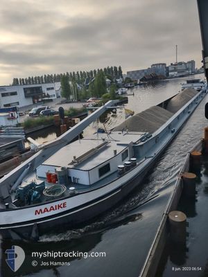
The vessel SOLA GRATIA (MMSI: 244700831) is a Other Type It's sailing under the flag of [NL] Netherlands.
In this page you can find informations about the vessels current position, last detected port calls, and current voyage information. If the vessels is not in coverage by AIS you will find the latest position.
The current position of SOLA GRATIA is detected by our AIS receivers and we are not responsible for the reliability of the data. The last position was recorded while the vessel was in Coverage by the Ais receivers of our vessel tracking app.
The current draught of SOLA GRATIA as reported by AIS is 0.1 meters
Weather
| Temperature | 4.1°C / 39.38°F |
|---|---|
| Wind Speed | 2 knots |
| Direction | 28° NNE |
| Pressure | 1006.7 hPa |
| Humidity | 86.9 % |
| Cloud Coverage | 100 % |
Featured Company
Last Port Calls
| Port | Arrival | Departure | Time In Port |
|---|---|---|---|
| 2024-04-23 12:48 | 2024-04-23 14:11 | 1 h | |
| 2024-04-22 18:12 | 2024-04-22 19:30 | 1 h | |
| 2024-04-22 13:55 | 2024-04-22 14:03 | 8 m | |
| 2024-04-19 11:04 | 2024-04-19 11:45 | 40 m | |
| 2024-04-18 17:53 | 2024-04-18 19:00 | 1 h | |
| 2024-04-17 11:45 | 2024-04-17 12:52 | 1 h | |
| 2024-04-08 15:38 | 2024-04-08 16:10 | 32 m | |
| 2024-04-08 05:36 | 2024-04-08 11:13 | 5 h | |
| 2024-03-29 09:03 | 2024-04-08 05:23 | 9 d | |
| 2024-03-26 21:46 | 2024-03-27 05:31 | 7 h |
Most Visited Ports (Last year)
| Port | Arrivals | |
|---|---|---|
| 74 | ||
| 29 | ||
| 28 | ||
| 17 | ||
| 15 | ||
| 13 |
Last Trips
| Origin | Departure | Destination | Arrival | Distance | |
|---|---|---|---|---|---|
| 2024-04-22 21:30 | 2024-04-23 14:48 | 28.52 nm | |||
| 2024-04-22 16:03 | 2024-04-22 20:12 | 20.42 nm | |||
| 2024-04-19 13:45 | 2024-04-22 15:55 | 79.29 nm | |||
| 2024-04-18 21:00 | 2024-04-19 13:04 | 29.22 nm | |||
| 2024-04-17 14:52 | 2024-04-18 19:53 | 101.81 nm | |||
| 2024-04-08 18:10 | 2024-04-17 13:45 | 337.92 nm | |||
| 2024-04-08 13:13 | 2024-04-08 17:38 | 2.62 nm | |||
| 2024-04-08 07:23 | 2024-04-08 07:36 | 2.39 nm | |||
| 2024-03-27 06:31 | 2024-03-29 10:03 | 83.39 nm | |||
| 2024-03-26 22:38 | 2024-03-26 22:46 | 1.08 nm |
Events
| Tijd | Evenement | Details | Positie / Bestemming | Info |
|---|---|---|---|---|
| 2024-04-26 16:37 | Status Changed | Moored Under way using engine |
53.05488 / 5.78843
230002DBD
|
Snelheid: Koers: 511° |
| 2024-04-26 16:17 | Stop beweging | 1.03 nm, North East of TERHERNE |
53.05479 / 5.78838
230002DBD
|
Snelheid: 0.3 kn Koers: 511° |
| 2024-04-26 13:43 | Start beweging | 0.88 nm, North West of LEMMER |
52.85444 / 5.67828
230002DBD
|
Snelheid: 4.2 kn Koers: 21.4° |
| 2024-04-26 13:08 | Stop beweging | 0.94 nm, West of LEMMER |
52.84781 / 5.67469
230002DBD
|
Snelheid: Koers: 511° |
| 2024-04-26 11:16 | Start beweging | 5.39 nm, East of ENKHUIZEN |
52.71443 / 5.44161
230002DBD
|
Snelheid: 4.2 kn Koers: 55.3° |
| 2024-04-26 11:14 | Status Changed | Under way using engine Moored |
52.71281 / 5.44031
230002DBD
|
Snelheid: 1 kn Koers: 511° |
| 2024-04-26 10:30 | Status Changed | Moored Under way using engine |
52.71298 / 5.43976
230002DBD
|
Snelheid: 0.1 kn Koers: 511° |
| 2024-04-26 10:11 | Stop beweging | 5.31 nm, East of ENKHUIZEN |
52.71288 / 5.43996
230002DBD
|
Snelheid: 0.2 kn Koers: 511° |
| 2024-04-26 09:31 | Start beweging | 0.32 nm, South of ENKHUIZEN |
52.69524 / 5.29608
230002DBD
|
Snelheid: 8.3 kn Koers: 356.4° |
| 2024-04-26 09:26 | Stop beweging | 0.6 nm, South of ENKHUIZEN |
52.69056 / 5.29553
230002DBD
|
Snelheid: 0.2 kn Koers: 511° |