
LEOPOLD OLDENDORFF
Cargo
Current Trip
| Trip Time | --- |
|---|---|
| Trip Distance | --- |
| AVG Speed | --- |
| MAX Speed | --- |
| Diepgang | --- |
| AVG Wind | --- |
| MAX Wind | --- |
| MIN Temp | --- |
| MAX Temp | --- |
| Positie ontvangen | 6 d geleden |
Current Position
| Lengtegraad | 120.29105° |
|---|---|
| Breedtegraat | 18.55513° |
| Status | Under way using engine |
| Snelheid | 11.2 Knopen |
| Koers | 37° |
| Gebied | South China Sea |
| Station | T-AIS |
| Positie ontvangen | 6 d geleden |
Info
Information
The current position of LEOPOLD OLDENDORFF is in South China Sea with coordinates 18.55513° / 120.29105° as reported on 2024-04-23 00:47 by AIS to our vessel tracker app. The vessel's current speed is 11.2 Knopen and is currently inside the port of OITA.
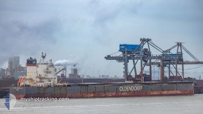
The vessel LEOPOLD OLDENDORFF (IMO: 9691943, MMSI: 255805612) is a Cargo It's sailing under the flag of [PT] Portugal.
In this page you can find informations about the vessels current position, last detected port calls, and current voyage information. If the vessels is not in coverage by AIS you will find the latest position.
The current position of LEOPOLD OLDENDORFF is detected by our AIS receivers and we are not responsible for the reliability of the data. The last position was recorded while the vessel was in Coverage by the Ais receivers of our vessel tracking app.
The current draught of LEOPOLD OLDENDORFF as reported by AIS is 18.1 meters
Weather
| Temperature | 17.6°C / 63.68°F |
|---|---|
| Wind Speed | 2 knots |
| Direction | 323° NW |
| Pressure | 1004.3 hPa |
| Humidity | 98 % |
| Cloud Coverage | 99 % |
Featured Company
Last Trips
| Origin | Departure | Destination | Arrival | Distance |
|---|
Events
| Tijd | Evenement | Details | Positie / Bestemming | Info |
|---|---|---|---|---|
| 2024-04-29 13:08 | Stop beweging |
33.27265 / 131.63124
[JP] OITA
|
Snelheid: 0.1 kn Koers: 233° |
|
| 2024-04-29 11:54 | Aankomsthaven |
|
33.28188 / 131.64131
[JP] OITA
|
Snelheid: 8.6 kn Koers: 257° |
| 2024-04-29 11:00 | Start beweging | 5.01 nm, West of SAGANOSEKI |
33.27523 / 131.77222
OITA JAPAN
|
Snelheid: 4.4 kn Koers: 321° |
| 2024-04-29 03:04 | Stop beweging | 4.72 nm, West of SAGANOSEKI |
33.27356 / 131.77771
OITA JAPAN
|
Snelheid: 0.1 kn Koers: 204° |
| 2024-04-28 18:12 | Start beweging | 18.24 nm, East of HOSOSHIMA |
32.33572 / 132.00479
OITA JAPAN
|
Snelheid: 4.5 kn Koers: 30° |
| 2024-04-27 12:55 | Stop beweging |
32.16667 / 132.21834
OITA JAPAN
|
Snelheid: Koers: -1° |
|
| 2024-04-27 10:40 | Start beweging | 20.62 nm, East of MIMITSU |
32.20833 / 131.98833
OITA JAPAN
|
Snelheid: 4 kn Koers: -1° |
| 2024-04-27 02:32 | Stop beweging |
32.20584 / 132.14134
OITA JAPAN
|
Snelheid: 0.3 kn Koers: 85° |
|
| 2024-04-23 00:49 | Status Changed | Default Under way using engine |
18.55833 / 120.29333
OITA JAPAN
|
Snelheid: 11.2 kn Koers: 37° |
| 2024-04-23 00:47 | Buitenbereik |
18.55513 / 120.29105
South China Sea
OITA JAPAN
|
Snelheid: 11.2 kn Koers: 37° |