
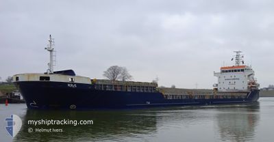
KRIS
General Cargo
Current Trip
| Time Travelled | 3 days |
|---|---|
| Remaining Time | --- |
| Distance Travelled | 699.64 nm |
| Remaining Distance | --- |
| AVG Speed | 9.7 Knopen |
| MAX Speed | 14.1 Knopen |
| AVG Wind | 19.9 knots |
| MAX Wind | 32 knots |
| MIN Temp | 6.4°C / 43.52°F |
| MAX Temp | 13.1°C / 55.58°F |
| Diepgang | 4.9 M |
| Positie ontvangen | 11 h, 54 m geleden |
Current Position
| Lengtegraad | --- |
|---|---|
| Breedtegraat | --- |
| Status | Under way using engine |
| Snelheid | 9.3 Knopen |
| Koers | 328.2° |
| Gebied | North Atlantic Ocean |
| Station | T-AIS |
| Positie ontvangen | 11 h, 54 m geleden |
Info
Information
The current position of KRIS is in North Atlantic Ocean with coordinates 51.52984° / -10.38040° as reported on 2025-12-14 12:32 by AIS to our vessel tracker app. The vessel's current speed is 9.3 Knopen
The vessel KRIS (IMO: 9408889, MMSI: 304502000) is a General Cargo that was built in 2007 ( 18 Jaar oud ). It's sailing under the flag of [AG] Antigua Barbuda.
In this page you can find informations about the vessels current position, last detected port calls, and current voyage information. If the vessels is not in coverage by AIS you will find the latest position.
The current position of KRIS is detected by our AIS receivers and we are not responsible for the reliability of the data. The last position was recorded while the vessel was in Coverage by the Ais receivers of our vessel tracking app.
The current draught of KRIS as reported by AIS is 4.9 meters
Weather
| Temperature | 8.2°C / 46.76°F |
|---|---|
| Wind Speed | 10 knots |
| Direction | 248° WSW |
| Pressure | 1001.7 hPa |
| Humidity | 87.6 % |
| Cloud Coverage | 100 % |
Featured Company
Last Port Calls
| Port | Arrival | Departure | Time In Port |
|---|---|---|---|
| 2025-12-11 20:34 | 2025-12-11 21:11 | 36 m | |
| 2025-12-06 21:00 | 2025-12-11 18:45 | 4 d | |
| 2025-11-29 05:44 | 2025-12-01 11:25 | 2 d | |
| 2025-11-26 01:17 | 2025-11-27 15:02 | 1 d | |
| 2025-11-24 07:40 | 2025-11-24 07:44 | 4 m | |
| 2025-11-21 15:58 | 2025-11-22 14:57 | 22 h | |
| 2025-11-18 01:32 | 2025-11-19 16:31 | 1 d | |
| 2025-11-12 03:58 | 2025-11-13 13:37 | 1 d | |
| 2025-11-03 18:06 | 2025-11-09 06:41 | 5 d | |
| 2025-10-30 07:16 | 2025-11-01 14:30 | 2 d |
Last Trips
| Origin | Departure | Destination | Arrival | Distance | |
|---|---|---|---|---|---|
| 2025-12-11 19:45 | 2025-12-11 21:34 | 9.68 nm | |||
| 2025-12-01 13:25 | 2025-12-06 22:00 | 1102.04 nm | |||
| 2025-11-27 17:02 | 2025-11-29 07:44 | 413.41 nm | |||
| 2025-11-24 08:44 | 2025-11-26 03:17 | 406.66 nm | |||
| 2025-11-22 15:57 | 2025-11-24 08:40 | 319.83 nm | |||
| 2025-11-19 17:31 | 2025-11-21 16:58 | 313.76 nm | |||
| 2025-11-13 14:37 | 2025-11-18 02:32 | 1032.39 nm | |||
| 2025-11-09 06:41 | 2025-11-12 04:58 | 478.17 nm | |||
| 2025-11-01 15:30 | 2025-11-03 18:06 | 506.59 nm | |||
| 2025-10-20 13:25 | 2025-10-30 08:16 | 2073.92 nm |
Events
| Tijd | Evenement | Details | Positie / Bestemming | Info |
|---|---|---|---|---|
| 2025-12-14 21:43 | Stop beweging | 2.48 nm, South West of CAPPA UPPER |
52.59833 / -9.54667
IE AUG
|
Snelheid: Koers: -1° |
| 2025-12-14 12:37 | Status Changed | Default Under way using engine |
51.53667 / -10.39167
IE AUG
|
Snelheid: 9.3 kn Koers: 328.2° |
| 2025-12-14 12:32 | Status Changed | Under way using engine Default |
51.52984 / -10.38040
IE AUG
|
Snelheid: 8 kn Koers: 317° |
| 2025-12-14 12:32 | Buitenbereik |
51.52984 / -10.38040
North Atlantic Ocean
IE AUG
|
Snelheid: 9.3 kn Koers: 328.2° |
|
| 2025-12-14 12:28 | Status Changed | Default Under way using engine |
51.52167 / -10.36833
IE AUG
|
Snelheid: 9.2 kn Koers: 324.1° |
| 2025-12-14 12:19 | Status Changed | Under way using engine Default |
51.50628 / -10.34872
IE AUG
|
Snelheid: 8 kn Koers: 324° |
| 2025-12-14 11:50 | Status Changed | Default Under way using engine |
51.45998 / -10.26658
IE AUG
|
Snelheid: 8.6 kn Koers: 306.2° |
| 2025-12-14 10:48 | Wijzig zee gebeid | Irish part of the North Atlantic Ocean Irish part of the Celtic Sea |
51.38786 / -10.08718
North Atlantic Ocean
IE AUG
|
Snelheid: 9.3 kn Koers: 331.3° |
| 2025-12-14 10:46 | Status Changed | Under way using engine Default |
51.38535 / -10.08359
IE AUG
|
Snelheid: 8 kn Koers: 308° |
| 2025-12-14 10:05 | Status Changed | Default Under way using engine |
51.32555 / -9.96367
IE AUG
|
Snelheid: 7.9 kn Koers: 305° |