
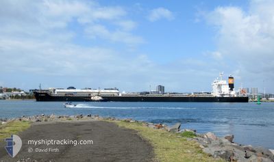
KM NAGOYA
Bulk Carrier
Current Trip
| Time Travelled | 4 days |
|---|---|
| Remaining Time | 7 days |
| Distance Travelled | 1516.13 nm |
| Remaining Distance | 2405.73 nm |
| AVG Speed | 12.9 Knopen |
| MAX Speed | 17.1 Knopen |
| AVG Wind | 11.4 knots |
| MAX Wind | 26.4 knots |
| MIN Temp | 10.3°C / 50.54°F |
| MAX Temp | 16.9°C / 62.42°F |
| Diepgang | 7.8 M |
| Positie ontvangen | 2 d geleden |
Current Position
| Lengtegraad | -5.21120° |
|---|---|
| Breedtegraat | 49.72869° |
| Status | Under way using engine |
| Snelheid | 14.5 Knopen |
| Koers | 269.5° |
| Gebied | English Channel |
| Station | T-AIS |
| Positie ontvangen | 2 d geleden |
Info
Information
The current position of KM NAGOYA is in English Channel with coordinates 49.72869° / -5.21120° as reported on 2024-06-06 10:49 by AIS to our vessel tracker app. The vessel's current speed is 14.5 Knopen and is heading at the port of BALTIMORE. The estimated time of arrival as calculated by MyShipTracking vessel tracking app is 2024-06-16 12:48 LT
The vessel KM NAGOYA (IMO: 9615212, MMSI: 566626000) is a Bulk Carrier that was built in 2012 ( 12 Jaar oud ). It's sailing under the flag of [SG] Singapore.
In this page you can find informations about the vessels current position, last detected port calls, and current voyage information. If the vessels is not in coverage by AIS you will find the latest position.
The current position of KM NAGOYA is detected by our AIS receivers and we are not responsible for the reliability of the data. The last position was recorded while the vessel was in Coverage by the Ais receivers of our vessel tracking app.
The current draught of KM NAGOYA as reported by AIS is 7.8 meters
Weather
| Temperature | 14°C / 57.2°F |
|---|---|
| Wind Speed | 4 knots |
| Direction | 158° SSE |
| Pressure | 1026 hPa |
| Humidity | 79.8 % |
| Cloud Coverage | 100 % |
Featured Company
Last Trips
Events
| Tijd | Evenement | Details | Positie / Bestemming | Info |
|---|---|---|---|---|
| 2024-06-06 10:55 | Status Changed | Default Under way using engine |
49.72859 / -5.24943
US BAL
|
Snelheid: 14.5 kn Koers: 269.5° |
| 2024-06-06 10:49 | Buitenbereik |
49.72869 / -5.21120
English Channel
US BAL
|
Snelheid: 14.5 kn Koers: 269.5° |
|
| 2024-06-06 10:48 | Status Changed | Under way using engine Default |
49.72875 / -5.20494
US BAL
|
Snelheid: 14.5 kn Koers: 270° |
| 2024-06-06 10:43 | Status Changed | Default Under way using engine |
49.72884 / -5.17448
US BAL
|
Snelheid: 14.5 kn Koers: 268.6° |
| 2024-06-06 10:36 | Status Changed | Under way using engine Default |
49.72928 / -5.12826
US BAL
|
Snelheid: 14.5 kn Koers: 268° |
| 2024-06-06 10:35 | Status Changed | Default Under way using engine |
49.72933 / -5.12525
US BAL
|
Snelheid: 14.5 kn Koers: 267.8° |
| 2024-06-06 10:28 | Status Changed | Under way using engine Default |
49.73057 / -5.07730
US BAL
|
Snelheid: 14.7 kn Koers: 268° |
| 2024-06-06 10:23 | Status Changed | Default Under way using engine |
49.73124 / -5.04907
US BAL
|
Snelheid: 14.8 kn Koers: 267.9° |
| 2024-06-06 10:16 | Status Changed | Under way using engine Default |
49.73221 / -5.00298
US BAL
|
Snelheid: 14.9 kn Koers: 268° |
| 2024-06-06 10:11 | Status Changed | Default Under way using engine |
49.73293 / -4.97489
US BAL
|
Snelheid: 14.9 kn Koers: 267.3° |