
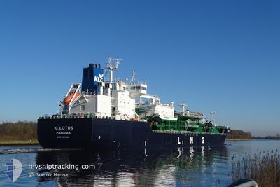
K.LOTUS
Tanker D
Current Trip
| Time Travelled | 2 days |
|---|---|
| Remaining Time | 3 h, 18 mins |
| Distance Travelled | 741.50 nm |
| Remaining Distance | 24.42 nm |
| AVG Speed | 9.6 Knopen |
| MAX Speed | 12.3 Knopen |
| AVG Wind | 12.8 knots |
| MAX Wind | 22 knots |
| MIN Temp | 7.3°C / 45.14°F |
| MAX Temp | 20.9°C / 69.62°F |
| Diepgang | 6.6 M |
| Positie ontvangen | 1 m geleden |
Current Position
| Lengtegraad | 9.55445° |
|---|---|
| Breedtegraat | 54.20024° |
| Status | Under way using engine |
| Snelheid | 2.2 Knopen |
| Koers | 234° |
| Gebied | Baltic Sea |
| Station | T-AIS |
| Positie ontvangen | 1 m geleden |
Info
Information
The current position of K.LOTUS is in Baltic Sea with coordinates 54.20024° / 9.55445° as reported on 2024-05-17 17:36 by AIS to our vessel tracker app. The vessel's current speed is 2.2 Knopen and is heading at the port of KIEL. The estimated time of arrival as calculated by MyShipTracking vessel tracking app is 2024-05-17 20:55 LT
The vessel K.LOTUS (IMO: 9901362, MMSI: 352980842) is a Tanker D It's sailing under the flag of [PA] Panama.
In this page you can find informations about the vessels current position, last detected port calls, and current voyage information. If the vessels is not in coverage by AIS you will find the latest position.
The current position of K.LOTUS is detected by our AIS receivers and we are not responsible for the reliability of the data. The last position was recorded while the vessel was in Coverage by the Ais receivers of our vessel tracking app.
The current draught of K.LOTUS as reported by AIS is 6.6 meters
Weather
| Temperature | 17.6°C / 63.68°F |
|---|---|
| Wind Speed | 11 knots |
| Direction | 70° ENE |
| Pressure | 1010.7 hPa |
| Humidity | 72.2 % |
| Cloud Coverage | 7 % |
Featured Company
Last Port Calls
| Port | Arrival | Departure | Time In Port |
|---|---|---|---|
| 2024-05-14 08:24 | 2024-05-14 22:04 | 13 h | |
| 2024-05-06 13:29 | 2024-05-07 03:22 | 13 h | |
| 2024-05-02 17:24 | 2024-05-03 16:53 | 23 h | |
| 2024-05-01 01:19 | 2024-05-02 01:54 | 1 d | |
| 2024-04-30 06:03 | 2024-04-30 19:57 | 13 h | |
| 2024-04-25 04:16 | 2024-04-26 06:08 | 1 d | |
| 2024-04-21 19:40 | 2024-04-22 09:55 | 14 h | |
| 2024-04-17 01:44 | 2024-04-17 17:43 | 15 h | |
| 2024-04-13 02:09 | 2024-04-13 21:16 | 19 h | |
| 2024-04-07 22:03 | 2024-04-08 13:02 | 14 h |
Most Visited Ports (Last year)
| Port | Arrivals | |
|---|---|---|
| 31 | ||
| 10 | ||
| 10 | ||
| 8 | ||
| 2 | ||
| 1 |
Last Trips
| Origin | Departure | Destination | Arrival | Distance | |
|---|---|---|---|---|---|
| 2024-05-07 05:22 | 2024-05-14 11:24 | 935.41 nm | |||
| 2024-05-03 18:53 | 2024-05-06 15:29 | 547.18 nm | |||
| 2024-05-02 03:54 | 2024-05-02 19:24 | 146.41 nm | |||
| 2024-04-30 21:57 | 2024-05-01 03:19 | 52.65 nm | |||
| 2024-04-26 08:08 | 2024-04-30 08:03 | 120.45 nm | |||
| 2024-04-22 11:55 | 2024-04-25 06:16 | 60.91 nm | |||
| 2024-04-17 19:43 | 2024-04-21 21:40 | 168.54 nm | |||
| 2024-04-13 23:16 | 2024-04-17 03:44 | 160.45 nm | |||
| 2024-04-08 15:02 | 2024-04-13 04:09 | 601.68 nm | |||
| 2024-04-05 11:38 | 2024-04-08 00:03 | 532.53 nm |
Events
| Tijd | Evenement | Details | Positie / Bestemming | Info |
|---|---|---|---|---|
| 2024-05-17 14:41 | Start beweging | 7.31 nm, West of KIEL |
54.34165 / 9.95222
FI HMN > KIEL
|
Snelheid: 4.4 kn Koers: 257° |
| 2024-05-17 14:18 | Stop beweging | 7.2 nm, West of KIEL |
54.34197 / 9.95542
FI HMN > KIEL
|
Snelheid: 0.3 kn Koers: 261° |
| 2024-05-17 13:36 | Start beweging | 3.89 nm, West of KIEL |
54.36019 / 10.05735
FI HMN > KIEL
|
Snelheid: 3.2 kn Koers: 255° |
| 2024-05-17 13:20 | Stop beweging | 3.8 nm, North West of KIEL |
54.36091 / 10.06044
FI HMN > KIEL
|
Snelheid: 0.3 kn Koers: 252° |
| 2024-05-17 12:41 | Start beweging | 1.42 nm, South West of STICKENHΟRN SPORT |
54.36644 / 10.13895
FI HMN > KIEL
|
Snelheid: 3.6 kn Koers: 283° |
| 2024-05-17 12:03 | Stop beweging | 1.36 nm, South West of STICKENHΟRN SPORT |
54.36594 / 10.14204
FI HMN > KIEL
|
Snelheid: 0.1 kn Koers: 282° |
| 2024-05-17 09:59 | Wijzig zee gebeid | German part of the Baltic Sea Danish part of the Baltic Sea |
54.56451 / 10.54416
Baltic Sea
FI HMN > KIEL
|
Snelheid: 10.4 kn Koers: 237.6° |
| 2024-05-17 09:08 | Gevonden in zee | Danish part of the Baltic Sea |
54.58849 / 10.80210
Baltic Sea
FI HMN > KIEL
|
Snelheid: 10.8 kn Koers: 268.1° |
| 2024-05-17 07:20 | Gevonden in zee | German part of the Baltic Sea |
54.55725 / 11.34283
Baltic Sea
FI HMN > KIEL
|
Snelheid: 10.4 kn Koers: 298.3° |
| 2024-05-17 06:02 | Draught Changed | 6.6 5.9 |
54.45325 / 11.69135
FI HMN > KIEL
|
Snelheid: 10.4 kn Koers: 298.3° |