
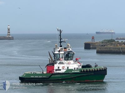
KITTIWAKE
Tug
Current Trip
| Time Travelled | 1 day |
|---|---|
| Remaining Time | 7 h, 30 mins |
| Distance Travelled | 255.89 nm |
| Remaining Distance | 84.06 nm |
| AVG Speed | 10.1 Knopen |
| MAX Speed | 12.9 Knopen |
| AVG Wind | 17.7 knots |
| MAX Wind | 22.8 knots |
| MIN Temp | 5.2°C / 41.36°F |
| MAX Temp | 9.6°C / 49.28°F |
| Diepgang | 5.3 M |
| Positie ontvangen | 1 h, 51 m geleden |
Current Position
| Lengtegraad | --- |
|---|---|
| Breedtegraat | --- |
| Status | Under way using engine |
| Snelheid | 10.6 Knopen |
| Koers | 158° |
| Gebied | North Sea |
| Station | T-AIS |
| Positie ontvangen | 1 h, 51 m geleden |
Info
Information
The current position of KITTIWAKE is in North Sea with coordinates 53.88191° / 0.22994° as reported on 2025-12-05 12:09 by AIS to our vessel tracker app. The vessel's current speed is 10.6 Knopen and is heading at the port of GREAT YARMOUTH. The estimated time of arrival as calculated by MyShipTracking vessel tracking app is 2025-12-05 21:30 LT
The vessel KITTIWAKE (IMO: 9788289, MMSI: 232008948) is a Tug It's sailing under the flag of [GB] United Kingdom.
In this page you can find informations about the vessels current position, last detected port calls, and current voyage information. If the vessels is not in coverage by AIS you will find the latest position.
The current position of KITTIWAKE is detected by our AIS receivers and we are not responsible for the reliability of the data. The last position was recorded while the vessel was in Coverage by the Ais receivers of our vessel tracking app.
The current draught of KITTIWAKE as reported by AIS is 5.3 meters
Weather
| Temperature | 7.3°C / 45.14°F |
|---|---|
| Wind Speed | 21 knots |
| Direction | 177° S |
| Pressure | 1004 hPa |
| Humidity | 78.4 % |
| Cloud Coverage | 27 % |
Featured Company
Last Port Calls
| Port | Arrival | Departure | Time In Port |
|---|---|---|---|
| 2025-12-01 16:31 | 2025-12-04 13:25 | 2 d | |
| 2025-11-29 19:19 | 2025-12-01 15:47 | 1 d | |
| 2025-11-25 20:29 | 2025-11-29 18:40 | 3 d | |
| 2025-11-24 16:54 | 2025-11-25 12:22 | 19 h | |
| 2025-11-22 13:57 | 2025-11-24 11:15 | 1 d | |
| 2025-11-21 23:31 | 2025-11-22 11:07 | 11 h | |
| 2025-11-20 12:14 | 2025-11-21 18:08 | 1 d | |
| 2025-11-18 05:19 | 2025-11-20 11:12 | 2 d | |
| 2025-11-12 17:07 | 2025-11-16 18:02 | 4 d | |
| 2025-11-10 14:03 | 2025-11-11 10:05 | 20 h |
Last Trips
| Origin | Departure | Destination | Arrival | Distance | |
|---|---|---|---|---|---|
| 2025-12-01 15:47 | 2025-12-01 16:31 | 2.41 nm | |||
| 2025-11-29 18:40 | 2025-11-29 19:19 | 2.63 nm | |||
| 2025-11-25 12:22 | 2025-11-25 20:29 | 14.42 nm | |||
| 2025-11-24 11:15 | 2025-11-24 16:54 | 56.92 nm | |||
| 2025-11-22 11:07 | 2025-11-22 13:57 | 23.54 nm | |||
| 2025-11-21 18:08 | 2025-11-21 23:31 | 57.82 nm | |||
| 2025-11-20 11:12 | 2025-11-20 12:14 | 5.32 nm | |||
| 2025-11-16 18:02 | 2025-11-18 05:19 | 255.77 nm | |||
| 2025-11-11 10:05 | 2025-11-12 17:07 | 230.61 nm | |||
| 2025-11-08 14:49 | 2025-11-10 14:03 | 173.45 nm |
Events
| Tijd | Evenement | Details | Positie / Bestemming | Info |
|---|---|---|---|---|
| 2025-12-05 12:17 | Status Changed | Default Under way using engine |
53.86138 / .24452
GREAT YARMOUTH
|
Snelheid: 10.6 kn Koers: 158° |
| 2025-12-05 12:09 | Buitenbereik |
53.88191 / .22994
North Sea
|
Snelheid: 10.6 kn Koers: 158° |
|
| 2025-12-05 10:12 | Status Changed | Under way using engine Default |
54.16783 / -.03168
GREAT YARMOUTH
|
Snelheid: 9.6 kn Koers: 155° |
| 2025-12-05 09:57 | Binnenbereik |
54.16475 / -.02925
North Sea
|
Snelheid: 9.2 kn Koers: 155.6° |
|
| 2025-12-05 08:33 | Status Changed | Default Under way using engine |
54.38378 / -.30885
GREAT YARMOUTH
|
Snelheid: 10.1 kn Koers: 135.6° |
| 2025-12-05 08:31 | Buitenbereik |
54.38733 / -.31478
North Sea
|
Snelheid: 10.1 kn Koers: 135.6° |
|
| 2025-12-05 07:41 | Status Changed | Under way using engine Default |
54.48971 / -.48271
GREAT YARMOUTH
|
Snelheid: 10.4 kn Koers: 139° |
| 2025-12-05 07:41 | Binnenbereik |
54.47920 / -.46585
North Sea
|
Snelheid: 10.2 kn Koers: 137.2° |
|
| 2025-12-05 06:51 | Status Changed | Default Under way using engine |
54.58611 / -.67781
GREAT YARMOUTH
|
Snelheid: 11.2 kn Koers: 123.9° |
| 2025-12-05 06:44 | Buitenbereik |
54.59800 / -.70791
North Sea
|
Snelheid: 11.2 kn Koers: 123.9° |