
JY RIVER
Cargo
Current Trip
| Time Travelled | 5 days |
|---|---|
| Remaining Time | --- |
| Distance Travelled | 1661.79 nm |
| Remaining Distance | --- |
| AVG Speed | 11.2 Knopen |
| MAX Speed | 14.6 Knopen |
| AVG Wind | 10.9 knots |
| MAX Wind | 32.5 knots |
| MIN Temp | 17.3°C / 63.14°F |
| MAX Temp | 25.2°C / 77.36°F |
| Diepgang | 12.6 M |
| Positie ontvangen | 3 d geleden |
Current Position
| Lengtegraad | -67.28117° |
|---|---|
| Breedtegraat | 32.56600° |
| Status | Under way using engine |
| Snelheid | 12 Knopen |
| Koers | 119° |
| Gebied | North Atlantic Ocean |
| Station | T-AIS |
| Positie ontvangen | 3 d geleden |
Info
Information
The current position of JY RIVER is in North Atlantic Ocean with coordinates 32.56600° / -67.28117° as reported on 2024-05-11 19:03 by AIS to our vessel tracker app. The vessel's current speed is 12 Knopen and is heading at the port of SINGAPORE. The estimated time of arrival as calculated by MyShipTracking vessel tracking app is 2024-06-30 15:00 LT
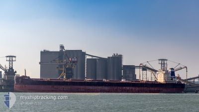
The vessel JY RIVER (IMO: 9845269, MMSI: 636019110) is a Cargo It's sailing under the flag of [LR] Liberia.
In this page you can find informations about the vessels current position, last detected port calls, and current voyage information. If the vessels is not in coverage by AIS you will find the latest position.
The current position of JY RIVER is detected by our AIS receivers and we are not responsible for the reliability of the data. The last position was recorded while the vessel was in Coverage by the Ais receivers of our vessel tracking app.
The current draught of JY RIVER as reported by AIS is 12.6 meters
Weather
| Temperature | 24.8°C / 76.64°F |
|---|---|
| Wind Speed | 5 knots |
| Direction | 152° SSE |
| Pressure | 1015.6 hPa |
| Humidity | 77.5 % |
| Cloud Coverage | 60 % |
Featured Company
Most Visited Ports (Last year)
| Port | Arrivals | |
|---|---|---|
| 3 | ||
| 2 | ||
| 2 | ||
| 1 | ||
| 1 | ||
| 1 |
Events
| Tijd | Evenement | Details | Positie / Bestemming | Info |
|---|---|---|---|---|
| 2024-05-11 19:09 | Status Changed | Default Under way using engine |
32.55500 / -67.25833
SGSIN
|
Snelheid: 12 kn Koers: 119° |
| 2024-05-11 19:03 | Buitenbereik |
32.56600 / -67.28117
North Atlantic Ocean
|
Snelheid: 12 kn Koers: 119° |
|
| 2024-05-11 18:55 | Status Changed | Under way using engine Default |
32.57872 / -67.30760
SGSIN
|
Snelheid: 11 kn Koers: 119° |
| 2024-05-11 18:51 | Status Changed | Default Under way using engine |
32.58500 / -67.32166
SGSIN
|
Snelheid: 11 kn Koers: 118° |
| 2024-05-11 18:18 | Status Changed | Under way using engine Default |
32.64224 / -67.43509
SGSIN
|
Snelheid: 11 kn Koers: 123° |
| 2024-05-11 18:12 | Status Changed | Default Under way using engine |
32.65167 / -67.45333
SGSIN
|
Snelheid: 12 kn Koers: 125° |
| 2024-05-11 16:24 | Status Changed | Under way using engine Default |
32.85581 / -67.81468
SGSIN
|
Snelheid: 12 kn Koers: 123° |
| 2024-05-11 16:18 | Status Changed | Default Under way using engine |
32.86500 / -67.83334
SGSIN
|
Snelheid: 12 kn Koers: 123° |
| 2024-05-11 16:13 | Wijzig zee gebeid | Bermudian part of the North Atlantic Ocean United States part of the North Atlantic Ocean |
32.87554 / -67.85073
North Atlantic Ocean
|
Snelheid: 12 kn Koers: 123° |
| 2024-05-11 16:13 | Status Changed | Under way using engine Default |
32.87554 / -67.85073
SGSIN
|
Snelheid: 12 kn Koers: 121° |