
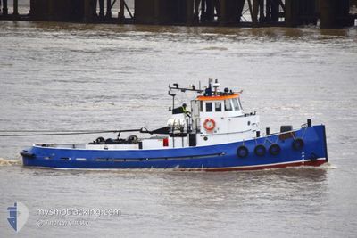
IRENE
Tug
Current Trip
| Trip Time | 1 h, 35 mins |
|---|---|
| Trip Distance | 8.08 nm |
| AVG Speed | 5 Knopen |
| MAX Speed | 6.6 Knopen |
| Diepgang | 2.2 M |
| AVG Wind | 6.4 knots |
| MAX Wind | 7.8 knots |
| MIN Temp | 19°C / 66.2°F |
| MAX Temp | 19.5°C / 67.1°F |
| Positie ontvangen | 2 d geleden |
Current Position
| Lengtegraad | -0.08153° |
|---|---|
| Breedtegraat | 51.50785° |
| Status | Under way using engine |
| Snelheid | 0.1 Knopen |
| Koers | --- |
| Gebied | North Sea |
| Station | T-AIS |
| Positie ontvangen | 2 d geleden |
Info
Information
The current position of IRENE is in North Sea with coordinates 51.50785° / -0.08153° as reported on 2024-05-10 12:12 by AIS to our vessel tracker app. The vessel's current speed is 0.1 Knopen and is currently inside the port of LONDON.
The vessel IRENE (MMSI: 232017999) is a Tug It's sailing under the flag of [GB] United Kingdom.
In this page you can find informations about the vessels current position, last detected port calls, and current voyage information. If the vessels is not in coverage by AIS you will find the latest position.
The current position of IRENE is detected by our AIS receivers and we are not responsible for the reliability of the data. The last position was recorded while the vessel was in Coverage by the Ais receivers of our vessel tracking app.
The current draught of IRENE as reported by AIS is 2.2 meters
Weather
| Temperature | 20.8°C / 69.44°F |
|---|---|
| Wind Speed | 6 knots |
| Direction | 88° E |
| Pressure | 1023.8 hPa |
| Humidity | 50.9 % |
| Cloud Coverage | 100 % |
Featured Company
Last Port Calls
| Port | Arrival | Departure | Time In Port |
|---|---|---|---|
| 2024-05-07 14:59 | |||
| 2024-05-07 07:33 | 2024-05-07 13:24 | 5 h | |
| 2024-04-08 18:56 | 2024-05-07 07:08 | 28 d | |
| 2024-04-08 16:20 | 2024-04-08 17:18 | 57 m | |
| 2024-03-26 13:23 | 2024-04-08 15:37 | 13 d | |
| 2024-03-26 08:16 | 2024-03-26 12:16 | 3 h | |
| 2024-03-26 07:55 |
Most Visited Ports (Last year)
| Port | Arrivals | |
|---|---|---|
| 8 | ||
| 6 | ||
| 3 | ||
| 1 |
Last Trips
| Origin | Departure | Destination | Arrival | Distance | |
|---|---|---|---|---|---|
| 2024-05-07 14:24 | 2024-05-07 15:59 | 8.08 nm | |||
| 2024-05-07 08:08 | 2024-05-07 08:33 | 2.42 nm | |||
| 2024-04-08 18:18 | 2024-04-08 19:56 | 10.51 nm | |||
| 2024-04-08 16:37 | 2024-04-08 17:20 | 7.32 nm | |||
| 2024-03-26 12:16 | 2024-03-26 13:23 | 8.61 nm | |||
| 2024-03-26 07:55 | 2024-03-26 08:16 | 2.48 nm |
Events
| Tijd | Evenement | Details | Positie / Bestemming | Info |
|---|---|---|---|---|
| 2024-05-10 12:12 | Buitenbereik |
51.50785 / -.08153
North Sea
[GB] LONDON
|
Snelheid: 0.1 kn Koers: 207.2° |
|
| 2024-05-10 11:30 | Stop beweging |
51.50766 / -.08156
[GB] LONDON
|
Snelheid: 0.3 kn Koers: 511° |
|
| 2024-05-10 11:22 | Binnenbereik |
51.50494 / -.07277
North Sea
[GB] LONDON
|
Snelheid: 4.5 kn Koers: 297.2° |
|
| 2024-05-10 10:43 | ETA Changed | 2024/05/10 00:00 2024/12/31 00:00 |
51.50477 / -.07386
[GB] LONDON
|
Snelheid: 1.7 kn Koers: 511° |
| 2024-05-10 10:20 | Buitenbereik |
51.50477 / -.07386
North Sea
[GB] LONDON
|
Snelheid: 1.7 kn Koers: 261.3° |
|
| 2024-05-10 10:20 | Stop beweging |
51.50501 / -.07377
[GB] LONDON
|
Snelheid: 0.3 kn Koers: 511° |
|
| 2024-05-10 10:18 | Binnenbereik |
51.50494 / -.07377
North Sea
[GB] LONDON
|
Snelheid: 1.1 kn Koers: 193.3° |
|
| 2024-05-10 06:45 | Buitenbereik |
51.50413 / -.06865
North Sea
[GB] LONDON
|
Snelheid: 7.4 kn Koers: 95.5° |
|
| 2024-05-10 06:30 | Binnenbereik |
51.50423 / -.06892
North Sea
[GB] LONDON
|
Snelheid: 0.1 kn Koers: 87.2° |
|
| 2024-05-09 12:31 | Buitenbereik |
51.50423 / -.06910
North Sea
[GB] LONDON
|
Snelheid: Koers: 231.5° |