
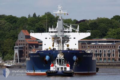
IONIC UNICORN
Cargo
Current Trip
| Trip Time | 12 days |
|---|---|
| Trip Distance | 3366.57 nm |
| AVG Speed | 11.5 Knopen |
| MAX Speed | 14.3 Knopen |
| Diepgang | 11.3 M |
| AVG Wind | 11.9 knots |
| MAX Wind | 30 knots |
| MIN Temp | -1°C / 30.2°F |
| MAX Temp | 34.5°C / 94.1°F |
| Positie ontvangen | 7 d geleden |
Current Position
| Lengtegraad | --- |
|---|---|
| Breedtegraat | --- |
| Status | Under way using engine |
| Snelheid | 12.5 Knopen |
| Koers | 156.9° |
| Gebied | North Atlantic Ocean |
| Station | T-AIS |
| Positie ontvangen | 7 d geleden |
Info
Information
The current position of IONIC UNICORN is in North Atlantic Ocean with coordinates 13.09400° / -53.15317° as reported on 2025-11-27 23:13 by AIS to our vessel tracker app. The vessel's current speed is 12.5 Knopen and is currently inside the port of SANTAREM.
The vessel IONIC UNICORN (IMO: 9747429, MMSI: 538006704) is a Cargo It's sailing under the flag of [MH] Marshall Is.
In this page you can find informations about the vessels current position, last detected port calls, and current voyage information. If the vessels is not in coverage by AIS you will find the latest position.
The current position of IONIC UNICORN is detected by our AIS receivers and we are not responsible for the reliability of the data. The last position was recorded while the vessel was in Coverage by the Ais receivers of our vessel tracking app.
The current draught of IONIC UNICORN as reported by AIS is 11.3 meters
Weather
| Temperature | 31.5°C / 88.7°F |
|---|---|
| Wind Speed | 4 knots |
| Direction | 69° ENE |
| Pressure | 1010.7 hPa |
| Humidity | 50.7 % |
| Cloud Coverage | 95 % |
Featured Company
Last Port Calls
| Port | Arrival | Departure | Time In Port |
|---|---|---|---|
| 2025-12-03 05:12 | |||
| 2025-11-14 19:05 | 2025-11-20 23:47 | 6 d | |
| 2025-11-14 05:06 | 2025-11-14 18:02 | 12 h | |
| 2025-11-05 10:11 | 2025-11-08 08:18 | 2 d | |
| 2025-10-27 12:03 | 2025-10-30 09:38 | 2 d |
Most Visited Ports (Last year)
| Port | Arrivals | |
|---|---|---|
| 2 | ||
| 2 | ||
| 1 | ||
| 1 | ||
| 1 | ||
| 1 |
Last Trips
| Origin | Departure | Destination | Arrival | Distance | |
|---|---|---|---|---|---|
| 2025-11-20 23:47 | 2025-12-03 05:12 | 3366.57 nm | |||
| 2025-11-14 18:02 | 2025-11-14 19:05 | 4.35 nm | |||
| 2025-11-08 08:18 | 2025-11-14 05:06 | 1296.13 nm | |||
| 2025-10-30 09:38 | 2025-11-05 10:11 | 130.77 nm | |||
| 2025-09-30 02:23 | 2025-10-27 12:03 | 5434.20 nm |
Events
| Tijd | Evenement | Details | Positie / Bestemming | Info |
|---|---|---|---|---|
| 2025-12-03 08:36 | Stop beweging |
-2.41279 / -54.73902
[BR] SANTAREM
|
Snelheid: 0.1 kn Koers: 288° |
|
| 2025-12-03 08:12 | Aankomsthaven |
|
-2.41307 / -54.73024
[BR] SANTAREM
|
Snelheid: 4.2 kn Koers: 261° |
| 2025-12-02 00:51 | Start beweging | 4.77 nm, East of SANTANA |
-.06305 / -51.09240
BRSTM TOW
|
Snelheid: 6.1 kn Koers: 83° |
| 2025-12-01 23:32 | Stop beweging | 4.41 nm, East of SANTANA |
-.06191 / -51.09845
BRSTM TOW
|
Snelheid: 0.3 kn Koers: 266° |
| 2025-12-01 09:06 | Start beweging |
1.16935 / -49.51501
BRSTM TOW
|
Snelheid: 4.2 kn Koers: 20° |
|
| 2025-12-01 03:45 | Stop beweging |
1.21013 / -49.47921
BRSTM TOW
|
Snelheid: 0.2 kn Koers: 209° |
|
| 2025-11-27 23:18 | Status Changed | Default Under way using engine |
13.07815 / -53.14653
BRSTM TOW
|
Snelheid: 12.5 kn Koers: 156.9° |
| 2025-11-27 23:13 | Buitenbereik |
13.09400 / -53.15317
North Atlantic Ocean
|
Snelheid: 12.5 kn Koers: 156.9° |
|
| 2025-11-27 22:42 | Draught Changed | 11.3 6.6 |
13.19613 / -53.19496
BRSTM TOW
|
Snelheid: 12.9 kn Koers: 158.4° |
| 2025-11-27 22:42 | Destination Changed | BRSTM TOW CASJB |
13.19613 / -53.19496
BRSTM TOW
|
Snelheid: 12.9 kn Koers: 158.4° |