
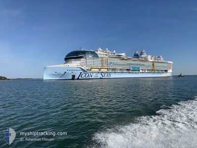
ICON OF THE SEAS
Passenger
Current Trip
| Time Travelled | 2 days |
|---|---|
| Remaining Time | 4 h, 31 mins |
| Distance Travelled | 1011.38 nm |
| Remaining Distance | 78.32 nm |
| AVG Speed | 18.3 Knopen |
| MAX Speed | 21.2 Knopen |
| AVG Wind | 12.1 knots |
| MAX Wind | 19.7 knots |
| MIN Temp | 20.9°C / 69.62°F |
| MAX Temp | 25.1°C / 77.18°F |
| Diepgang | 9.1 M |
| Positie ontvangen | 7 m geleden |
Current Position
| Lengtegraad | --- |
|---|---|
| Breedtegraat | --- |
| Status | Under way using engine |
| Snelheid | 14.8 Knopen |
| Koers | 138.9° |
| Gebied | Caribbean Sea |
| Station | T-AIS |
| Positie ontvangen | 7 m geleden |
Info
Information
The current position of ICON OF THE SEAS is in Caribbean Sea with coordinates 18.78423° / -63.97235° as reported on 2026-01-06 05:48 by AIS to our vessel tracker app. The vessel's current speed is 14.8 Knopen and is heading at the port of PHILIPSBURG. The estimated time of arrival as calculated by MyShipTracking vessel tracking app is 2026-01-06 06:26 LT
The vessel ICON OF THE SEAS (IMO: 9829930, MMSI: 311001178) is a Passenger It's sailing under the flag of [BS] Bahamas.
In this page you can find informations about the vessels current position, last detected port calls, and current voyage information. If the vessels is not in coverage by AIS you will find the latest position.
The current position of ICON OF THE SEAS is detected by our AIS receivers and we are not responsible for the reliability of the data. The last position was recorded while the vessel was in Coverage by the Ais receivers of our vessel tracking app.
The current draught of ICON OF THE SEAS as reported by AIS is 9.1 meters
Weather
| Temperature | 25.2°C / 77.36°F |
|---|---|
| Wind Speed | 6 knots |
| Direction | 356° N |
| Pressure | 1013.7 hPa |
| Humidity | 75.4 % |
| Cloud Coverage | 79 % |
Featured Company
Last Port Calls
| Port | Arrival | Departure | Time In Port |
|---|---|---|---|
| 2026-01-03 02:40 | 2026-01-03 16:53 | 14 h | |
| 2025-12-31 07:26 | 2025-12-31 18:09 | 10 h | |
| 2025-12-30 06:37 | 2025-12-30 16:44 | 10 h | |
| 2025-12-29 07:24 | 2025-12-29 17:46 | 10 h | |
| 2025-12-27 02:17 | 2025-12-27 16:58 | 14 h | |
| 2025-12-23 06:47 | 2025-12-23 18:43 | 11 h | |
| 2025-12-20 02:28 | 2025-12-20 17:10 | 14 h | |
| 2025-12-17 07:25 | 2025-12-17 18:10 | 10 h | |
| 2025-12-15 07:39 | 2025-12-15 17:18 | 9 h | |
| 2025-12-13 02:33 | 2025-12-13 17:08 | 14 h |
Most Visited Ports (Last year)
| Port | Arrivals | |
|---|---|---|
| 52 | ||
| 24 | ||
| 20 | ||
| 19 | ||
| 18 | ||
| 4 |
Last Trips
| Origin | Departure | Destination | Arrival | Distance | |
|---|---|---|---|---|---|
| 2025-12-31 18:09 | 2026-01-03 02:40 | 782.80 nm | |||
| 2025-12-30 16:44 | 2025-12-31 07:26 | 259.95 nm | |||
| 2025-12-29 17:46 | 2025-12-30 06:37 | 167.13 nm | |||
| 2025-12-27 16:58 | 2025-12-29 07:24 | 629.47 nm | |||
| 2025-12-23 18:43 | 2025-12-27 02:17 | 1117.79 nm | |||
| 2025-12-20 17:10 | 2025-12-23 06:47 | 1088.89 nm | |||
| 2025-12-17 18:10 | 2025-12-20 02:28 | 783.17 nm | |||
| 2025-12-15 17:18 | 2025-12-17 07:25 | 264.39 nm | |||
| 2025-12-13 17:08 | 2025-12-15 07:39 | 628.72 nm | |||
| 2025-12-09 18:38 | 2025-12-13 02:33 | 1113.13 nm |
Events
| Tijd | Evenement | Details | Positie / Bestemming | Info |
|---|---|---|---|---|
| 2026-01-06 05:15 | Gevonden in zee | British Virgin Islands part of the Caribbean Sea |
18.88497 / -64.06440
Caribbean Sea
SX PHI
|
Snelheid: 14.5 kn Koers: 139.1° |
| 2026-01-06 05:15 | Status Changed | Under way using engine Default |
18.88497 / -64.06440
SX PHI
|
Snelheid: 14.6 kn Koers: 139° |
| 2026-01-06 05:10 | Binnenbereik |
18.88497 / -64.06440
Caribbean Sea
SX PHI
|
Snelheid: 14.5 kn Koers: 139.1° |
|
| 2026-01-06 00:23 | Status Changed | Default Under way using engine |
19.58732 / -65.15226
SX PHI
|
Snelheid: 15.1 kn Koers: 120.9° |
| 2026-01-06 00:22 | Status Changed | Under way using engine Default |
19.59036 / -65.15762
SX PHI
|
Snelheid: 15.1 kn Koers: 121° |
| 2026-01-06 00:22 | Buitenbereik |
19.59036 / -65.15762
North Atlantic Ocean
SX PHI
|
Snelheid: 15.1 kn Koers: 120.9° |
|
| 2026-01-05 23:49 | Status Changed | Default Under way using engine |
19.66167 / -65.28167
SX PHI
|
Snelheid: 15 kn Koers: 120.8° |
| 2026-01-05 23:28 | Wijzig zee gebeid | British Virgin Islands part of the North Atlantic Ocean Puerto Rican part of the North Atlantic Ocean |
19.70627 / -65.36112
North Atlantic Ocean
SX PHI
|
Snelheid: 15.1 kn Koers: 120.9° |
| 2026-01-05 23:15 | Wijzig zee gebeid | Puerto Rican part of the North Atlantic Ocean Bahamas part of the North Atlantic Ocean |
19.73449 / -65.41053
North Atlantic Ocean
SX PHI
|
Snelheid: 15.1 kn Koers: 122.1° |
| 2026-01-05 23:14 | Status Changed | Under way using engine Default |
19.73628 / -65.41355
SX PHI
|
Snelheid: 15 kn Koers: 120° |