
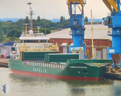
HUMBER SPRINTER
General Cargo
Current Trip
| Time Travelled | 5 days |
|---|---|
| Remaining Time | 9 h, 10 mins |
| Distance Travelled | 856.50 nm |
| Remaining Distance | 111.98 nm |
| AVG Speed | 8.5 Knopen |
| MAX Speed | 14.4 Knopen |
| AVG Wind | 14.7 knots |
| MAX Wind | 28 knots |
| MIN Temp | 2.5°C / 36.5°F |
| MAX Temp | 11.3°C / 52.34°F |
| Diepgang | 5.7 M |
| Positie ontvangen | 8 h, 56 m geleden |
Current Position
| Lengtegraad | --- |
|---|---|
| Breedtegraat | --- |
| Status | Under way using engine |
| Snelheid | 10 Knopen |
| Koers | 249.3° |
| Gebied | North Sea |
| Station | T-AIS |
| Positie ontvangen | 8 h, 56 m geleden |
Info
Information
The current position of HUMBER SPRINTER is in North Sea with coordinates 53.53978° / 4.87437° as reported on 2025-12-11 01:20 by AIS to our vessel tracker app. The vessel's current speed is 10 Knopen and is heading at the port of IMMINGHAM. The estimated time of arrival as calculated by MyShipTracking vessel tracking app is 2025-12-11 19:27 LT
The vessel HUMBER SPRINTER (IMO: 9467172, MMSI: 305649000) is a General Cargo that was built in 2009 ( 16 Jaar oud ). It's sailing under the flag of [AG] Antigua Barbuda.
In this page you can find informations about the vessels current position, last detected port calls, and current voyage information. If the vessels is not in coverage by AIS you will find the latest position.
The current position of HUMBER SPRINTER is detected by our AIS receivers and we are not responsible for the reliability of the data. The last position was recorded while the vessel was in Coverage by the Ais receivers of our vessel tracking app.
The current draught of HUMBER SPRINTER as reported by AIS is 5.7 meters
Weather
| Temperature | 9.2°C / 48.56°F |
|---|---|
| Wind Speed | 19 knots |
| Direction | 218° SW |
| Pressure | 1018.6 hPa |
| Humidity | 87.2 % |
| Cloud Coverage | 76 % |
Featured Company
Last Port Calls
| Port | Arrival | Departure | Time In Port |
|---|---|---|---|
| 2025-12-04 21:41 | 2025-12-05 13:27 | 15 h | |
| 2025-12-03 18:57 | 2025-12-04 03:34 | 8 h | |
| 2025-11-26 23:23 | 2025-11-30 13:09 | 3 d | |
| 2025-11-26 00:22 | 2025-11-26 18:19 | 17 h | |
| 2025-11-17 03:35 | 2025-11-18 10:27 | 1 d | |
| 2025-11-11 14:21 | 2025-11-14 07:34 | 2 d | |
| 2025-11-08 21:36 | 2025-11-09 20:11 | 22 h | |
| 2025-11-07 08:48 | 2025-11-08 15:46 | 1 d | |
| 2025-10-31 13:12 | 2025-10-31 18:00 | 4 h | |
| 2025-10-30 07:01 | 2025-10-30 17:56 | 10 h |
Last Trips
| Origin | Departure | Destination | Arrival | Distance | |
|---|---|---|---|---|---|
| 2025-12-04 03:34 | 2025-12-04 21:41 | 235.42 nm | |||
| 2025-11-30 13:09 | 2025-12-03 18:57 | 840.47 nm | |||
| 2025-11-26 18:19 | 2025-11-26 23:23 | 32.98 nm | |||
| 2025-11-18 10:27 | 2025-11-26 00:22 | 1452.66 nm | |||
| 2025-11-14 07:34 | 2025-11-17 03:35 | 716.95 nm | |||
| 2025-11-09 20:11 | 2025-11-11 14:21 | 245.96 nm | |||
| 2025-11-08 15:46 | 2025-11-08 21:36 | 31.83 nm | |||
| 2025-10-31 18:00 | 2025-11-07 08:48 | 1103.70 nm | |||
| 2025-10-30 17:56 | 2025-10-31 13:12 | 235.17 nm | |||
| 2025-10-26 19:50 | 2025-10-30 07:01 | 849.03 nm |
Events
| Tijd | Evenement | Details | Positie / Bestemming | Info |
|---|---|---|---|---|
| 2025-12-11 01:25 | Status Changed | Default Under way using engine |
53.53462 / 4.85086
GBIMM
|
Snelheid: 10 kn Koers: 249.3° |
| 2025-12-11 01:20 | Buitenbereik |
53.53978 / 4.87437
North Sea
GBIMM
|
Snelheid: 10 kn Koers: 249.3° |
|
| 2025-12-10 22:16 | Gevonden in zee | Dutch part of the North Sea |
53.69403 / 5.64830
North Sea
GBIMM
|
Snelheid: 8.8 kn Koers: 251.8° |
| 2025-12-10 22:16 | Status Changed | Under way using engine Default |
53.69403 / 5.64830
GBIMM
|
Snelheid: 9.1 kn Koers: 254° |
| 2025-12-10 22:04 | Binnenbereik |
53.69403 / 5.64830
North Sea
GBIMM
|
Snelheid: 8.8 kn Koers: 251.8° |
|
| 2025-12-10 10:37 | Status Changed | Default Under way using engine |
53.84752 / 8.94028
GBIMM
|
Snelheid: 14.3 kn Koers: 254.5° |
| 2025-12-10 10:29 | Buitenbereik |
53.85383 / 8.99463
North Sea
GBIMM
|
Snelheid: 14.3 kn Koers: 254.5° |
|
| 2025-12-10 10:27 | Status Changed | Under way using engine Default |
53.85587 / 9.00655
GBIMM
|
Snelheid: 14.1 kn Koers: 247° |
| 2025-12-10 10:21 | Status Changed | Default Under way using engine |
53.86553 / 9.04615
GBIMM
|
Snelheid: 14.4 kn Koers: 248.9° |
| 2025-12-10 10:05 | ETA Changed | 2025/12/11 16:00 2025/12/11 14:00 |
53.88970 / 9.13760
GBIMM
|
Snelheid: 8.8 kn Koers: 217.8° |