
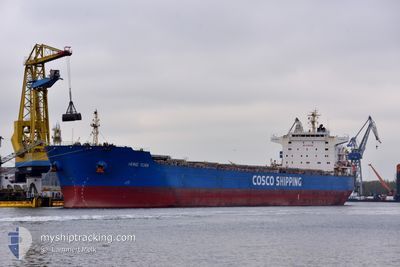
HONG YUAN
Bulk Carrier
Current Trip
| Time Travelled | 3 days |
|---|---|
| Remaining Time | 2 days |
| Distance Travelled | 788.97 nm |
| Remaining Distance | 719.50 nm |
| AVG Speed | 9.3 Knopen |
| MAX Speed | 11.7 Knopen |
| AVG Wind | 18.2 knots |
| MAX Wind | 35.1 knots |
| MIN Temp | 12.1°C / 53.78°F |
| MAX Temp | 16.9°C / 62.42°F |
| Diepgang | 12.8 M |
| Positie ontvangen | 3 d geleden |
Current Position
| Lengtegraad | -1.76507° |
|---|---|
| Breedtegraat | 46.10527° |
| Status | Under way using engine |
| Snelheid | 10.4 Knopen |
| Koers | 254° |
| Gebied | Bay of Biscay |
| Station | T-AIS |
| Positie ontvangen | 3 d geleden |
Info
Information
The current position of HONG YUAN is in Bay of Biscay with coordinates 46.10527° / -1.76507° as reported on 2024-05-02 15:25 by AIS to our vessel tracker app. The vessel's current speed is 10.4 Knopen and is heading at the port of LAS PALMAS. The estimated time of arrival as calculated by MyShipTracking vessel tracking app is 2024-05-08 02:08 LT
The vessel HONG YUAN (IMO: 9500883, MMSI: 353143000) is a Bulk Carrier that was built in 2009 ( 15 Jaar oud ). It's sailing under the flag of [PA] Panama.
In this page you can find informations about the vessels current position, last detected port calls, and current voyage information. If the vessels is not in coverage by AIS you will find the latest position.
The current position of HONG YUAN is detected by our AIS receivers and we are not responsible for the reliability of the data. The last position was recorded while the vessel was in Coverage by the Ais receivers of our vessel tracking app.
The current draught of HONG YUAN as reported by AIS is 12.8 meters
Weather
| Temperature | 16.7°C / 62.06°F |
|---|---|
| Wind Speed | 12 knots |
| Direction | 295° WNW |
| Pressure | 1016.9 hPa |
| Humidity | 87.6 % |
| Cloud Coverage | 100 % |
Featured Company
Last Port Calls
| Port | Arrival | Departure | Time In Port |
|---|---|---|---|
| 2024-04-30 05:59 | 2024-05-02 12:50 | 2 d | |
| 2024-03-26 22:56 | 2024-04-16 19:10 | 20 d | |
| 2024-03-08 06:55 |
Most Visited Ports (Last year)
| Port | Arrivals | |
|---|---|---|
| 2 | ||
| 2 | ||
| 2 | ||
| 1 | ||
| 1 | ||
| 1 |
Last Trips
| Origin | Departure | Destination | Arrival | Distance | |
|---|---|---|---|---|---|
| 2024-04-16 20:10 | 2024-04-30 07:59 | 1235.27 nm | |||
| 2024-03-08 03:55 | 2024-03-26 22:56 | 4195.30 nm |
Events
| Tijd | Evenement | Details | Positie / Bestemming | Info |
|---|---|---|---|---|
| 2024-05-02 15:25 | Buitenbereik |
46.10527 / -1.76507
Bay of Biscay
LAS PALMAS
|
Snelheid: 10.4 kn Koers: 254° |
|
| 2024-05-02 15:22 | Status Changed | Under way using engine Default |
46.10778 / -1.75242
LAS PALMAS
|
Snelheid: 10.4 kn Koers: 271° |
| 2024-05-02 14:57 | Status Changed | Default Under way using engine |
46.12663 / -1.65247
LAS PALMAS
|
Snelheid: 10.7 kn Koers: 272° |
| 2024-05-02 12:50 | Vertrekhaven |
|
46.15332 / -1.23982
LAS PALMAS
|
Snelheid: 3.3 kn Koers: 226° |
| 2024-05-02 12:49 | Start beweging |
46.15435 / -1.23793
[FR] LA PALLICE
|
Snelheid: 3.1 kn Koers: 240° |
|
| 2024-05-02 12:12 | Status Changed | Under way using engine Moored |
46.15242 / -1.23017
[FR] LA PALLICE
|
Snelheid: Koers: 54° |
| 2024-05-02 12:12 | Draught Changed | 12.8 11.1 |
46.15240 / -1.23013
[FR] LA PALLICE
|
Snelheid: Koers: 54° |
| 2024-05-02 12:12 | Destination Changed | LAS PALMAS LA PALLICE |
46.15240 / -1.23013
[FR] LA PALLICE
|
Snelheid: Koers: 54° |
| 2024-05-02 12:12 | ETA Changed | 2024/05/08 12:00 2025/04/28 12:00 |
46.15240 / -1.23013
[FR] LA PALLICE
|
Snelheid: Koers: 54° |
| 2024-05-01 00:01 | ETA Changed | 2025/04/28 12:00 2024/04/28 12:00 |
46.15242 / -1.23015
[FR] LA PALLICE
|
Snelheid: Koers: 54° |