
SEAWIND
Pleasure Craft
Current Trip
| Trip Time | 1 h, 47 mins |
|---|---|
| Trip Distance | 13.57 nm |
| AVG Speed | 7.5 Knopen |
| MAX Speed | 8.3 Knopen |
| Diepgang | --- |
| AVG Wind | 7.9 knots |
| MAX Wind | 9 knots |
| MIN Temp | 9.9°C / 49.82°F |
| MAX Temp | 11.8°C / 53.24°F |
| Positie ontvangen | 1 d geleden |
Current Position
| Lengtegraad | 5.06456° |
|---|---|
| Breedtegraat | 52.48757° |
| Status | Default |
| Snelheid | |
| Koers | --- |
| Gebied | North Sea |
| Station | T-AIS |
| Positie ontvangen | 1 d geleden |
Info
Information
The current position of SEAWIND is in North Sea with coordinates 52.48757° / 5.06456° as reported on 2024-04-28 09:16 by AIS to our vessel tracker app. The vessel's current speed is 0 Knopen and is currently inside the port of VOLENDAM.
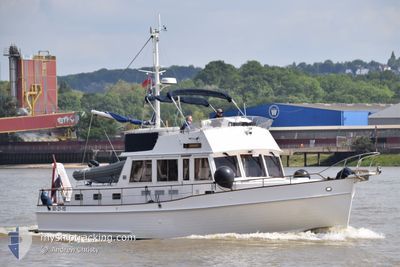
The vessel SEAWIND (MMSI: 244630410) is a Pleasure Craft It's sailing under the flag of [NL] Netherlands.
In this page you can find informations about the vessels current position, last detected port calls, and current voyage information. If the vessels is not in coverage by AIS you will find the latest position.
The current position of SEAWIND is detected by our AIS receivers and we are not responsible for the reliability of the data. The last position was recorded while the vessel was in Coverage by the Ais receivers of our vessel tracking app.
Weather
| Temperature | 14.3°C / 57.74°F |
|---|---|
| Wind Speed | 15 knots |
| Direction | 182° S |
| Pressure | 1004.4 hPa |
| Humidity | 68.3 % |
| Cloud Coverage | 100 % |
Featured Company
Events
| Tijd | Evenement | Details | Positie / Bestemming | Info |
|---|---|---|---|---|
| 2024-04-28 09:16 | Buitenbereik |
52.48757 / 5.06456
North Sea
[NL] VOLENDAM
|
Snelheid: Koers: 511° |
|
| 2024-04-26 13:10 | Stop beweging |
52.48765 / 5.06439
[NL] VOLENDAM
|
Snelheid: 0.2 kn Koers: 511° |
|
| 2024-04-26 13:06 | Aankomsthaven |
|
52.48900 / 5.06808
[NL] VOLENDAM
|
Snelheid: 5.7 kn Koers: 293.1° |
| 2024-04-26 11:22 | Start beweging | 0.28 nm, North of NAARDEN |
52.31484 / 5.15189
|
Snelheid: 7.6 kn Koers: 349.8° |
| 2024-04-26 11:19 | Vertrekhaven |
|
52.31484 / 5.15189
|
Snelheid: Koers: 511° |
| 2024-04-26 10:58 | Binnenbereik |
52.31099 / 5.14384
North Sea
[NL] NAARDEN
|
Snelheid: Koers: 511° |
|
| 2024-04-23 14:42 | Buitenbereik |
52.31098 / 5.14384
North Sea
[NL] NAARDEN
|
Snelheid: Koers: 511° |
|
| 2024-04-23 14:36 | Binnenbereik |
52.31099 / 5.14384
North Sea
[NL] NAARDEN
|
Snelheid: Koers: 511° |
|
| 2024-04-21 11:17 | Buitenbereik |
52.31099 / 5.14386
North Sea
[NL] NAARDEN
|
Snelheid: Koers: 511° |
|
| 2024-04-21 09:20 | Binnenbereik |
52.31100 / 5.14384
North Sea
[NL] NAARDEN
|
Snelheid: Koers: 511° |