
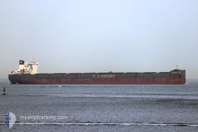
HERMANN OLDENDORFF
Cargo
Current Trip
| Time Travelled | 4 days |
|---|---|
| Remaining Time | 7 days |
| Distance Travelled | 1028.59 nm |
| Remaining Distance | 2052.89 nm |
| AVG Speed | 11.5 Knopen |
| MAX Speed | 14.5 Knopen |
| AVG Wind | 18.7 knots |
| MAX Wind | 23.9 knots |
| MIN Temp | 21.9°C / 71.42°F |
| MAX Temp | 30.2°C / 86.36°F |
| Diepgang | 10 M |
| Positie ontvangen | 2 d geleden |
Current Position
| Lengtegraad | 114.58164° |
|---|---|
| Breedtegraat | 21.90926° |
| Status | Under way using engine |
| Snelheid | 11.1 Knopen |
| Koers | 154° |
| Gebied | South China Sea |
| Station | T-AIS |
| Positie ontvangen | 2 d geleden |
Info
Information
The current position of HERMANN OLDENDORFF is in South China Sea with coordinates 21.90926° / 114.58164° as reported on 2024-06-04 23:06 by AIS to our vessel tracker app. The vessel's current speed is 11.1 Knopen and is heading at the port of PORT HEDLAND. The estimated time of arrival as calculated by MyShipTracking vessel tracking app is 2024-06-14 15:42 LT
The vessel HERMANN OLDENDORFF (IMO: 9731585, MMSI: 255805682) is a Cargo It's sailing under the flag of [PT] Portugal.
In this page you can find informations about the vessels current position, last detected port calls, and current voyage information. If the vessels is not in coverage by AIS you will find the latest position.
The current position of HERMANN OLDENDORFF is detected by our AIS receivers and we are not responsible for the reliability of the data. The last position was recorded while the vessel was in Coverage by the Ais receivers of our vessel tracking app.
The current draught of HERMANN OLDENDORFF as reported by AIS is 10 meters
Weather
| Temperature | 29.1°C / 84.38°F |
|---|---|
| Wind Speed | 1 knots |
| Direction | 236° SW |
| Pressure | 1008.5 hPa |
| Humidity | 67.5 % |
| Cloud Coverage | 100 % |
Featured Company
Last Port Calls
| Port | Arrival | Departure | Time In Port |
|---|---|---|---|
| 2024-05-31 03:58 | 2024-06-03 00:46 | 2 d | |
| 2024-05-16 07:14 | 2024-05-18 11:20 | 2 d | |
| 2024-04-29 03:12 | 2024-04-29 06:36 | 3 h | |
| 2024-04-25 17:19 | 2024-04-28 15:56 | 2 d | |
| 2024-04-03 12:01 | 2024-04-25 16:43 | 22 d | |
| 2024-04-01 09:29 |
Most Visited Ports (Last year)
| Port | Arrivals | |
|---|---|---|
| 3 | ||
| 2 | ||
| 1 | ||
| 1 | ||
| 1 | ||
| 1 |
Last Trips
| Origin | Departure | Destination | Arrival | Distance | |
|---|---|---|---|---|---|
| 2024-05-18 19:20 | 2024-05-31 11:58 | 2848.92 nm | |||
| 2024-04-29 15:36 | 2024-05-16 15:14 | 3545.41 nm | |||
| 2024-04-29 00:56 | 2024-04-29 12:12 | 5.22 nm | |||
| 2024-04-26 01:43 | 2024-04-26 02:19 | 0.51 nm | |||
| 2024-04-01 18:29 | 2024-04-03 21:01 | 464.63 nm |
Events
| Tijd | Evenement | Details | Positie / Bestemming | Info |
|---|---|---|---|---|
| 2024-06-04 23:11 | Status Changed | Default Under way using engine |
21.89331 / 114.58974
AU PHE
|
Snelheid: 11.1 kn Koers: 154° |
| 2024-06-04 23:06 | Status Changed | Under way using engine Default |
21.90926 / 114.58164
AU PHE
|
Snelheid: 10.9 kn Koers: 154° |
| 2024-06-04 23:06 | Buitenbereik |
21.90926 / 114.58164
South China Sea
AU PHE
|
Snelheid: 11.1 kn Koers: 154° |
|
| 2024-06-04 23:00 | Status Changed | Default Under way using engine |
21.92641 / 114.57301
AU PHE
|
Snelheid: 11 kn Koers: 153.9° |
| 2024-06-04 22:53 | Status Changed | Under way using engine Default |
21.94401 / 114.56430
AU PHE
|
Snelheid: 11.2 kn Koers: 157° |
| 2024-06-04 22:39 | Status Changed | Default Under way using engine |
21.98486 / 114.54557
AU PHE
|
Snelheid: 11.3 kn Koers: 156.3° |
| 2024-06-04 21:17 | Draught Changed | 10 9.7 |
22.10544 / 114.33070
AU PHE
|
Snelheid: 11.1 kn Koers: 96.8° |
| 2024-06-04 21:17 | Destination Changed | AU PHE CNHKG |
22.10544 / 114.33070
AU PHE
|
Snelheid: 11.1 kn Koers: 96.8° |
| 2024-06-04 21:17 | ETA Changed | 2024/06/14 04:00 2024/06/04 06:30 |
22.10544 / 114.33070
AU PHE
|
Snelheid: 11.1 kn Koers: 96.8° |
| 2024-06-04 20:14 | Start beweging | 8.07 nm, North East of WAILINGDING ISLAND |
22.15483 / 114.15641
CNHKG
|
Snelheid: 4.5 kn Koers: 132° |