
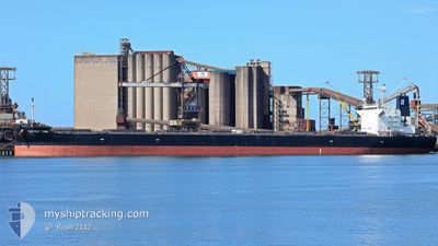
HARVEST TIME
Cargo
Current Trip
| Time Travelled | 17 days |
|---|---|
| Remaining Time | --- |
| Distance Travelled | 4354.02 nm |
| Remaining Distance | --- |
| AVG Speed | 10.7 Knopen |
| MAX Speed | 13.5 Knopen |
| AVG Wind | 9.4 knots |
| MAX Wind | 25 knots |
| MIN Temp | 10.3°C / 50.54°F |
| MAX Temp | 29.3°C / 84.74°F |
| Diepgang | 13.5 M |
| Positie ontvangen | 18 h, 21 m geleden |
Current Position
| Lengtegraad | --- |
|---|---|
| Breedtegraat | --- |
| Status | Under way using engine |
| Snelheid | 12.2 Knopen |
| Koers | 315.1° |
| Gebied | Philippine Sea |
| Station | T-AIS |
| Positie ontvangen | 18 h, 21 m geleden |
Info
Information
The current position of HARVEST TIME is in Philippine Sea with coordinates 34.68746° / 136.85680° as reported on 2025-12-07 22:25 by AIS to our vessel tracker app. The vessel's current speed is 12.2 Knopen
The vessel HARVEST TIME (IMO: 9643881, MMSI: 538006106) is a Cargo It's sailing under the flag of [MH] Marshall Is.
In this page you can find informations about the vessels current position, last detected port calls, and current voyage information. If the vessels is not in coverage by AIS you will find the latest position.
The current position of HARVEST TIME is detected by our AIS receivers and we are not responsible for the reliability of the data. The last position was recorded while the vessel was in Coverage by the Ais receivers of our vessel tracking app.
The current draught of HARVEST TIME as reported by AIS is 13.5 meters
Weather
| Temperature | 10.1°C / 50.18°F |
|---|---|
| Wind Speed | 13 knots |
| Direction | 314° NW |
| Pressure | 1020.7 hPa |
| Humidity | 60.6 % |
| Cloud Coverage | 52 % |
Featured Company
Events
| Tijd | Evenement | Details | Positie / Bestemming | Info |
|---|---|---|---|---|
| 2025-12-08 00:01 | Stop beweging | 3.58 nm, East of SUZUKA |
34.89220 / 136.70604
JP YKK
|
Snelheid: 0.2 kn Koers: 31° |
| 2025-12-07 22:33 | Status Changed | Default Under way using engine |
34.70697 / 136.83340
JP YKK
|
Snelheid: 12.2 kn Koers: 315.1° |
| 2025-12-07 22:25 | Buitenbereik |
34.68746 / 136.85680
Philippine Sea
|
Snelheid: 12.2 kn Koers: 315.1° |
|
| 2025-12-07 22:22 | Wijzig zee gebeid | Japanese part of the Philippine Sea Australian part of the Coral Sea |
34.68071 / 136.86571
Philippine Sea
|
Snelheid: 12.3 kn Koers: 310° |
| 2025-12-07 22:22 | Status Changed | Under way using engine Default |
34.68071 / 136.86571
JP YKK
|
Snelheid: 12.4 kn Koers: 310° |
| 2025-12-07 22:17 | Binnenbereik |
34.68071 / 136.86571
Philippine Sea
|
Snelheid: 12.3 kn Koers: 310° |