
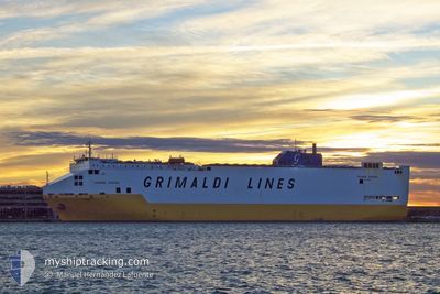
GRANDE EUROPA
Vehicles Carrier
Current Trip
| Time Travelled | 3 days |
|---|---|
| Remaining Time | 1 h, 28 mins |
| Distance Travelled | 908.36 nm |
| Remaining Distance | 5.49 nm |
| AVG Speed | 13.1 Knopen |
| MAX Speed | 18.3 Knopen |
| AVG Wind | 14.6 knots |
| MAX Wind | 22.8 knots |
| MIN Temp | 8.4°C / 47.12°F |
| MAX Temp | 23.9°C / 75.02°F |
| Diepgang | 8.2 M |
| Positie ontvangen | 1 m geleden |
Current Position
| Lengtegraad | 15.79809° |
|---|---|
| Breedtegraat | 38.42137° |
| Status | Under way using engine |
| Snelheid | 3 Knopen |
| Koers | 207° |
| Gebied | Tyrrhenian Sea |
| Station | T-AIS |
| Positie ontvangen | 1 m geleden |
Info
Information
The current position of GRANDE EUROPA is in Tyrrhenian Sea with coordinates 38.42137° / 15.79809° as reported on 2024-04-20 01:19 by AIS to our vessel tracker app. The vessel's current speed is 3 Knopen and is heading at the port of GIOIA TAURO. The estimated time of arrival as calculated by MyShipTracking vessel tracking app is 2024-04-20 02:48 LT
The vessel GRANDE EUROPA (IMO: 9138381, MMSI: 247206000) is a Vehicles Carrier that was built in 1998 ( 26 Jaar oud ). It's sailing under the flag of [IT] Italy.
In this page you can find informations about the vessels current position, last detected port calls, and current voyage information. If the vessels is not in coverage by AIS you will find the latest position.
The current position of GRANDE EUROPA is detected by our AIS receivers and we are not responsible for the reliability of the data. The last position was recorded while the vessel was in Coverage by the Ais receivers of our vessel tracking app.
The current draught of GRANDE EUROPA as reported by AIS is 8.2 meters
Weather
| Temperature | 14.8°C / 58.64°F |
|---|---|
| Wind Speed | 16 knots |
| Direction | 306° NW |
| Pressure | 1013.4 hPa |
| Humidity | 64.6 % |
| Cloud Coverage | 8 % |
Featured Company
Last Port Calls
| Port | Arrival | Departure | Time In Port |
|---|---|---|---|
| 2024-04-16 11:44 | 2024-04-17 00:29 | 12 h | |
| 2024-04-11 11:14 | 2024-04-12 06:16 | 19 h | |
| 2024-04-09 11:40 | 2024-04-09 19:11 | 7 h | |
| 2024-04-06 13:46 | 2024-04-07 20:02 | 1 d | |
| 2024-03-29 12:31 | 2024-03-31 03:19 | 1 d | |
| 2024-03-27 06:10 | 2024-03-27 21:21 | 15 h | |
| 2024-03-26 04:22 | 2024-03-26 12:51 | 8 h | |
| 2024-03-26 04:01 | 2024-03-26 04:16 | 14 m | |
| 2024-03-20 09:18 | 2024-03-20 20:19 | 11 h | |
| 2024-03-17 16:09 | 2024-03-18 12:29 | 20 h |
Last Trips
| Origin | Departure | Destination | Arrival | Distance | |
|---|---|---|---|---|---|
| 2024-04-12 09:16 | 2024-04-16 14:44 | 914.95 nm | |||
| 2024-04-09 22:11 | 2024-04-11 14:14 | 676.74 nm | |||
| 2024-04-07 22:02 | 2024-04-09 14:40 | 677.47 nm | |||
| 2024-03-31 05:19 | 2024-04-06 15:46 | 2486.36 nm | |||
| 2024-03-27 22:21 | 2024-03-29 13:31 | 584.29 nm | |||
| 2024-03-26 13:51 | 2024-03-27 07:10 | 276.36 nm | |||
| 2024-03-26 05:16 | 2024-03-26 05:22 | 0.35 nm | |||
| 2024-03-20 21:19 | 2024-03-26 05:01 | 2094.98 nm | |||
| 2024-03-18 13:29 | 2024-03-20 10:18 | 712.44 nm | |||
| 2024-03-14 14:05 | 2024-03-17 17:09 | 1186.90 nm |
Events
| Tijd | Evenement | Details | Positie / Bestemming | Info |
|---|---|---|---|---|
| 2024-04-19 18:21 | Status Changed | Under way using engine Default |
38.44806 / 15.81307
TRIZT>ITGIT
|
Snelheid: 2.5 kn Koers: 216° |
| 2024-04-19 18:20 | Status Changed | Default Under way using engine |
38.44874 / 15.81330
TRIZT>ITGIT
|
Snelheid: 2.3 kn Koers: 222° |
| 2024-04-19 07:10 | Wijzig zee gebeid | Italian part of the Tyrrhenian Sea Italian part of the Ionian Sea |
38.25300 / 15.67304
Tyrrhenian Sea
TRIZT>ITGIT
|
Snelheid: 14.8 kn Koers: 69° |
| 2024-04-19 03:38 | Gevonden in zee | Italian part of the Ionian Sea |
37.79409 / 16.13342
Ionian Sea
TRIZT>ITGIT
|
Snelheid: 14.3 kn Koers: 283.8° |
| 2024-04-19 03:38 | Binnenbereik |
37.79409 / 16.13342
Ionian Sea
TRIZT>ITGIT
|
Snelheid: 14.3 kn Koers: 283.8° |
|
| 2024-04-18 15:59 | Buitenbereik |
37.05254 / 19.71368
Ionian Sea
TRIZT>ITGIT
|
Snelheid: 16.5 kn Koers: 285.1° |
|
| 2024-04-18 13:28 | Wijzig zee gebeid | Greek part of the Ionian Sea Greek part of the Mediterranean Sea - Eastern Basin |
36.88068 / 20.54907
Ionian Sea
TRIZT>ITGIT
|
Snelheid: 16.4 kn Koers: 288.7° |
| 2024-04-18 13:28 | Status Changed | Under way using engine Default |
36.88068 / 20.54907
TRIZT>ITGIT
|
Snelheid: 16.4 kn Koers: 286° |
| 2024-04-18 13:28 | Binnenbereik |
36.88068 / 20.54907
Ionian Sea
TRIZT>ITGIT
|
Snelheid: 16.4 kn Koers: 288.7° |
|
| 2024-04-18 07:12 | Buitenbereik |
36.36110 / 22.50788
Mediterranean Sea - Eastern Basin
TRIZT>ITGIT
|
Snelheid: 16.7 kn Koers: 262.9° |