
GOLD STAR
Vehicles Carrier
Current Trip
| Time Travelled | 1 day |
|---|---|
| Remaining Time | --- |
| Distance Travelled | 234.14 nm |
| Remaining Distance | --- |
| AVG Speed | 14.2 Knopen |
| MAX Speed | 16 Knopen |
| AVG Wind | 13.4 knots |
| MAX Wind | 21.8 knots |
| MIN Temp | 20.9°C / 69.62°F |
| MAX Temp | 22.3°C / 72.14°F |
| Diepgang | 7.6 M |
| Positie ontvangen | 14 h, 53 m geleden |
Current Position
| Lengtegraad | 127.88320° |
|---|---|
| Breedtegraat | 33.67582° |
| Status | Under way using engine |
| Snelheid | 15.5 Knopen |
| Koers | 228.7° |
| Gebied | Japan Sea |
| Station | T-AIS |
| Positie ontvangen | 14 h, 53 m geleden |
Info
Information
The current position of GOLD STAR is in Japan Sea with coordinates 33.67582° / 127.88320° as reported on 2024-06-11 16:25 by AIS to our vessel tracker app. The vessel's current speed is 15.5 Knopen and is heading at the port of MELBOURNE. The estimated time of arrival as calculated by MyShipTracking vessel tracking app is 2024-06-06 10:00 LT
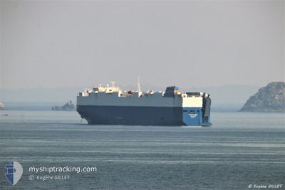
The vessel GOLD STAR (IMO: 9325178, MMSI: 636015991) is a Vehicles Carrier that was built in 2007 ( 17 Jaar oud ). It's sailing under the flag of [LR] Liberia.
In this page you can find informations about the vessels current position, last detected port calls, and current voyage information. If the vessels is not in coverage by AIS you will find the latest position.
The current position of GOLD STAR is detected by our AIS receivers and we are not responsible for the reliability of the data. The last position was recorded while the vessel was in Coverage by the Ais receivers of our vessel tracking app.
The current draught of GOLD STAR as reported by AIS is 7.6 meters
Weather
| Temperature | 21.9°C / 71.42°F |
|---|---|
| Wind Speed | 8 knots |
| Direction | 83° E |
| Pressure | 1004.1 hPa |
| Humidity | 94 % |
| Cloud Coverage | 100 % |
Featured Company
Events
| Tijd | Evenement | Details | Positie / Bestemming | Info |
|---|---|---|---|---|
| 2024-06-11 21:02 | Draught Changed | 7.6 8.3 |
32.97786 / 126.85998
MELBOURNE
|
Snelheid: 15.3 kn Koers: 234° |
| 2024-06-11 21:02 | Destination Changed | MELBOURNE CN SHG |
32.97786 / 126.85998
MELBOURNE
|
Snelheid: 15.3 kn Koers: 234° |
| 2024-06-11 21:02 | ETA Changed | 2024/06/06 00:00 2024/06/12 18:00 |
32.97786 / 126.85998
MELBOURNE
|
Snelheid: 15.3 kn Koers: 234° |
| 2024-06-11 16:28 | Status Changed | Default Under way using engine |
33.66703 / 127.87116
CN SHG
|
Snelheid: 15.5 kn Koers: 228.7° |
| 2024-06-11 16:25 | Buitenbereik |
33.67582 / 127.88320
Japan Sea
CN SHG
|
Snelheid: 15.5 kn Koers: 228.7° |
|
| 2024-06-11 16:20 | Status Changed | Under way using engine Default |
33.69105 / 127.90423
CN SHG
|
Snelheid: 15.6 kn Koers: 229° |
| 2024-06-11 16:11 | Binnenbereik |
33.68313 / 127.89331
Japan Sea
CN SHG
|
Snelheid: 15.5 kn Koers: 229.3° |
|
| 2024-06-11 14:57 | Status Changed | Default Under way using engine |
33.91382 / 128.24136
CN SHG
|
Snelheid: 15.6 kn Koers: 231.7° |
| 2024-06-11 14:49 | Buitenbereik |
33.93626 / 128.27700
Japan Sea
CN SHG
|
Snelheid: 15.6 kn Koers: 231.7° |
|
| 2024-06-11 14:47 | Status Changed | Under way using engine Default |
33.94004 / 128.28281
CN SHG
|
Snelheid: 15.4 kn Koers: 233° |