
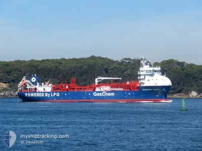
GASCHEM HOMER
Tanker D
Current Trip
| Time Travelled | 9 days |
|---|---|
| Remaining Time | 7 h, 49 mins |
| Distance Travelled | 1027.36 nm |
| Remaining Distance | 66.05 nm |
| AVG Speed | 10.3 Knopen |
| MAX Speed | 15.5 Knopen |
| AVG Wind | 15.5 knots |
| MAX Wind | 26 knots |
| MIN Temp | 14°C / 57.2°F |
| MAX Temp | 23.7°C / 74.66°F |
| Diepgang | 5.5 M |
| Positie ontvangen | 1 m geleden |
Current Position
| Lengtegraad | 145.82816° |
|---|---|
| Breedtegraat | -38.98856° |
| Status | Under way using engine |
| Snelheid | 8.1 Knopen |
| Koers | 303.1° |
| Gebied | Bass Strait |
| Station | T-AIS |
| Positie ontvangen | 1 m geleden |
Info
Information
The current position of GASCHEM HOMER is in Bass Strait with coordinates -38.98856° / 145.82816° as reported on 2024-05-01 13:10 by AIS to our vessel tracker app. The vessel's current speed is 8.1 Knopen and is heading at the port of WESTERNPORT. The estimated time of arrival as calculated by MyShipTracking vessel tracking app is 2024-05-01 21:00 LT
The vessel GASCHEM HOMER (IMO: 9915258, MMSI: 636093032) is a Tanker D It's sailing under the flag of [LR] Liberia.
In this page you can find informations about the vessels current position, last detected port calls, and current voyage information. If the vessels is not in coverage by AIS you will find the latest position.
The current position of GASCHEM HOMER is detected by our AIS receivers and we are not responsible for the reliability of the data. The last position was recorded while the vessel was in Coverage by the Ais receivers of our vessel tracking app.
The current draught of GASCHEM HOMER as reported by AIS is 5.5 meters
Weather
| Temperature | 14.5°C / 58.1°F |
|---|---|
| Wind Speed | 6 knots |
| Direction | 74° ENE |
| Pressure | 1033.2 hPa |
| Humidity | 69.6 % |
| Cloud Coverage | 6 % |
Featured Company
Last Port Calls
| Port | Arrival | Departure | Time In Port |
|---|---|---|---|
| 2024-04-21 18:57 | 2024-04-22 12:45 | 17 h | |
| 2024-04-16 18:46 | 2024-04-17 08:11 | 13 h | |
| 2024-04-12 02:53 | 2024-04-12 22:35 | 19 h | |
| 2024-04-03 17:52 | 2024-04-04 08:20 | 14 h | |
| 2024-03-28 09:17 | 2024-03-28 23:20 | 14 h | |
| 2024-03-26 21:30 | 2024-03-27 05:43 | 8 h | |
| 2024-03-22 13:20 | 2024-03-23 15:08 | 1 d | |
| 2024-03-18 17:42 | 2024-03-19 09:31 | 15 h | |
| 2024-03-12 19:44 | 2024-03-13 10:13 | 14 h | |
| 2024-03-06 20:22 | 2024-03-07 07:11 | 10 h |
Last Trips
| Origin | Departure | Destination | Arrival | Distance | |
|---|---|---|---|---|---|
| 2024-04-17 18:11 | 2024-04-22 04:57 | 1066.71 nm | |||
| 2024-04-13 08:35 | 2024-04-17 04:46 | 1046.38 nm | |||
| 2024-04-04 19:20 | 2024-04-12 12:53 | 1125.67 nm | |||
| 2024-03-29 09:20 | 2024-04-04 04:52 | 1152.92 nm | |||
| 2024-03-27 15:43 | 2024-03-28 19:17 | 316.81 nm | |||
| 2024-03-24 02:08 | 2024-03-27 07:30 | 753.38 nm | |||
| 2024-03-19 19:31 | 2024-03-23 00:20 | 567.65 nm | |||
| 2024-03-13 21:13 | 2024-03-19 03:42 | 1056.34 nm | |||
| 2024-03-07 18:11 | 2024-03-13 06:44 | 194.16 nm | |||
| 2024-02-28 00:38 | 2024-03-07 07:22 | 1054.88 nm |
Events
| Tijd | Evenement | Details | Positie / Bestemming | Info |
|---|---|---|---|---|
| 2024-05-01 09:14 | Wijzig zee gebeid | Australian part of the Bass Strait Australian part of the Tasman Sea |
-39.16752 / 146.42546
Bass Strait
AUWEP
|
Snelheid: 8.2 kn Koers: 247.9° |
| 2024-05-01 09:11 | Status Changed | Under way using engine Default |
-39.16573 / 146.43240
AUWEP
|
Snelheid: 8.4 kn Koers: 253° |
| 2024-05-01 08:59 | Binnenbereik |
-39.16752 / 146.42546
Bass Strait
AUWEP
|
Snelheid: 8.2 kn Koers: 247.9° |
|
| 2024-04-29 11:42 | Status Changed | Default Under way using engine |
-34.66500 / 151.77499
AUWEP
|
Snelheid: 8.9 kn Koers: 203.4° |
| 2024-04-29 11:37 | Buitenbereik |
-34.65483 / 151.78080
Tasman Sea
AUWEP
|
Snelheid: 8.9 kn Koers: 203.4° |
|
| 2024-04-29 11:28 | Status Changed | Under way using engine Default |
-34.63429 / 151.79169
AUWEP
|
Snelheid: 9.2 kn Koers: 208° |
| 2024-04-29 11:23 | Status Changed | Default Under way using engine |
-34.62206 / 151.79929
AUWEP
|
Snelheid: 9.2 kn Koers: 209° |
| 2024-04-29 11:14 | Status Changed | Under way using engine Default |
-34.60052 / 151.81301
AUWEP
|
Snelheid: 9.1 kn Koers: 210° |
| 2024-04-29 11:11 | Status Changed | Default Under way using engine |
-34.59374 / 151.81737
AUWEP
|
Snelheid: 9.3 kn Koers: 207.1° |
| 2024-04-29 10:06 | Status Changed | Under way using engine Default |
-34.44418 / 151.90217
AUWEP
|
Snelheid: 9.2 kn Koers: 201° |