
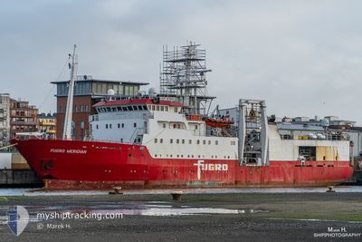
FUGRO MERIDIAN
Research/Survey Vessel
Current Trip
SURVEY SITE
| Time Travelled | 3 days |
|---|---|
| Remaining Time | --- |
| Distance Travelled | 331.73 nm |
| Remaining Distance | --- |
| AVG Speed | 7.3 Knopen |
| MAX Speed | 11.7 Knopen |
| AVG Wind | 12.4 knots |
| MAX Wind | 19.5 knots |
| MIN Temp | 4.2°C / 39.56°F |
| MAX Temp | 7.6°C / 45.68°F |
| Diepgang | 6.6 M |
| Positie ontvangen | 35 m geleden |
Current Position
| Lengtegraad | 1.97897° |
|---|---|
| Breedtegraat | 60.58157° |
| Status | Restricted manoeuverability |
| Snelheid | 4.3 Knopen |
| Koers | 263° |
| Gebied | North Sea |
| Station | T-AIS |
| Positie ontvangen | 35 m geleden |
Info
Information
The current position of FUGRO MERIDIAN is in North Sea with coordinates 60.58157° / 1.97897° as reported on 2024-04-27 12:01 by AIS to our vessel tracker app. The vessel's current speed is 4.3 Knopen
The vessel FUGRO MERIDIAN (IMO: 8101331, MMSI: 308036000) is a Research/Survey Vessel that was built in 1982 ( 42 Jaar oud ). It's sailing under the flag of [BS] Bahamas.
In this page you can find informations about the vessels current position, last detected port calls, and current voyage information. If the vessels is not in coverage by AIS you will find the latest position.
The current position of FUGRO MERIDIAN is detected by our AIS receivers and we are not responsible for the reliability of the data. The last position was recorded while the vessel was in Coverage by the Ais receivers of our vessel tracking app.
The current draught of FUGRO MERIDIAN as reported by AIS is 6.6 meters
Weather
| Temperature | 7.6°C / 45.68°F |
|---|---|
| Wind Speed | 5 knots |
| Direction | 100° E |
| Pressure | 1013.6 hPa |
| Humidity | 70.1 % |
| Cloud Coverage | 75 % |
Featured Company
Last Port Calls
| Port | Arrival | Departure | Time In Port |
|---|---|---|---|
| 2024-04-23 07:59 | 2024-04-24 10:32 | 1 d | |
| 2024-04-13 06:52 | 2024-04-13 15:25 | 8 h | |
| 2024-04-09 09:42 | 2024-04-11 09:47 | 2 d | |
| 2024-03-23 06:36 | 2024-03-25 21:17 | 2 d | |
| 2024-02-25 18:29 | 2024-03-11 16:45 | 14 d | |
| 2024-02-10 19:30 | 2024-02-24 20:15 | 14 d | |
| 2024-02-09 15:17 |
Last Trips
| Origin | Departure | Destination | Arrival | Distance | |
|---|---|---|---|---|---|
| 2024-04-13 16:25 | 2024-04-23 09:59 | 761.25 nm | |||
| 2024-04-11 11:47 | 2024-04-13 07:52 | 369.63 nm | |||
| 2024-03-25 22:17 | 2024-04-09 11:42 | 1234.20 nm | |||
| 2024-03-11 17:45 | 2024-03-23 07:36 | 372.78 nm | |||
| 2024-02-24 21:15 | 2024-02-25 19:29 | 46.89 nm | |||
| 2024-02-09 16:17 | 2024-02-10 20:30 | 129.92 nm |
Events
| Tijd | Evenement | Details | Positie / Bestemming | Info |
|---|---|---|---|---|
| 2024-04-27 12:13 | Status Changed | Default Restricted manoeuverability |
60.57873 / 1.94822
SURVEY SITE
|
Snelheid: 4.3 kn Koers: 263° |
| 2024-04-27 12:01 | Status Changed | Restricted manoeuverability Default |
60.58157 / 1.97897
SURVEY SITE
|
Snelheid: 4.4 kn Koers: 262° |
| 2024-04-27 11:55 | Status Changed | Default Restricted manoeuverability |
60.58294 / 1.99373
SURVEY SITE
|
Snelheid: 4.5 kn Koers: 260° |
| 2024-04-27 11:44 | Status Changed | Restricted manoeuverability Default |
60.58535 / 2.01985
SURVEY SITE
|
Snelheid: 4.5 kn Koers: 291° |
| 2024-04-27 11:13 | Status Changed | Default Restricted manoeuverability |
60.57731 / 2.09394
SURVEY SITE
|
Snelheid: 4.5 kn Koers: 250° |
| 2024-04-27 11:02 | Status Changed | Restricted manoeuverability Default |
60.58013 / 2.09542
SURVEY SITE
|
Snelheid: 4.5 kn Koers: 95° |
| 2024-04-27 10:58 | Binnenbereik |
60.58001 / 2.10103
North Sea
|
Snelheid: 4.3 kn Koers: 92.6° |
|
| 2024-04-27 10:04 | Status Changed | Default Restricted manoeuverability |
60.58259 / 1.95891
SURVEY SITE
|
Snelheid: 4 kn Koers: 248° |
| 2024-04-27 09:58 | Status Changed | Restricted manoeuverability Default |
60.58079 / 1.96890
SURVEY SITE
|
Snelheid: 4.4 kn Koers: 229° |
| 2024-04-27 09:58 | Buitenbereik |
60.58079 / 1.96890
North Sea
|
Snelheid: 4 kn Koers: 259.2° |