
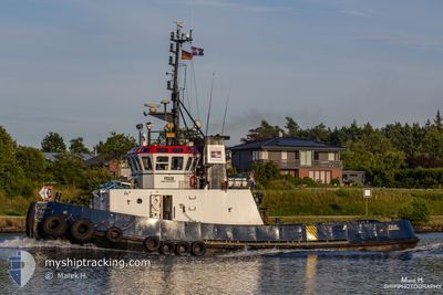
FELIX
Tug
Current Trip
GUARD ELBE HARBOUR
| Time Travelled | --- |
|---|---|
| Remaining Time | --- |
| Distance Travelled | 2549.52 nm |
| Remaining Distance | --- |
| AVG Speed | 3.9 Knopen |
| MAX Speed | 9.9 Knopen |
| AVG Wind | 10 knots |
| MAX Wind | 27 knots |
| MIN Temp | -0.5°C / 31.1°F |
| MAX Temp | 14.7°C / 58.46°F |
| Diepgang | 3.4 M |
| Positie ontvangen | Nu |
Current Position
| Lengtegraad | 9.18689° |
|---|---|
| Breedtegraat | 53.88592° |
| Status | Under way using engine |
| Snelheid | 2.3 Knopen |
| Koers | 324° |
| Gebied | North Sea |
| Station | T-AIS |
| Positie ontvangen | Nu |
Info
Information
The current position of FELIX is in North Sea with coordinates 53.88592° / 9.18689° as reported on 2024-04-30 11:13 by AIS to our vessel tracker app. The vessel's current speed is 2.3 Knopen
The vessel FELIX (IMO: 8616269, MMSI: 244890853) is a Tug that was built in 1988 ( 36 Jaar oud ). It's sailing under the flag of [NL] Netherlands.
In this page you can find informations about the vessels current position, last detected port calls, and current voyage information. If the vessels is not in coverage by AIS you will find the latest position.
The current position of FELIX is detected by our AIS receivers and we are not responsible for the reliability of the data. The last position was recorded while the vessel was in Coverage by the Ais receivers of our vessel tracking app.
The current draught of FELIX as reported by AIS is 3.4 meters
Weather
| Temperature | 19.3°C / 66.74°F |
|---|---|
| Wind Speed | 8 knots |
| Direction | 103° ESE |
| Pressure | 1017.9 hPa |
| Humidity | 73.6 % |
| Cloud Coverage | 92 % |
Featured Company
Last Port Calls
Most Visited Ports (Last year)
| Port | Arrivals | |
|---|---|---|
| 4 |
Last Trips
| Origin | Departure | Destination | Arrival | Distance |
|---|
Events
| Tijd | Evenement | Details | Positie / Bestemming | Info |
|---|---|---|---|---|
| 2024-04-30 10:48 | Start beweging | 1.04 nm, South of BRUNSBUETTEL |
53.88596 / 9.16385
GUARD ELBE HARBOUR
|
Snelheid: 3.6 kn Koers: 223° |
| 2024-04-30 10:27 | Stop beweging | 1.09 nm, South of BRUNSBUETTEL |
53.88630 / 9.17147
GUARD ELBE HARBOUR
|
Snelheid: 0.2 kn Koers: 92° |
| 2024-04-30 09:27 | Start beweging | 1.59 nm, South East of BRUNSBUETTEL |
53.88590 / 9.19406
GUARD ELBE HARBOUR
|
Snelheid: 3.2 kn Koers: 19° |
| 2024-04-30 09:22 | Stop beweging | 1.7 nm, South East of BRUNSBUETTEL |
53.88557 / 9.19754
GUARD ELBE HARBOUR
|
Snelheid: 0.3 kn Koers: 91° |
| 2024-04-30 06:35 | Start beweging | 1.07 nm, South of BRUNSBUETTEL |
53.88564 / 9.16661
GUARD ELBE HARBOUR
|
Snelheid: 3.2 kn Koers: 94° |
| 2024-04-30 06:03 | Stop beweging | 1.33 nm, South East of BRUNSBUETTEL |
53.88533 / 9.18237
GUARD ELBE HARBOUR
|
Snelheid: 0.3 kn Koers: 77° |
| 2024-04-30 05:42 | Start beweging | 1.15 nm, South of BRUNSBUETTEL |
53.88451 / 9.16823
GUARD ELBE HARBOUR
|
Snelheid: 5.4 kn Koers: 100° |
| 2024-04-30 05:28 | Stop beweging | 1.07 nm, South of BRUNSBUETTEL |
53.88551 / 9.16498
GUARD ELBE HARBOUR
|
Snelheid: 0.3 kn Koers: 287° |
| 2024-04-30 05:26 | Start beweging | 1.11 nm, South of BRUNSBUETTEL |
53.88479 / 9.16423
GUARD ELBE HARBOUR
|
Snelheid: 3.1 kn Koers: 42° |
| 2024-04-30 05:02 | Stop beweging | 1.03 nm, South of BRUNSBUETTEL |
53.88587 / 9.16039
GUARD ELBE HARBOUR
|
Snelheid: 0.2 kn Koers: 258° |