
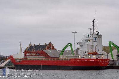
FEED HELGELAND
General Cargo
Current Trip
| Time Travelled | 17 h, 3 mins |
|---|---|
| Remaining Time | 2 days |
| Distance Travelled | 163.01 nm |
| Remaining Distance | 524.44 nm |
| AVG Speed | 9.7 Knopen |
| MAX Speed | 13.6 Knopen |
| AVG Wind | 21.4 knots |
| MAX Wind | 28.8 knots |
| MIN Temp | 9.5°C / 49.1°F |
| MAX Temp | 10.5°C / 50.9°F |
| Diepgang | 5.6 M |
| Positie ontvangen | 14 h, 33 m geleden |
Current Position
| Lengtegraad | --- |
|---|---|
| Breedtegraat | --- |
| Status | Under way using engine |
| Snelheid | 10.2 Knopen |
| Koers | 40.3° |
| Gebied | North Sea |
| Station | T-AIS |
| Positie ontvangen | 14 h, 33 m geleden |
Info
Information
The current position of FEED HELGELAND is in North Sea with coordinates 53.59275° / 0.31589° as reported on 2025-12-10 03:58 by AIS to our vessel tracker app. The vessel's current speed is 10.2 Knopen and is heading at the port of AVEROY. The estimated time of arrival as calculated by MyShipTracking vessel tracking app is 2025-12-13 05:31 LT
The vessel FEED HELGELAND (IMO: 9163635, MMSI: 257066860) is a General Cargo that was built in 1999 ( 26 Jaar oud ). It's sailing under the flag of [NO] Norway.
In this page you can find informations about the vessels current position, last detected port calls, and current voyage information. If the vessels is not in coverage by AIS you will find the latest position.
The current position of FEED HELGELAND is detected by our AIS receivers and we are not responsible for the reliability of the data. The last position was recorded while the vessel was in Coverage by the Ais receivers of our vessel tracking app.
The current draught of FEED HELGELAND as reported by AIS is 5.6 meters
Weather
| Temperature | 10.4°C / 50.72°F |
|---|---|
| Wind Speed | 28 knots |
| Direction | 245° WSW |
| Pressure | 1007.7 hPa |
| Humidity | 77.6 % |
| Cloud Coverage | 7 % |
Featured Company
Last Port Calls
| Port | Arrival | Departure | Time In Port |
|---|---|---|---|
| 2025-12-08 06:12 | 2025-12-10 01:28 | 1 d | |
| 2025-12-06 01:25 | 2025-12-06 20:41 | 19 h | |
| 2025-12-03 11:30 | 2025-12-04 18:56 | 1 d | |
| 2025-11-29 15:27 | 2025-11-30 08:17 | 16 h | |
| 2025-11-28 10:28 | 2025-11-29 14:24 | 1 d | |
| 2025-11-26 06:39 | 2025-11-26 19:01 | 12 h | |
| 2025-11-21 19:56 | 2025-11-24 23:47 | 3 d | |
| 2025-11-18 23:26 | 2025-11-19 16:57 | 17 h | |
| 2025-11-08 14:02 | 2025-11-16 16:16 | 8 d | |
| 2025-11-06 05:17 | 2025-11-06 18:02 | 12 h |
Last Trips
| Origin | Departure | Destination | Arrival | Distance | |
|---|---|---|---|---|---|
| 2025-12-06 20:41 | 2025-12-08 06:12 | 237.82 nm | |||
| 2025-12-04 18:56 | 2025-12-06 01:25 | 194.96 nm | |||
| 2025-11-30 08:17 | 2025-12-03 11:30 | 322.01 nm | |||
| 2025-11-29 14:24 | 2025-11-29 15:27 | 6.81 nm | |||
| 2025-11-26 19:01 | 2025-11-28 10:28 | 321.46 nm | |||
| 2025-11-24 23:47 | 2025-11-26 06:39 | 208.44 nm | |||
| 2025-11-19 16:57 | 2025-11-21 19:56 | 421.20 nm | |||
| 2025-11-16 16:16 | 2025-11-18 23:26 | 344.75 nm | |||
| 2025-11-06 18:02 | 2025-11-08 14:02 | 378.54 nm | |||
| 2025-11-04 21:01 | 2025-11-06 05:17 | 138.28 nm |
Events
| Tijd | Evenement | Details | Positie / Bestemming | Info |
|---|---|---|---|---|
| 2025-12-10 04:05 | Status Changed | Default Under way using engine |
53.60770 / .33794
NOAVE
|
Snelheid: 10.2 kn Koers: 40.3° |
| 2025-12-10 03:58 | Buitenbereik |
53.59275 / .31589
North Sea
NOAVE
|
Snelheid: 10.2 kn Koers: 40.3° |
|
| 2025-12-10 03:17 | Draught Changed | 5.6 5.2 |
53.54478 / .15046
NOAVE
|
Snelheid: 11.1 kn Koers: 116.1° |
| 2025-12-10 01:28 | Vertrekhaven |
|
53.73718 / -.27548
NOAVE
|
Snelheid: 6.4 kn Koers: 172° |
| 2025-12-10 01:26 | Start beweging |
53.73950 / -.27634
[GB] HULL
|
Snelheid: 5.1 kn Koers: 219° |
|
| 2025-12-10 00:32 | Status Changed | Under way using engine Default |
53.74173 / -.25989
[GB] HULL
|
Snelheid: Koers: -1° |
| 2025-12-10 00:15 | Binnenbereik |
53.74180 / -.25988
North Sea
[GB] HULL
|
Snelheid: 0.2 kn Koers: 353.6° |
|
| 2025-12-09 23:33 | Status Changed | Default Moored |
53.74175 / -.25988
[GB] HULL
|
Snelheid: Koers: 109° |
| 2025-12-09 23:27 | Buitenbereik |
53.74176 / -.25990
North Sea
[GB] HULL
|
Snelheid: Koers: 339.9° |
|
| 2025-12-09 23:12 | Status Changed | Moored Default |
53.74177 / -.25993
[GB] HULL
|
Snelheid: Koers: -1° |