
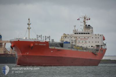
EVA HONGKONG
Tanker B
Current Trip
FOR ORDERS
| Time Travelled | 9 days |
|---|---|
| Remaining Time | --- |
| Distance Travelled | 438.31 nm |
| Remaining Distance | --- |
| AVG Speed | 6.8 Knopen |
| MAX Speed | 13.1 Knopen |
| AVG Wind | 9.9 knots |
| MAX Wind | 24 knots |
| MIN Temp | 15.3°C / 59.54°F |
| MAX Temp | 19°C / 66.2°F |
| Diepgang | 6.2 M |
| Positie ontvangen | 1 m geleden |
Current Position
| Lengtegraad | 14.02692° |
|---|---|
| Breedtegraat | 36.68138° |
| Status | Under way using engine |
| Snelheid | 0.6 Knopen |
| Koers | 30° |
| Gebied | Mediterranean Sea - Eastern Basin |
| Station | T-AIS |
| Positie ontvangen | 1 m geleden |
Info
Information
The current position of EVA HONGKONG is in Mediterranean Sea - Eastern Basin with coordinates 36.68138° / 14.02692° as reported on 2024-05-11 17:42 by AIS to our vessel tracker app. The vessel's current speed is 0.6 Knopen
The vessel EVA HONGKONG (IMO: 9800001, MMSI: 548955000) is a Tanker B It's sailing under the flag of [PH] Philippines.
In this page you can find informations about the vessels current position, last detected port calls, and current voyage information. If the vessels is not in coverage by AIS you will find the latest position.
The current position of EVA HONGKONG is detected by our AIS receivers and we are not responsible for the reliability of the data. The last position was recorded while the vessel was in Coverage by the Ais receivers of our vessel tracking app.
The current draught of EVA HONGKONG as reported by AIS is 6.2 meters
Weather
| Temperature | 18.2°C / 64.76°F |
|---|---|
| Wind Speed | 6 knots |
| Direction | 265° W |
| Pressure | 1015.9 hPa |
| Humidity | 82.5 % |
| Cloud Coverage | --- |
Featured Company
Last Port Calls
| Port | Arrival | Departure | Time In Port |
|---|---|---|---|
| 2024-05-01 06:39 | 2024-05-01 22:00 | 15 h | |
| 2024-04-24 14:04 | 2024-04-25 18:07 | 1 d | |
| 2024-03-23 15:33 | 2024-03-24 05:32 | 13 h |
Most Visited Ports (Last year)
| Port | Arrivals | |
|---|---|---|
| 5 | ||
| 3 | ||
| 3 | ||
| 2 | ||
| 2 | ||
| 1 |
Last Trips
| Origin | Departure | Destination | Arrival | Distance | |
|---|---|---|---|---|---|
| 2024-04-25 20:07 | 2024-05-01 08:39 | 831.18 nm | |||
| 2024-03-24 05:32 | 2024-04-24 16:04 | 2597.29 nm | |||
| 2024-02-19 08:37 | 2024-03-23 15:33 | 10110.75 nm |
Events
| Tijd | Evenement | Details | Positie / Bestemming | Info |
|---|---|---|---|---|
| 2024-05-11 13:27 | Start beweging | 12.53 nm, South of GELA |
36.83267 / 14.19984
FOR ORDERS
|
Snelheid: 3.2 kn Koers: 2° |
| 2024-05-11 03:43 | Stop beweging | 17.07 nm, South West of GELA |
36.78064 / 14.09596
FOR ORDERS
|
Snelheid: 0.3 kn Koers: 11° |
| 2024-05-10 14:06 | Start beweging | 14.85 nm, South of GELA |
36.79769 / 14.17349
FOR ORDERS
|
Snelheid: 3.6 kn Koers: 16° |
| 2024-05-10 05:08 | Stop beweging | 19.83 nm, South West of GELA |
36.73878 / 14.07247
FOR ORDERS
|
Snelheid: 0.3 kn Koers: 16° |
| 2024-05-10 03:59 | Start beweging | 17.59 nm, South of GELA |
36.74528 / 14.22519
FOR ORDERS
|
Snelheid: 3.4 kn Koers: 357° |
| 2024-05-09 06:03 | Stop beweging | 21.03 nm, South of GELA |
36.71023 / 14.09226
FOR ORDERS
|
Snelheid: 0.2 kn Koers: 7° |
| 2024-05-09 01:36 | Start beweging |
36.65582 / 14.22265
FOR ORDERS
|
Snelheid: 3.1 kn Koers: 27° |
|
| 2024-05-08 22:44 | Status Changed | Under way using engine Default |
36.64187 / 14.10631
FOR ORDERS
|
Snelheid: 0.9 kn Koers: 36° |
| 2024-05-08 22:36 | Status Changed | Default Under way using engine |
36.64121 / 14.10355
FOR ORDERS
|
Snelheid: 0.9 kn Koers: 42° |
| 2024-05-08 22:31 | Status Changed | Under way using engine Default |
36.64091 / 14.10215
FOR ORDERS
|
Snelheid: 0.7 kn Koers: 48° |