
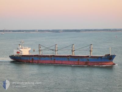
EMERALD BAY
General Cargo
Current Trip
| Time Travelled | 5 days |
|---|---|
| Remaining Time | --- |
| Distance Travelled | 1242.38 nm |
| Remaining Distance | --- |
| AVG Speed | 10 Knopen |
| MAX Speed | 13.2 Knopen |
| AVG Wind | 20.6 knots |
| MAX Wind | 43 knots |
| MIN Temp | 19°C / 66.2°F |
| MAX Temp | 28.4°C / 83.12°F |
| Diepgang | 10.2 M |
| Positie ontvangen | 8 h, 37 m geleden |
Current Position
| Lengtegraad | --- |
|---|---|
| Breedtegraat | --- |
| Status | Under way using engine |
| Snelheid | 10.9 Knopen |
| Koers | 67° |
| Gebied | South Atlantic Ocean |
| Station | T-AIS |
| Positie ontvangen | 8 h, 37 m geleden |
Info
Information
The current position of EMERALD BAY is in South Atlantic Ocean with coordinates -27.08847° / -43.90876° as reported on 2025-12-11 23:42 by AIS to our vessel tracker app. The vessel's current speed is 10.9 Knopen and is heading at the port of ALGECIRAS. The estimated time of arrival as calculated by MyShipTracking vessel tracking app is 2025-12-26 03:00 LT
The vessel EMERALD BAY (IMO: 9385075, MMSI: 235102768) is a General Cargo that was built in 2008 ( 17 Jaar oud ). It's sailing under the flag of [GB] United Kingdom.
In this page you can find informations about the vessels current position, last detected port calls, and current voyage information. If the vessels is not in coverage by AIS you will find the latest position.
The current position of EMERALD BAY is detected by our AIS receivers and we are not responsible for the reliability of the data. The last position was recorded while the vessel was in Coverage by the Ais receivers of our vessel tracking app.
The current draught of EMERALD BAY as reported by AIS is 10.2 meters
Weather
| Temperature | 23.7°C / 74.66°F |
|---|---|
| Wind Speed | 12 knots |
| Direction | 288° WNW |
| Pressure | 1008 hPa |
| Humidity | 71.4 % |
| Cloud Coverage | --- |
Featured Company
Last Port Calls
| Port | Arrival | Departure | Time In Port |
|---|---|---|---|
| 2025-12-04 13:18 | 2025-12-07 04:42 | 2 d | |
| 2025-11-16 06:31 | 2025-11-19 04:17 | 2 d | |
| 2025-10-07 16:21 | 2025-10-11 11:48 | 3 d |
Events
| Tijd | Evenement | Details | Positie / Bestemming | Info |
|---|---|---|---|---|
| 2025-12-11 23:49 | Status Changed | Default Under way using engine |
-27.08000 / -43.88667
ARSLO>ESALG
|
Snelheid: 10.9 kn Koers: 67° |
| 2025-12-11 23:42 | Buitenbereik |
-27.08847 / -43.90876
South Atlantic Ocean
ARSLO>ESALG
|
Snelheid: 10.9 kn Koers: 67° |
|
| 2025-12-11 23:30 | Status Changed | Under way using engine Default |
-27.10038 / -43.94462
ARSLO>ESALG
|
Snelheid: 11.1 kn Koers: 68° |
| 2025-12-11 23:25 | Status Changed | Default Under way using engine |
-27.10667 / -43.96333
ARSLO>ESALG
|
Snelheid: 11.3 kn Koers: 71.7° |
| 2025-12-11 23:21 | Wijzig zee gebeid | High seas of the South Atlantic Ocean Brazilian part of the South Atlantic Ocean |
-27.11039 / -43.97500
South Atlantic Ocean
ARSLO>ESALG
|
Snelheid: 11.3 kn Koers: 71.7° |
| 2025-12-11 23:20 | Status Changed | Under way using engine Default |
-27.11190 / -43.97922
ARSLO>ESALG
|
Snelheid: 10.9 kn Koers: 69° |
| 2025-12-11 23:17 | Binnenbereik |
-27.11039 / -43.97500
South Atlantic Ocean
ARSLO>ESALG
|
Snelheid: 11.3 kn Koers: 71.7° |
|
| 2025-12-11 06:19 | Status Changed | Default Under way using engine |
-28.38500 / -47.46500
ARSLO>ESALG
|
Snelheid: 12 kn Koers: 67.7° |
| 2025-12-11 06:16 | Buitenbereik |
-28.38863 / -47.47320
South Atlantic Ocean
ARSLO>ESALG
|
Snelheid: 12 kn Koers: 67.7° |
|
| 2025-12-11 06:00 | Status Changed | Under way using engine Default |
-28.41611 / -47.53017
ARSLO>ESALG
|
Snelheid: 12.7 kn Koers: 50° |