
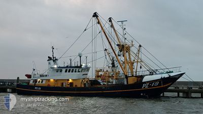
ELISABETH OF LADRAM
Trawler
Current Trip
| Time Travelled | 11 days |
|---|---|
| Remaining Time | 4 days |
| Distance Travelled | 623.32 nm |
| Remaining Distance | 418.98 nm |
| AVG Speed | 4.6 Knopen |
| MAX Speed | 4.6 Knopen |
| AVG Wind | 12.9 knots |
| MAX Wind | 27.9 knots |
| MIN Temp | 10.7°C / 51.26°F |
| MAX Temp | 14.8°C / 58.64°F |
| Diepgang | 3.6 M |
| Positie ontvangen | 1 m geleden |
Current Position
| Lengtegraad | -4.52913° |
|---|---|
| Breedtegraat | 50.01806° |
| Status | Engaged in Fishing |
| Snelheid | 3.9 Knopen |
| Koers | 8° |
| Gebied | English Channel |
| Station | T-AIS |
| Positie ontvangen | 1 m geleden |
Info
Information
The current position of ELISABETH OF LADRAM is in English Channel with coordinates 50.01806° / -4.52913° as reported on 2024-05-11 08:33 by AIS to our vessel tracker app. The vessel's current speed is 3.9 Knopen and is heading at the port of DEN HELDER. The estimated time of arrival as calculated by MyShipTracking vessel tracking app is 2024-05-15 19:28 LT
The vessel ELISABETH OF LADRAM (IMO: 8807820, MMSI: 232040373) is a Trawler that was built in 1988 ( 36 Jaar oud ). It's sailing under the flag of [GB] United Kingdom.
In this page you can find informations about the vessels current position, last detected port calls, and current voyage information. If the vessels is not in coverage by AIS you will find the latest position.
The current position of ELISABETH OF LADRAM is detected by our AIS receivers and we are not responsible for the reliability of the data. The last position was recorded while the vessel was in Coverage by the Ais receivers of our vessel tracking app.
The current draught of ELISABETH OF LADRAM as reported by AIS is 3.6 meters
Weather
| Temperature | 12.9°C / 55.22°F |
|---|---|
| Wind Speed | 17 knots |
| Direction | 85° E |
| Pressure | 1018.6 hPa |
| Humidity | 91.3 % |
| Cloud Coverage | 100 % |
Featured Company
Last Port Calls
| Port | Arrival | Departure | Time In Port |
|---|---|---|---|
| 2024-04-25 15:40 | 2024-04-29 18:26 | 4 d | |
| 2024-04-16 14:04 | 2024-04-18 13:01 | 1 d | |
| 2024-04-13 10:33 | 2024-04-13 18:57 | 8 h | |
| 2024-04-05 15:26 | 2024-04-08 07:46 | 2 d | |
| 2024-04-02 07:31 | 2024-04-03 15:19 | 1 d | |
| 2024-03-25 07:32 | 2024-03-26 19:45 | 1 d | |
| 2024-03-20 11:01 | 2024-03-20 20:13 | 9 h | |
| 2024-03-06 12:39 | 2024-03-15 20:10 | 9 d |
Most Visited Ports (Last year)
| Port | Arrivals | |
|---|---|---|
| 18 | ||
| 3 | ||
| 2 | ||
| 1 | ||
| 1 |
Last Trips
| Origin | Departure | Destination | Arrival | Distance | |
|---|---|---|---|---|---|
| 2024-04-18 13:01 | 2024-04-25 15:40 | 227.23 nm | |||
| 2024-04-13 18:57 | 2024-04-16 14:04 | 115.18 nm | |||
| 2024-04-08 07:46 | 2024-04-13 10:33 | 414.95 nm | |||
| 2024-04-03 15:19 | 2024-04-05 15:26 | 15.03 nm | |||
| 2024-03-26 19:45 | 2024-04-02 07:31 | 152.24 nm | |||
| 2024-03-20 20:13 | 2024-03-25 07:32 | 198.67 nm | |||
| 2024-03-15 20:10 | 2024-03-20 11:01 | 133.49 nm | |||
| 2024-02-28 17:21 | 2024-03-06 12:39 | 95.38 nm |
Events
| Tijd | Evenement | Details | Positie / Bestemming | Info |
|---|---|---|---|---|
| 2024-05-11 06:28 | Start beweging | 15.89 nm, South East of MEVAGISSEY |
50.04003 / -4.57830
FISHING GROUNDS
|
Snelheid: 3.6 kn Koers: 185° |
| 2024-05-11 06:22 | Stop beweging | 15.81 nm, South East of MEVAGISSEY |
50.04190 / -4.57749
FISHING GROUNDS
|
Snelheid: 0.2 kn Koers: 193° |
| 2024-05-11 00:51 | Status Changed | Engaged in Fishing Default |
50.04591 / -4.61496
FISHING GROUNDS
|
Snelheid: 49.1 kn Koers: 48° |
| 2024-05-11 00:51 | Status Changed | Default Engaged in Fishing |
50.04580 / -4.61515
FISHING GROUNDS
|
Snelheid: 4.3 kn Koers: 41° |
| 2024-05-10 21:53 | Start beweging | 17.6 nm, South East of MEVAGISSEY |
50.00101 / -4.60035
FISHING GROUNDS
|
Snelheid: 3.6 kn Koers: 170° |
| 2024-05-10 21:49 | Stop beweging | 17.49 nm, South East of MEVAGISSEY |
50.00294 / -4.60016
FISHING GROUNDS
|
Snelheid: 0.3 kn Koers: 174° |
| 2024-05-10 15:08 | Start beweging |
49.96388 / -4.26913
FISHING GROUNDS
|
Snelheid: 4.3 kn Koers: 247° |
|
| 2024-05-10 15:05 | Stop beweging |
49.96424 / -4.26628
FISHING GROUNDS
|
Snelheid: 0.3 kn Koers: 252° |
|
| 2024-05-10 09:43 | Binnenbereik |
50.27564 / -3.52108
English Channel
|
Snelheid: 7.8 kn Koers: 199° |
|
| 2024-05-07 16:31 | Buitenbereik |
50.26060 / -3.55198
English Channel
|
Snelheid: 11.2 kn Koers: 25° |