
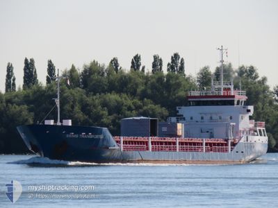
EEMS TRANSPORTER
General Cargo
Current Trip
| Trip Time | 1 day |
|---|---|
| Trip Distance | 415.43 nm |
| AVG Speed | 11.7 Knopen |
| MAX Speed | 14.5 Knopen |
| Diepgang | 4.6 M |
| AVG Wind | 10.4 knots |
| MAX Wind | 28.3 knots |
| MIN Temp | 7.6°C / 45.68°F |
| MAX Temp | 11.1°C / 51.98°F |
| Positie ontvangen | 7 h, 25 m geleden |
Current Position
| Lengtegraad | -2.10988° |
|---|---|
| Breedtegraat | 48.70467° |
| Status | At anchor |
| Snelheid | 0.1 Knopen |
| Koers | 98° |
| Gebied | English Channel |
| Station | T-AIS |
| Positie ontvangen | 7 h, 25 m geleden |
Info
Information
The current position of EEMS TRANSPORTER is in English Channel with coordinates 48.70467° / -2.10988° as reported on 2024-04-28 13:22 by AIS to our vessel tracker app. The vessel's current speed is 0.1 Knopen and is currently inside the port of SAINT MALO.
The vessel EEMS TRANSPORTER (IMO: 9340300, MMSI: 245017000) is a General Cargo that was built in 2006 ( 18 Jaar oud ). It's sailing under the flag of [NL] Netherlands.
In this page you can find informations about the vessels current position, last detected port calls, and current voyage information. If the vessels is not in coverage by AIS you will find the latest position.
The current position of EEMS TRANSPORTER is detected by our AIS receivers and we are not responsible for the reliability of the data. The last position was recorded while the vessel was in Coverage by the Ais receivers of our vessel tracking app.
The current draught of EEMS TRANSPORTER as reported by AIS is 4.6 meters
Weather
| Temperature | 10.7°C / 51.26°F |
|---|---|
| Wind Speed | 7 knots |
| Direction | 307° NW |
| Pressure | 1013.8 hPa |
| Humidity | 72.3 % |
| Cloud Coverage | 14 % |
Featured Company
Last Port Calls
| Port | Arrival | Departure | Time In Port |
|---|---|---|---|
| 2024-04-28 17:58 | |||
| 2024-04-25 15:56 | 2024-04-26 21:31 | 1 d | |
| 2024-04-19 10:51 | 2024-04-25 15:10 | 6 d | |
| 2024-04-17 05:13 | 2024-04-19 10:39 | 2 d | |
| 2024-04-10 02:23 | 2024-04-10 17:16 | 14 h | |
| 2024-04-07 11:43 | 2024-04-09 10:44 | 1 d | |
| 2024-03-28 20:17 | 2024-03-30 00:16 | 1 d | |
| 2024-03-26 19:36 | |||
| 2024-03-18 19:09 | 2024-03-19 17:18 | 22 h | |
| 2024-03-17 08:08 | 2024-03-18 18:48 | 1 d |
Last Trips
| Origin | Departure | Destination | Arrival | Distance | |
|---|---|---|---|---|---|
| 2024-04-26 23:31 | 2024-04-28 19:58 | 415.43 nm | |||
| 2024-04-25 17:10 | 2024-04-25 17:56 | 2.09 nm | |||
| 2024-04-19 12:39 | 2024-04-19 12:51 | 1.09 nm | |||
| 2024-04-10 19:16 | 2024-04-17 07:13 | 1664.75 nm | |||
| 2024-04-09 12:44 | 2024-04-10 04:23 | 168.86 nm | |||
| 2024-03-30 01:16 | 2024-04-07 13:43 | 1865.07 nm | |||
| 2024-03-26 19:36 | 2024-03-28 21:17 | 405.32 nm | |||
| 2024-03-18 19:48 | 2024-03-18 20:09 | 2.65 nm | |||
| 2024-03-12 15:26 | 2024-03-14 15:13 | 522.48 nm | |||
| 2024-03-08 19:13 | 2024-03-12 02:29 | 692.27 nm |
Events
| Tijd | Evenement | Details | Positie / Bestemming | Info |
|---|---|---|---|---|
| 2024-04-28 18:10 | Stop beweging |
48.64321 / -2.02410
[FR] SAINT MALO
|
Snelheid: 0.3 kn Koers: 70° |
|
| 2024-04-28 17:58 | Aankomsthaven |
|
48.64150 / -2.02976
[FR] SAINT MALO
|
Snelheid: 3.8 kn Koers: 93° |
| 2024-04-28 17:22 | Start beweging | 4.72 nm, North West of SAINT MALO |
48.69893 / -2.11092
FRSML
|
Snelheid: 7.8 kn Koers: 154° |
| 2024-04-28 13:30 | Status Changed | Default At anchor |
48.70470 / -2.10992
FRSML
|
Snelheid: 0.1 kn Koers: 98° |
| 2024-04-28 13:22 | Buitenbereik |
48.70467 / -2.10988
English Channel
FRSML
|
Snelheid: 0.1 kn Koers: 72.3° |
|
| 2024-04-28 12:43 | Wijzig zee gebeid | French part of the English Channel Jersey part of the English Channel |
48.70475 / -2.10979
English Channel
FRSML
|
Snelheid: Koers: 197° |
| 2024-04-28 12:41 | Status Changed | At anchor Default |
48.70482 / -2.10986
FRSML
|
Snelheid: 0.3 kn Koers: 119° |
| 2024-04-28 12:30 | Binnenbereik |
48.70475 / -2.10979
English Channel
FRSML
|
Snelheid: Koers: 197° |
|
| 2024-04-28 10:02 | Stop beweging | 4.89 nm, North West of SAINT MALO |
48.70544 / -2.10626
FRSML
|
Snelheid: 0.3 kn Koers: 231° |
| 2024-04-28 08:15 | Buitenbereik |
48.93086 / -2.38548
English Channel
FRSML
|
Snelheid: 11.6 kn Koers: 144° |