
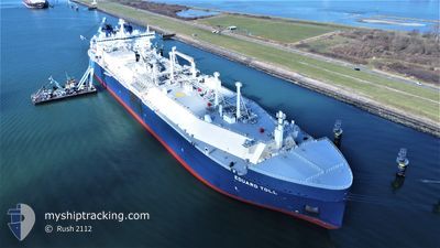
EDUARD TOLL
Tanker
Current Trip
FOR ORDERS
| Time Travelled | 3 days |
|---|---|
| Remaining Time | --- |
| Distance Travelled | 1373.87 nm |
| Remaining Distance | --- |
| AVG Speed | 16 Knopen |
| MAX Speed | 19.9 Knopen |
| AVG Wind | 11.9 knots |
| MAX Wind | 25 knots |
| MIN Temp | -6°C / 21.2°F |
| MAX Temp | 9.9°C / 49.82°F |
| Diepgang | 12 M |
| Positie ontvangen | 7 h, 26 m geleden |
Current Position
| Lengtegraad | 14.01724° |
|---|---|
| Breedtegraat | 70.29947° |
| Status | Under way using engine |
| Snelheid | 19.4 Knopen |
| Koers | 224.3° |
| Gebied | Norwegian Sea |
| Station | T-AIS |
| Positie ontvangen | 7 h, 26 m geleden |
Info
Information
The current position of EDUARD TOLL is in Norwegian Sea with coordinates 70.29947° / 14.01724° as reported on 2024-06-06 14:22 by AIS to our vessel tracker app. The vessel's current speed is 19.4 Knopen
The vessel EDUARD TOLL (IMO: 9750696, MMSI: 311000548) is a Tanker It's sailing under the flag of [BS] Bahamas.
In this page you can find informations about the vessels current position, last detected port calls, and current voyage information. If the vessels is not in coverage by AIS you will find the latest position.
The current position of EDUARD TOLL is detected by our AIS receivers and we are not responsible for the reliability of the data. The last position was recorded while the vessel was in Coverage by the Ais receivers of our vessel tracking app.
The current draught of EDUARD TOLL as reported by AIS is 12 meters
Weather
| Temperature | 9°C / 48.2°F |
|---|---|
| Wind Speed | 15 knots |
| Direction | 296° WNW |
| Pressure | 1005.7 hPa |
| Humidity | 87.7 % |
| Cloud Coverage | 100 % |
Featured Company
Last Port Calls
| Port | Arrival | Departure | Time In Port |
|---|---|---|---|
| 2024-06-02 04:30 | 2024-06-03 04:27 | 23 h | |
| 2024-05-25 11:20 | 2024-05-26 10:30 | 23 h | |
| 2024-05-16 21:14 | 2024-05-18 01:32 | 1 d | |
| 2024-05-07 21:44 | 2024-05-08 21:06 | 23 h | |
| 2024-04-28 14:11 | 2024-04-29 14:47 | 1 d | |
| 2024-04-20 21:37 | 2024-04-21 20:33 | 22 h | |
| 2024-04-08 11:57 | 2024-04-12 03:36 | 3 d |
Last Trips
| Origin | Departure | Destination | Arrival | Distance | |
|---|---|---|---|---|---|
| 2024-05-26 10:30 | 2024-06-02 04:30 | 2676.49 nm | |||
| 2024-05-18 01:32 | 2024-05-25 11:20 | 2757.10 nm | |||
| 2024-05-08 21:06 | 2024-05-16 21:14 | 2671.32 nm | |||
| 2024-04-29 14:47 | 2024-05-07 21:44 | 2639.10 nm | |||
| 2024-04-21 20:33 | 2024-04-28 14:11 | 2647.64 nm | |||
| 2024-04-12 03:36 | 2024-04-20 21:37 | 2872.04 nm | |||
| 2024-03-31 10:13 | 2024-04-08 11:57 | 2651.45 nm |
Events
| Tijd | Evenement | Details | Positie / Bestemming | Info |
|---|---|---|---|---|
| 2024-06-06 14:22 | Buitenbereik |
70.29947 / 14.01724
Norwegian Sea
FOR ORDERS
|
Snelheid: 19.4 kn Koers: 224.3° |
|
| 2024-06-06 09:59 | Status Changed | Under way using engine Default |
71.25610 / 16.95679
FOR ORDERS
|
Snelheid: 19.3 kn Koers: 226° |
| 2024-06-06 09:52 | Binnenbereik |
71.25610 / 16.95679
Norwegian Sea
FOR ORDERS
|
Snelheid: 19.5 kn Koers: 225.8° |
|
| 2024-06-06 08:54 | Status Changed | Default Under way using engine |
71.48834 / 17.71833
FOR ORDERS
|
Snelheid: 18.6 kn Koers: 226.7° |
| 2024-06-06 08:44 | Buitenbereik |
71.52472 / 17.84183
Norwegian Sea
FOR ORDERS
|
Snelheid: 18.6 kn Koers: 226.7° |
|
| 2024-06-06 02:56 | Wijzig zee gebeid | Norwegian part of the Norwegian Sea Norwegian part of the Barentsz Sea |
72.72354 / 22.44787
Norwegian Sea
FOR ORDERS
|
Snelheid: 18.7 kn Koers: 232.7° |
| 2024-06-05 23:37 | Draught Changed | 12 10.9 |
73.34377 / 25.27001
FOR ORDERS
|
Snelheid: 18.9 kn Koers: 234.6° |
| 2024-06-05 23:37 | ETA Changed | 2024/06/11 03:00 2024/06/02 02:00 |
73.34377 / 25.27001
FOR ORDERS
|
Snelheid: 18.9 kn Koers: 234.6° |
| 2024-06-05 22:02 | Binnenbereik |
73.62679 / 26.70714
Barentsz Sea
|
Snelheid: 18.7 kn Koers: 234.3° |
|
| 2024-06-03 00:15 | Start beweging | 5.76 nm, North East of SABETTA |
71.34673 / 72.29128
FOR ORDERS
|
Snelheid: 8.2 kn Koers: 34° |