
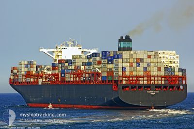
EDISON
Container Ship
Current Trip
| Time Travelled | 3 days |
|---|---|
| Remaining Time | 20 mins |
| Distance Travelled | 1226.14 nm |
| Remaining Distance | 8.79 nm |
| AVG Speed | 14.9 Knopen |
| MAX Speed | 20.3 Knopen |
| AVG Wind | 18.1 knots |
| MAX Wind | 32 knots |
| MIN Temp | 10.9°C / 51.62°F |
| MAX Temp | 21.1°C / 69.98°F |
| Diepgang | 13.8 M |
| Positie ontvangen | 1 m geleden |
Current Position
| Lengtegraad | --- |
|---|---|
| Breedtegraat | --- |
| Status | Under way using engine |
| Snelheid | 14.5 Knopen |
| Koers | 303° |
| Gebied | South China Sea |
| Station | T-AIS |
| Positie ontvangen | 1 m geleden |
Info
Information
The current position of EDISON is in South China Sea with coordinates 22.36152° / 113.92153° as reported on 2025-12-10 18:38 by AIS to our vessel tracker app. The vessel's current speed is 14.5 Knopen and is heading at the port of SHEKOU. The estimated time of arrival as calculated by MyShipTracking vessel tracking app is 2025-12-11 02:59 LT
The vessel EDISON (IMO: 9463011, MMSI: 235082896) is a Container Ship that was built in 2011 ( 14 Jaar oud ). It's sailing under the flag of [GB] United Kingdom.
In this page you can find informations about the vessels current position, last detected port calls, and current voyage information. If the vessels is not in coverage by AIS you will find the latest position.
The current position of EDISON is detected by our AIS receivers and we are not responsible for the reliability of the data. The last position was recorded while the vessel was in Coverage by the Ais receivers of our vessel tracking app.
The current draught of EDISON as reported by AIS is 13.8 meters
Weather
| Temperature | 21.1°C / 69.98°F |
|---|---|
| Wind Speed | 7 knots |
| Direction | 350° N |
| Pressure | 1017.8 hPa |
| Humidity | 71.3 % |
| Cloud Coverage | 100 % |
Featured Company
Events
| Tijd | Evenement | Details | Positie / Bestemming | Info |
|---|---|---|---|---|
| 2025-12-10 17:34 | Draught Changed | 13.8 9.5 |
22.28333 / 114.10589
CNSHK
|
Snelheid: 11.1 kn Koers: 335.8° |
| 2025-12-10 17:34 | Destination Changed | CNSHK CNZOS |
22.28333 / 114.10589
CNSHK
|
Snelheid: 11.1 kn Koers: 335.8° |
| 2025-12-10 17:34 | ETA Changed | 2025/12/10 17:00 2025/11/02 05:00 |
22.28333 / 114.10589
CNSHK
|
Snelheid: 11.1 kn Koers: 335.8° |
| 2025-12-10 17:26 | Status Changed | Under way using engine Default |
22.26234 / 114.11618
CNZOS
|
Snelheid: 11.6 kn Koers: 331° |
| 2025-12-10 17:17 | Binnenbereik |
22.26325 / 114.11570
South China Sea
|
Snelheid: 11.4 kn Koers: 334° |
|
| 2025-12-10 15:05 | Start beweging | 19.03 nm, South East of HONG KONG |
22.13469 / 114.47791
CNZOS
|
Snelheid: 3.1 kn Koers: 31° |
| 2025-12-10 14:17 | Stop beweging | 19.1 nm, South East of HONG KONG |
22.13656 / 114.48044
CNZOS
|
Snelheid: 0.3 kn Koers: 67° |
| 2025-12-07 08:33 | Vertrekhaven |
|
36.01183 / 120.36977
CNZOS
|
Snelheid: 12.2 kn Koers: 105° |
| 2025-12-07 07:49 | Start beweging |
36.01236 / 120.22412
[CN] QINGDAO
|
Snelheid: 7.3 kn Koers: 55° |
|
| 2025-12-06 04:29 | Stop beweging |
36.00396 / 120.21706
[CN] QINGDAO
|
Snelheid: 0.1 kn Koers: 232° |