
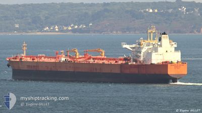
EAGLE LE HAVRE
Tanker
Current Trip
| Time Travelled | 10 days |
|---|---|
| Remaining Time | --- |
| Distance Travelled | 2673.96 nm |
| Remaining Distance | --- |
| AVG Speed | 11.6 Knopen |
| MAX Speed | 14.5 Knopen |
| AVG Wind | 11.8 knots |
| MAX Wind | 28.6 knots |
| MIN Temp | 14.3°C / 57.74°F |
| MAX Temp | 37.5°C / 99.5°F |
| Diepgang | 13.6 M |
| Positie ontvangen | 1 m geleden |
Current Position
| Lengtegraad | -5.58235° |
|---|---|
| Breedtegraat | 35.87796° |
| Status | Under way using engine |
| Snelheid | 0.3 Knopen |
| Koers | 196° |
| Gebied | Strait of Gibraltar |
| Station | T-AIS |
| Positie ontvangen | 1 m geleden |
Info
Information
The current position of EAGLE LE HAVRE is in Strait of Gibraltar with coordinates 35.87796° / -5.58235° as reported on 2024-04-26 00:52 by AIS to our vessel tracker app. The vessel's current speed is 0.3 Knopen
The vessel EAGLE LE HAVRE (IMO: 9795103, MMSI: 228091700) is a Tanker It's sailing under the flag of [FR] France.
In this page you can find informations about the vessels current position, last detected port calls, and current voyage information. If the vessels is not in coverage by AIS you will find the latest position.
The current position of EAGLE LE HAVRE is detected by our AIS receivers and we are not responsible for the reliability of the data. The last position was recorded while the vessel was in Coverage by the Ais receivers of our vessel tracking app.
The current draught of EAGLE LE HAVRE as reported by AIS is 13.6 meters
Weather
| Temperature | 14.7°C / 58.46°F |
|---|---|
| Wind Speed | 14 knots |
| Direction | 230° SW |
| Pressure | 1011.1 hPa |
| Humidity | 88.8 % |
| Cloud Coverage | 12 % |
Featured Company
Last Port Calls
| Port | Arrival | Departure | Time In Port |
|---|---|---|---|
| 2024-04-17 06:53 | 2024-04-17 16:25 | 9 h | |
| 2024-04-14 03:34 | 2024-04-15 03:43 | 1 d | |
| 2024-04-10 06:36 | 2024-04-10 15:35 | 8 h | |
| 2024-04-01 11:14 | 2024-04-02 16:51 | 1 d | |
| 2024-03-19 13:16 | 2024-03-24 04:20 | 4 d | |
| 2024-03-07 06:23 | 2024-03-07 15:28 | 9 h | |
| 2024-02-09 20:48 | 2024-02-12 03:19 | 2 d |
Most Visited Ports (Last year)
| Port | Arrivals | |
|---|---|---|
| 5 | ||
| 4 | ||
| 2 | ||
| 1 | ||
| 1 | ||
| 1 |
Last Trips
| Origin | Departure | Destination | Arrival | Distance | |
|---|---|---|---|---|---|
| 2024-04-15 06:43 | 2024-04-17 08:53 | 501.57 nm | |||
| 2024-04-02 16:51 | 2024-04-14 06:34 | 2914.87 nm | |||
| 2024-04-02 16:51 | 2024-04-10 08:36 | 2233.27 nm | |||
| 2024-03-24 04:20 | 2024-04-01 11:14 | 560.45 nm | |||
| 2024-01-31 22:59 | 2024-02-09 23:48 | 20.20 nm |
Events
| Tijd | Evenement | Details | Positie / Bestemming | Info |
|---|---|---|---|---|
| 2024-04-26 00:52 | Stop beweging | 2.14 nm, North of KSAR SEGHIR |
35.87796 / -5.58235
TANGER MED
|
Snelheid: 0.3 kn Koers: 196° |
| 2024-04-25 23:16 | Wijzig zee gebeid | Moroccan part of the Strait of Gibraltar Spanish part of the Strait of Gibraltar |
35.97254 / -5.47726
Strait of Gibraltar
|
Snelheid: 8.1 kn Koers: 203.2° |
| 2024-04-25 22:28 | Wijzig zee gebeid | Spanish part of the Strait of Gibraltar Gibraltarian part of the Strait of Gibraltar |
36.01044 / -5.33620
Strait of Gibraltar
|
Snelheid: 10 kn Koers: 258.2° |
| 2024-04-25 22:25 | Wijzig zee gebeid | Gibraltarian part of the Strait of Gibraltar Gibraltarian part of the Alboran Sea |
36.01219 / -5.32609
Strait of Gibraltar
|
Snelheid: 10 kn Koers: 258° |
| 2024-04-25 21:46 | Wijzig zee gebeid | Gibraltarian part of the Alboran Sea Spanish part of the Alboran Sea |
36.02986 / -5.19588
Alboran Sea
|
Snelheid: 10 kn Koers: 281.8° |
| 2024-04-25 19:10 | Wijzig zee gebeid | Spanish part of the Alboran Sea Moroccan part of the Alboran Sea |
35.83764 / -4.64375
Alboran Sea
|
Snelheid: 8.5 kn Koers: 299.9° |
| 2024-04-25 18:57 | ETA Changed | 2024/04/25 11:00 2024/04/25 14:00 |
35.82476 / -4.61761
TANGER MED
|
Snelheid: 3.5 kn Koers: 300° |
| 2024-04-25 18:30 | Start beweging |
35.82657 / -4.61400
TANGER MED
|
Snelheid: 7.9 kn Koers: 116.2° |
|
| 2024-04-25 17:26 | Gevonden in zee | Moroccan part of the Alboran Sea |
35.83584 / -4.63869
Alboran Sea
TANGER MED
|
Snelheid: 1.1 kn Koers: 113.1° |
| 2024-04-25 16:41 | Status Changed | Under way using engine Default |
35.84192 / -4.65628
TANGER MED
|
Snelheid: 1.3 kn Koers: 229° |