
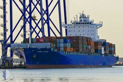
DUBAI EXPRESS
Container Ship
Current Trip
| Time Travelled | 1 day |
|---|---|
| Remaining Time | 2 days |
| Distance Travelled | 526.98 nm |
| Remaining Distance | 1000.90 nm |
| AVG Speed | 13.1 Knopen |
| MAX Speed | 17.8 Knopen |
| AVG Wind | 18.8 knots |
| MAX Wind | 39 knots |
| MIN Temp | 5.4°C / 41.72°F |
| MAX Temp | 10.4°C / 50.72°F |
| Diepgang | 10.5 M |
| Positie ontvangen | 1 d geleden |
Current Position
| Lengtegraad | --- |
|---|---|
| Breedtegraat | --- |
| Status | Under way using engine |
| Snelheid | 13 Knopen |
| Koers | 311.8° |
| Gebied | English Channel |
| Station | T-AIS |
| Positie ontvangen | 1 d geleden |
Info
Information
The current position of DUBAI EXPRESS is in English Channel with coordinates 50.14448° / -1.40023° as reported on 2026-01-04 16:23 by AIS to our vessel tracker app. The vessel's current speed is 13 Knopen and is heading at the port of TANGER MED. The estimated time of arrival as calculated by MyShipTracking vessel tracking app is 2026-01-08 21:48 LT
The vessel DUBAI EXPRESS (IMO: 9440825, MMSI: 636093143) is a Container Ship that was built in 2009 ( 17 Jaar oud ). It's sailing under the flag of [LR] Liberia.
In this page you can find informations about the vessels current position, last detected port calls, and current voyage information. If the vessels is not in coverage by AIS you will find the latest position.
The current position of DUBAI EXPRESS is detected by our AIS receivers and we are not responsible for the reliability of the data. The last position was recorded while the vessel was in Coverage by the Ais receivers of our vessel tracking app.
The current draught of DUBAI EXPRESS as reported by AIS is 10.5 meters
Weather
| Temperature | 10.4°C / 50.72°F |
|---|---|
| Wind Speed | 22 knots |
| Direction | 15° NNE |
| Pressure | 1024.2 hPa |
| Humidity | 53.2 % |
| Cloud Coverage | 100 % |
Featured Company
Last Port Calls
| Port | Arrival | Departure | Time In Port |
|---|---|---|---|
| 2026-01-03 12:45 | 2026-01-04 12:01 | 23 h | |
| 2025-12-31 01:22 | 2026-01-02 14:15 | 2 d | |
| 2025-12-20 20:32 | 2025-12-21 23:47 | 1 d | |
| 2025-12-18 17:27 | 2025-12-19 18:45 | 1 d | |
| 2025-12-14 12:53 | 2025-12-15 06:04 | 17 h | |
| 2025-12-05 14:03 | 2025-12-07 15:35 | 2 d | |
| 2025-12-03 04:27 | 2025-12-04 00:40 | 20 h | |
| 2025-11-28 13:18 | 2025-11-29 05:28 | 16 h | |
| 2025-11-22 05:41 | 2025-11-23 19:37 | 1 d | |
| 2025-11-20 09:46 | 2025-11-21 10:35 | 1 d |
Last Trips
| Origin | Departure | Destination | Arrival | Distance | |
|---|---|---|---|---|---|
| 2026-01-02 14:15 | 2026-01-03 12:45 | 285.13 nm | |||
| 2025-12-21 23:47 | 2025-12-31 01:22 | 2693.02 nm | |||
| 2025-12-19 18:45 | 2025-12-20 20:32 | 284.14 nm | |||
| 2025-12-15 06:04 | 2025-12-18 17:27 | 1410.82 nm | |||
| 2025-12-07 15:35 | 2025-12-14 12:53 | 1505.84 nm | |||
| 2025-12-04 00:40 | 2025-12-05 14:03 | 288.35 nm | |||
| 2025-11-29 05:28 | 2025-12-03 04:27 | 1406.51 nm | |||
| 2025-11-23 19:37 | 2025-11-28 13:18 | 1314.59 nm | |||
| 2025-11-21 10:35 | 2025-11-22 05:41 | 277.63 nm | |||
| 2025-11-16 18:46 | 2025-11-20 09:46 | 1425.21 nm |
Events
| Tijd | Evenement | Details | Positie / Bestemming | Info |
|---|---|---|---|---|
| 2026-01-04 16:31 | Status Changed | Default Under way using engine |
50.15156 / -1.44161
FRLEH>>MAPTM
|
Snelheid: 13 kn Koers: 311.8° |
| 2026-01-04 16:23 | Wijzig zee gebeid | United Kingdom part of the English Channel French part of the English Channel |
50.14448 / -1.40023
English Channel
FRLEH>>MAPTM
|
Snelheid: 13 kn Koers: 311.8° |
| 2026-01-04 16:23 | Buitenbereik |
50.14448 / -1.40023
English Channel
FRLEH>>MAPTM
|
Snelheid: 13 kn Koers: 311.8° |
|
| 2026-01-04 16:22 | Status Changed | Under way using engine Default |
50.14238 / -1.39685
FRLEH>>MAPTM
|
Snelheid: 12.7 kn Koers: 327° |
| 2026-01-04 16:22 | Binnenbereik |
50.14448 / -1.40023
English Channel
FRLEH>>MAPTM
|
Snelheid: 13 kn Koers: 311.8° |
|
| 2026-01-04 14:51 | Status Changed | Default Under way using engine |
49.88855 / -1.03497
FRLEH>>MAPTM
|
Snelheid: 15 kn Koers: 305.4° |
| 2026-01-04 14:42 | Buitenbereik |
49.86805 / -.98973
English Channel
FRLEH>>MAPTM
|
Snelheid: 15 kn Koers: 305.4° |
|
| 2026-01-04 11:01 | Vertrekhaven |
|
49.48612 / .08716
FRLEH>>MAPTM
|
Snelheid: 11.8 kn Koers: 287° |
| 2026-01-04 10:38 | Start beweging |
49.47301 / .15476
[FR] LE HAVRE
|
Snelheid: 3.9 kn Koers: 232° |
|
| 2026-01-04 10:34 | Status Changed | Under way using engine Moored |
49.47443 / .15649
[FR] LE HAVRE
|
Snelheid: Koers: 235° |