
DREAM
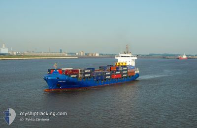
Container Ship
Current Trip
| Time Travelled | 1 day |
|---|---|
| Remaining Time | 11 h, 34 mins |
| Distance Travelled | 500.02 nm |
| Remaining Distance | 187.17 nm |
| AVG Speed | 15.5 Knopen |
| MAX Speed | 16.3 Knopen |
| AVG Wind | 9.6 knots |
| MAX Wind | 17 knots |
| MIN Temp | 15.1°C / 59.18°F |
| MAX Temp | 19.2°C / 66.56°F |
| Diepgang | 6.9 M |
| Positie ontvangen | 20 h, 52 m geleden |
Current Position
| Lengtegraad | -8.68270° |
|---|---|
| Breedtegraat | 34.47393° |
| Status | Under way using engine |
| Snelheid | 16.1 Knopen |
| Koers | 219.9° |
| Gebied | North Atlantic Ocean |
| Station | T-AIS |
| Positie ontvangen | 20 h, 52 m geleden |
Info
Information
The current position of DREAM is in North Atlantic Ocean with coordinates 34.47393° / -8.68270° as reported on 2024-05-05 14:21 by AIS to our vessel tracker app. The vessel's current speed is 16.1 Knopen and is heading at the port of LAS PALMAS. The estimated time of arrival as calculated by MyShipTracking vessel tracking app is 2024-05-06 22:47 LT
The vessel DREAM (IMO: 9322578, MMSI: 255805838) is a Container Ship that was built in 2006 ( 18 Jaar oud ). It's sailing under the flag of [PT] Portugal.
In this page you can find informations about the vessels current position, last detected port calls, and current voyage information. If the vessels is not in coverage by AIS you will find the latest position.
The current position of DREAM is detected by our AIS receivers and we are not responsible for the reliability of the data. The last position was recorded while the vessel was in Coverage by the Ais receivers of our vessel tracking app.
The current draught of DREAM as reported by AIS is 6.9 meters
Weather
| Temperature | 19.1°C / 66.38°F |
|---|---|
| Wind Speed | 17 knots |
| Direction | 25° NNE |
| Pressure | 1016.2 hPa |
| Humidity | 90.4 % |
| Cloud Coverage | 24 % |
Featured Company
Last Port Calls
| Port | Arrival | Departure | Time In Port |
|---|---|---|---|
| 2024-05-04 10:44 | 2024-05-05 03:16 | 16 h | |
| 2024-05-03 01:41 | 2024-05-04 01:35 | 23 h | |
| 2024-04-30 08:09 | 2024-04-30 17:36 | 9 h | |
| 2024-04-30 00:36 | 2024-04-30 04:27 | 3 h | |
| 2024-04-27 16:12 | 2024-04-28 03:14 | 11 h | |
| 2024-04-26 08:11 | 2024-04-27 06:38 | 22 h | |
| 2024-04-23 07:43 | 2024-04-23 20:09 | 12 h | |
| 2024-04-23 00:08 | 2024-04-23 03:51 | 3 h | |
| 2024-04-20 17:25 | 2024-04-21 04:04 | 10 h | |
| 2024-04-19 00:53 | 2024-04-20 02:41 | 1 d |
Last Trips
| Origin | Departure | Destination | Arrival | Distance | |
|---|---|---|---|---|---|
| 2024-05-04 03:35 | 2024-05-04 12:44 | 69.15 nm | |||
| 2024-04-30 18:36 | 2024-05-03 03:41 | 766.56 nm | |||
| 2024-04-30 05:27 | 2024-04-30 09:09 | 54.46 nm | |||
| 2024-04-28 05:14 | 2024-04-30 01:36 | 688.56 nm | |||
| 2024-04-27 08:38 | 2024-04-27 18:12 | 66.92 nm | |||
| 2024-04-23 21:09 | 2024-04-26 10:11 | 765.73 nm | |||
| 2024-04-23 04:51 | 2024-04-23 08:43 | 54.77 nm | |||
| 2024-04-21 06:04 | 2024-04-23 01:08 | 687.98 nm | |||
| 2024-04-20 04:41 | 2024-04-20 19:25 | 71.14 nm | |||
| 2024-04-16 18:46 | 2024-04-19 02:53 | 753.41 nm |
Events
| Tijd | Evenement | Details | Positie / Bestemming | Info |
|---|---|---|---|---|
| 2024-05-05 14:26 | Status Changed | Default Under way using engine |
34.45500 / -8.70167
ESLPA
|
Snelheid: 16.1 kn Koers: 219.9° |
| 2024-05-05 14:21 | Status Changed | Under way using engine Default |
34.47393 / -8.68270
ESLPA
|
Snelheid: 16 kn Koers: 220° |
| 2024-05-05 14:21 | Buitenbereik |
34.47393 / -8.68270
North Atlantic Ocean
ESLPA
|
Snelheid: 16.1 kn Koers: 219.9° |
|
| 2024-05-05 13:53 | Status Changed | Default Under way using engine |
34.56500 / -8.58500
ESLPA
|
Snelheid: 15.9 kn Koers: 222.1° |
| 2024-05-05 13:45 | Status Changed | Under way using engine Default |
34.59398 / -8.55519
ESLPA
|
Snelheid: 15.9 kn Koers: 222° |
| 2024-05-05 13:42 | Binnenbereik |
34.58802 / -8.56161
North Atlantic Ocean
ESLPA
|
Snelheid: 15.9 kn Koers: 221.5° |
|
| 2024-05-05 11:49 | Status Changed | Default Under way using engine |
34.97448 / -8.15043
ESLPA
|
Snelheid: 15.6 kn Koers: 221.9° |
| 2024-05-05 11:44 | Buitenbereik |
34.99229 / -8.13092
North Atlantic Ocean
ESLPA
|
Snelheid: 15.6 kn Koers: 221.9° |
|
| 2024-05-05 11:43 | Status Changed | Under way using engine Default |
34.99491 / -8.12808
ESLPA
|
Snelheid: 15 kn Koers: 221° |
| 2024-05-05 11:41 | Status Changed | Default Under way using engine |
35.00167 / -8.12000
ESLPA
|
Snelheid: 15.7 kn Koers: 221° |