
DIONYSSIS A
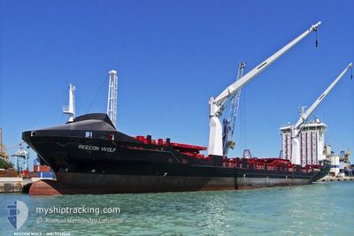
Container Ship
Current Trip
LYMRA
| Time Travelled | 2 days |
|---|---|
| Remaining Time | --- |
| Distance Travelled | 670.14 nm |
| Remaining Distance | --- |
| AVG Speed | 12.1 Knopen |
| MAX Speed | 13.2 Knopen |
| AVG Wind | 6.5 knots |
| MAX Wind | 14.8 knots |
| MIN Temp | 17.1°C / 62.78°F |
| MAX Temp | 18.9°C / 66.02°F |
| Diepgang | 9.2 M |
| Positie ontvangen | 5 d geleden |
Current Position
| Lengtegraad | --- |
|---|---|
| Breedtegraat | --- |
| Status | Under way using engine |
| Snelheid | 6.9 Knopen |
| Koers | 257.5° |
| Gebied | Mediterranean Sea - Eastern Basin |
| Station | T-AIS |
| Positie ontvangen | 5 d geleden |
Info
Information
The current position of DIONYSSIS A is in Mediterranean Sea - Eastern Basin with coordinates 36.30629° / 22.28075° as reported on 2025-12-07 11:15 by AIS to our vessel tracker app. The vessel's current speed is 6.9 Knopen
The vessel DIONYSSIS A (IMO: 9356660, MMSI: 271050526) is a Container Ship that was built in 2008 ( 17 Jaar oud ). It's sailing under the flag of [TR] Turkey.
In this page you can find informations about the vessels current position, last detected port calls, and current voyage information. If the vessels is not in coverage by AIS you will find the latest position.
The current position of DIONYSSIS A is detected by our AIS receivers and we are not responsible for the reliability of the data. The last position was recorded while the vessel was in Coverage by the Ais receivers of our vessel tracking app.
The current draught of DIONYSSIS A as reported by AIS is 9.2 meters
Weather
| Temperature | 18.8°C / 65.84°F |
|---|---|
| Wind Speed | 7 knots |
| Direction | 313° NW |
| Pressure | 1019.2 hPa |
| Humidity | 61.1 % |
| Cloud Coverage | 6 % |
Featured Company
Last Port Calls
| Port | Arrival | Departure | Time In Port |
|---|---|---|---|
| 2025-12-10 21:05 | |||
| 2025-12-04 13:14 | 2025-12-05 03:26 | 14 h | |
| 2025-12-03 17:14 | 2025-12-04 07:48 | 14 h | |
| 2025-11-26 06:57 | 2025-11-29 15:28 | 3 d | |
| 2025-11-21 16:16 | 2025-11-22 10:57 | 18 h | |
| 2025-11-20 19:44 | 2025-11-21 11:13 | 15 h | |
| 2025-11-19 05:52 | 2025-11-19 21:11 | 15 h | |
| 2025-11-14 07:40 | 2025-11-16 06:47 | 1 d | |
| 2025-11-08 14:55 | 2025-11-13 07:04 | 4 d | |
| 2025-11-02 02:49 | 2025-11-02 12:55 | 10 h |
Most Visited Ports (Last year)
| Port | Arrivals | |
|---|---|---|
| 27 | ||
| 27 | ||
| 10 | ||
| 6 | ||
| 5 | ||
| 4 |
Last Trips
| Origin | Departure | Destination | Arrival | Distance | |
|---|---|---|---|---|---|
| 2025-12-04 07:48 | 2025-12-04 13:14 | 54.24 nm | |||
| 2025-11-29 15:28 | 2025-12-03 17:14 | 1050.81 nm | |||
| 2025-11-22 10:57 | 2025-11-26 06:57 | 1108.27 nm | |||
| 2025-11-21 11:13 | 2025-11-21 16:16 | 53.38 nm | |||
| 2025-11-19 21:11 | 2025-11-20 19:44 | 271.75 nm | |||
| 2025-11-16 06:47 | 2025-11-19 05:52 | 898.18 nm | |||
| 2025-11-13 07:04 | 2025-11-14 07:40 | 218.79 nm | |||
| 2025-11-02 12:55 | 2025-11-08 14:55 | 1055.16 nm | |||
| 2025-11-01 09:23 | 2025-11-02 02:49 | 67.32 nm | |||
| 2025-10-30 18:21 | 2025-10-31 22:39 | 315.90 nm |
Events
| Tijd | Evenement | Details | Positie / Bestemming | Info |
|---|---|---|---|---|
| 2025-12-10 19:05 | Vertrekhaven |
|
32.37161 / 15.23829
LYMRA
|
Snelheid: 5.2 kn Koers: 90° |
| 2025-12-10 18:53 | Start beweging |
32.37037 / 15.21868
[LY] MISURATA
|
Snelheid: 3.3 kn Koers: 64° |
|
| 2025-12-07 11:24 | Status Changed | Default Under way using engine |
36.30309 / 22.26054
LYMRA
|
Snelheid: 6.9 kn Koers: 257.5° |
| 2025-12-07 11:15 | Buitenbereik |
36.30629 / 22.28075
Mediterranean Sea - Eastern Basin
LYMRA
|
Snelheid: 6.9 kn Koers: 257.5° |
|
| 2025-12-07 07:42 | Status Changed | Under way using engine Default |
36.39984 / 22.78369
LYMRA
|
Snelheid: 7.2 kn Koers: 259° |
| 2025-12-07 07:40 | Status Changed | Default Under way using engine |
36.40050 / 22.78795
LYMRA
|
Snelheid: 7.1 kn Koers: 257.9° |
| 2025-12-07 07:15 | Status Changed | Under way using engine Default |
36.41145 / 22.85128
LYMRA
|
Snelheid: 7.3 kn Koers: 257° |
| 2025-12-07 06:57 | Status Changed | Default Under way using engine |
36.42003 / 22.89469
LYMRA
|
Snelheid: 7.3 kn Koers: 256° |
| 2025-12-07 06:54 | Wijzig zee gebeid | Greek part of the Mediterranean Sea - Eastern Basin Greek part of the Aegean Sea |
36.42133 / 22.90156
Mediterranean Sea - Eastern Basin
LYMRA
|
Snelheid: 7.3 kn Koers: 256° |
| 2025-12-07 06:54 | Status Changed | Under way using engine Default |
36.42133 / 22.90156
LYMRA
|
Snelheid: 7.3 kn Koers: 255° |