
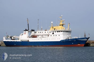
DANA
Fishery Research Vessel
Current Trip
RESEARCH
| Time Travelled | 3 days |
|---|---|
| Remaining Time | --- |
| Distance Travelled | 193.56 nm |
| Remaining Distance | --- |
| AVG Speed | 9.3 Knopen |
| MAX Speed | 11.8 Knopen |
| AVG Wind | 17.7 knots |
| MAX Wind | 25.8 knots |
| MIN Temp | 6.5°C / 43.7°F |
| MAX Temp | 12.4°C / 54.32°F |
| Diepgang | 6 M |
| Positie ontvangen | 28 m geleden |
Current Position
| Lengtegraad | 18.09334° |
|---|---|
| Breedtegraat | 70.72129° |
| Status | Under way using engine |
| Snelheid | 6.7 Knopen |
| Koers | 60.7° |
| Gebied | Norwegian Sea |
| Station | T-AIS |
| Positie ontvangen | 28 m geleden |
Info
Information
The current position of DANA is in Norwegian Sea with coordinates 70.72129° / 18.09334° as reported on 2024-05-17 12:45 by AIS to our vessel tracker app. The vessel's current speed is 6.7 Knopen
The vessel DANA (IMO: 7912680, MMSI: 219384000) is a Fishery Research Vessel that was built in 1981 ( 43 Jaar oud ). It's sailing under the flag of [DK] Denmark.
In this page you can find informations about the vessels current position, last detected port calls, and current voyage information. If the vessels is not in coverage by AIS you will find the latest position.
The current position of DANA is detected by our AIS receivers and we are not responsible for the reliability of the data. The last position was recorded while the vessel was in Coverage by the Ais receivers of our vessel tracking app.
The current draught of DANA as reported by AIS is 6 meters
Weather
| Temperature | 6.4°C / 43.52°F |
|---|---|
| Wind Speed | 14 knots |
| Direction | 140° SE |
| Pressure | 1013.3 hPa |
| Humidity | 91.8 % |
| Cloud Coverage | 82 % |
Featured Company
Last Port Calls
| Port | Arrival | Departure | Time In Port |
|---|---|---|---|
| 2024-05-13 11:21 | 2024-05-14 13:02 | 1 d | |
| 2024-04-18 03:55 | 2024-04-29 10:39 | 11 d | |
| 2024-03-23 07:10 | 2024-04-15 22:24 | 23 d | |
| 2024-03-22 05:42 | 2024-03-22 13:19 | 7 h | |
| 2024-03-13 18:59 | 2024-03-14 14:27 | 19 h | |
| 2024-03-06 07:39 | 2024-03-06 12:46 | 5 h | |
| 2024-03-05 14:12 |
Last Trips
| Origin | Departure | Destination | Arrival | Distance | |
|---|---|---|---|---|---|
| 2024-04-29 12:39 | 2024-05-13 13:21 | 1109.74 nm | |||
| 2024-04-16 00:24 | 2024-04-18 05:55 | 131.70 nm | |||
| 2024-03-22 14:19 | 2024-03-23 08:10 | 181.34 nm | |||
| 2024-03-14 15:27 | 2024-03-22 06:42 | 811.13 nm | |||
| 2024-03-06 13:46 | 2024-03-13 19:59 | 393.09 nm | |||
| 2024-03-05 15:12 | 2024-03-06 08:39 | 177.19 nm |
Events
| Tijd | Evenement | Details | Positie / Bestemming | Info |
|---|---|---|---|---|
| 2024-05-17 12:45 | Binnenbereik |
70.72129 / 18.09334
Norwegian Sea
RESEARCH
|
Snelheid: 6.7 kn Koers: 60.7° |
|
| 2024-05-15 06:07 | Buitenbereik |
70.20511 / 15.64447
Norwegian Sea
RESEARCH
|
Snelheid: 9.2 kn Koers: 274.4° |
|
| 2024-05-15 03:40 | Status Changed | Under way using engine Engaged in Fishing |
70.17937 / 16.62751
RESEARCH
|
Snelheid: 1.8 kn Koers: 217° |
| 2024-05-15 01:46 | Status Changed | Engaged in Fishing Under way using engine |
70.19233 / 16.30195
RESEARCH
|
Snelheid: 7.8 kn Koers: 8° |
| 2024-05-14 13:02 | Vertrekhaven |
|
69.68350 / 19.01698
RESEARCH
|
Snelheid: 9.7 kn Koers: 59° |
| 2024-05-14 13:00 | Start beweging |
69.68006 / 19.00183
[NO] TROMSO
|
Snelheid: 4.1 kn Koers: 53° |
|
| 2024-05-14 12:50 | Status Changed | Under way using engine Moored |
69.67966 / 18.99694
[NO] TROMSO
|
Snelheid: Koers: 229° |
| 2024-05-14 12:50 | Destination Changed | RESEARCH TROMSOE |
69.67966 / 18.99694
[NO] TROMSO
|
Snelheid: Koers: 229° |
| 2024-05-14 12:50 | ETA Changed | 2024/05/27 14:00 2024/05/13 14:00 |
69.67966 / 18.99694
[NO] TROMSO
|
Snelheid: Koers: 229° |
| 2024-05-13 11:45 | Status Changed | Moored Under way using engine |
69.67966 / 18.99694
[NO] TROMSO
|
Snelheid: Koers: 229° |