
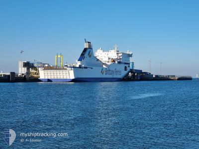
COTENTIN
Ro-Ro/Passenger Ship
Current Trip
| Time Travelled | 10 h, 5 mins |
|---|---|
| Remaining Time | 7 h, 42 mins |
| Distance Travelled | 183.41 nm |
| Remaining Distance | 135.77 nm |
| AVG Speed | 18.3 Knopen |
| MAX Speed | 20.8 Knopen |
| AVG Wind | 10.1 knots |
| MAX Wind | 12.3 knots |
| MIN Temp | 14.9°C / 58.82°F |
| MAX Temp | 17.2°C / 62.96°F |
| Diepgang | 5.5 M |
| Positie ontvangen | 1 m geleden |
Current Position
| Lengtegraad | -5.89262° |
|---|---|
| Breedtegraat | 50.15988° |
| Status | Under way using engine |
| Snelheid | 17.6 Knopen |
| Koers | 357.6° |
| Gebied | Celtic Sea |
| Station | T-AIS |
| Positie ontvangen | 1 m geleden |
Info
Information
The current position of COTENTIN is in Celtic Sea with coordinates 50.15988° / -5.89262° as reported on 2024-07-27 05:53 by AIS to our vessel tracker app. The vessel's current speed is 17.6 Knopen and is heading at the port of ROSSLARE. The estimated time of arrival as calculated by MyShipTracking vessel tracking app is 2024-07-27 13:36 LT
The vessel COTENTIN (IMO: 9364978, MMSI: 228263800) is a Ro-Ro/Passenger Ship that was built in 2007 ( 17 Jaar oud ). It's sailing under the flag of [FR] France.
In this page you can find informations about the vessels current position, last detected port calls, and current voyage information. If the vessels is not in coverage by AIS you will find the latest position.
The current position of COTENTIN is detected by our AIS receivers and we are not responsible for the reliability of the data. The last position was recorded while the vessel was in Coverage by the Ais receivers of our vessel tracking app.
The current draught of COTENTIN as reported by AIS is 5.5 meters
Weather
| Temperature | 15.9°C / 60.62°F |
|---|---|
| Wind Speed | 13 knots |
| Direction | 257° WSW |
| Pressure | 1013.2 hPa |
| Humidity | 74.1 % |
| Cloud Coverage | 9 % |
Featured Company
Last Port Calls
| Port | Arrival | Departure | Time In Port |
|---|---|---|---|
| 2024-07-26 16:45 | 2024-07-26 19:49 | 3 h | |
| 2024-07-26 05:45 | 2024-07-26 11:36 | 5 h | |
| 2024-07-25 16:02 | 2024-07-25 19:13 | 3 h | |
| 2024-07-25 05:43 | 2024-07-25 10:33 | 4 h | |
| 2024-07-24 16:04 | 2024-07-24 19:13 | 3 h | |
| 2024-07-24 05:45 | 2024-07-24 10:32 | 4 h | |
| 2024-07-23 15:47 | 2024-07-23 19:03 | 3 h | |
| 2024-07-23 05:48 | 2024-07-23 10:35 | 4 h | |
| 2024-07-22 16:01 | 2024-07-22 19:10 | 3 h | |
| 2024-07-22 05:46 | 2024-07-22 10:45 | 4 h |
Most Visited Ports (Last year)
| Port | Arrivals | |
|---|---|---|
| 251 | ||
| 153 | ||
| 82 | ||
| 64 | ||
| 43 | ||
| 1 |
Last Trips
| Origin | Departure | Destination | Arrival | Distance | |
|---|---|---|---|---|---|
| 2024-07-26 12:36 | 2024-07-26 18:45 | 74.47 nm | |||
| 2024-07-25 21:13 | 2024-07-26 06:45 | 101.78 nm | |||
| 2024-07-25 11:33 | 2024-07-25 18:02 | 93.08 nm | |||
| 2024-07-24 21:13 | 2024-07-25 06:43 | 103.10 nm | |||
| 2024-07-24 11:32 | 2024-07-24 18:04 | 93.45 nm | |||
| 2024-07-23 21:03 | 2024-07-24 06:45 | 105.86 nm | |||
| 2024-07-23 11:35 | 2024-07-23 17:47 | 93.32 nm | |||
| 2024-07-22 21:10 | 2024-07-23 06:48 | 102.18 nm | |||
| 2024-07-22 11:45 | 2024-07-22 18:01 | 91.70 nm | |||
| 2024-07-21 23:12 | 2024-07-22 06:46 | 83.94 nm |
Events
| Tijd | Evenement | Details | Positie / Bestemming | Info |
|---|---|---|---|---|
| 2024-07-27 05:04 | Status Changed | Under way using engine Default |
49.98380 / -5.74857
IE ROE
|
Snelheid: 17 kn Koers: 282° |
| 2024-07-27 05:01 | Status Changed | Default Under way using engine |
49.98163 / -5.73011
IE ROE
|
Snelheid: 16.9 kn Koers: 280.4° |
| 2024-07-27 04:48 | Wijzig zee gebeid | United Kingdom part of the Celtic Sea United Kingdom part of the English Channel |
49.97004 / -5.63886
Celtic Sea
IE ROE
|
Snelheid: 16.7 kn Koers: 285.6° |
| 2024-07-26 23:06 | Wijzig zee gebeid | United Kingdom part of the English Channel Guernsey part of the English Channel |
50.01578 / -2.97263
English Channel
IE ROE
|
Snelheid: 19.1 kn Koers: 251.9° |
| 2024-07-26 23:03 | Status Changed | Under way using engine Default |
50.02042 / -2.95078
IE ROE
|
Snelheid: 19 kn Koers: 254° |
| 2024-07-26 23:01 | Status Changed | Default Under way using engine |
50.02302 / -2.93657
IE ROE
|
Snelheid: 18.9 kn Koers: 255.2° |
| 2024-07-26 21:51 | Destination Changed | IE ROE FR CER |
50.04789 / -2.38200
IE ROE
|
Snelheid: 19.1 kn Koers: 307.6° |
| 2024-07-26 21:51 | ETA Changed | 2024/07/27 13:00 2024/07/26 17:00 |
50.04789 / -2.38200
IE ROE
|
Snelheid: 19.1 kn Koers: 307.6° |
| 2024-07-26 21:28 | Status Changed | Under way using engine Default |
49.96804 / -2.23299
FR CER
|
Snelheid: 20.4 kn Koers: 312° |
| 2024-07-26 21:17 | Status Changed | Default Under way using engine |
49.92912 / -2.15930
FR CER
|
Snelheid: 20.5 kn Koers: 304.4° |