
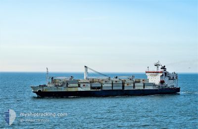
COTE D IVOIRIAN STAR
Reefer
Current Trip
| Time Travelled | 4 days |
|---|---|
| Remaining Time | 2 days |
| Distance Travelled | 1434.78 nm |
| Remaining Distance | 975.99 nm |
| AVG Speed | 14.7 Knopen |
| MAX Speed | 18 Knopen |
| AVG Wind | 15.9 knots |
| MAX Wind | 23.8 knots |
| MIN Temp | 17.4°C / 63.32°F |
| MAX Temp | 26.6°C / 79.88°F |
| Diepgang | 9 M |
| Positie ontvangen | 1 d geleden |
Current Position
| Lengtegraad | --- |
|---|---|
| Breedtegraat | --- |
| Status | Under way using engine |
| Snelheid | 14.4 Knopen |
| Koers | 15.8° |
| Gebied | North Atlantic Ocean |
| Station | T-AIS |
| Positie ontvangen | 1 d geleden |
Info
Information
The current position of COTE D IVOIRIAN STAR is in North Atlantic Ocean with coordinates 30.72914° / -14.98811° as reported on 2025-12-03 23:54 by AIS to our vessel tracker app. The vessel's current speed is 14.4 Knopen and is heading at the port of PORTSMOUTH. The estimated time of arrival as calculated by MyShipTracking vessel tracking app is 2025-12-08 01:25 LT
The vessel COTE D IVOIRIAN STAR (IMO: 9172478, MMSI: 636014241) is a Reefer that was built in 1998 ( 27 Jaar oud ). It's sailing under the flag of [LR] Liberia.
In this page you can find informations about the vessels current position, last detected port calls, and current voyage information. If the vessels is not in coverage by AIS you will find the latest position.
The current position of COTE D IVOIRIAN STAR is detected by our AIS receivers and we are not responsible for the reliability of the data. The last position was recorded while the vessel was in Coverage by the Ais receivers of our vessel tracking app.
The current draught of COTE D IVOIRIAN STAR as reported by AIS is 9 meters
Weather
| Temperature | 17.9°C / 64.22°F |
|---|---|
| Wind Speed | 17 knots |
| Direction | 264° W |
| Pressure | 1022 hPa |
| Humidity | 83.2 % |
| Cloud Coverage | 50 % |
Featured Company
Last Port Calls
| Port | Arrival | Departure | Time In Port |
|---|---|---|---|
| 2025-11-30 23:01 | 2025-12-01 05:46 | 6 h | |
| 2025-11-27 04:25 | 2025-11-28 00:51 | 20 h | |
| 2025-11-25 07:12 | 2025-11-26 07:25 | 1 d | |
| 2025-11-21 19:44 | 2025-11-23 06:13 | 1 d | |
| 2025-11-18 05:47 | 2025-11-19 13:34 | 1 d | |
| 2025-11-06 03:52 | 2025-11-09 00:50 | 2 d | |
| 2025-11-04 07:05 | 2025-11-05 07:14 | 1 d | |
| 2025-10-25 17:42 | 2025-10-26 17:26 | 23 h | |
| 2025-10-23 03:52 | 2025-10-24 00:40 | 20 h | |
| 2025-10-20 06:12 | 2025-10-21 05:28 | 23 h |
Last Trips
| Origin | Departure | Destination | Arrival | Distance | |
|---|---|---|---|---|---|
| 2025-11-28 00:51 | 2025-11-30 23:01 | 1177.71 nm | |||
| 2025-11-26 07:25 | 2025-11-27 04:25 | 278.64 nm | |||
| 2025-11-23 06:13 | 2025-11-25 07:12 | 703.03 nm | |||
| 2025-11-19 13:34 | 2025-11-21 19:44 | 896.55 nm | |||
| 2025-11-09 00:50 | 2025-11-18 05:47 | 3787.36 nm | |||
| 2025-11-05 07:14 | 2025-11-06 03:52 | 247.35 nm | |||
| 2025-10-26 17:26 | 2025-11-04 07:05 | 3572.04 nm | |||
| 2025-10-24 00:40 | 2025-10-25 17:42 | 305.87 nm | |||
| 2025-10-21 05:28 | 2025-10-23 03:52 | 692.67 nm | |||
| 2025-10-17 19:50 | 2025-10-20 06:12 | 899.89 nm |
Events
| Tijd | Evenement | Details | Positie / Bestemming | Info |
|---|---|---|---|---|
| 2025-12-03 23:58 | Status Changed | Default Under way using engine |
30.74500 / -14.98167
GBPME
|
Snelheid: 14.4 kn Koers: 15.8° |
| 2025-12-03 23:54 | Buitenbereik |
30.72914 / -14.98811
North Atlantic Ocean
GBPME
|
Snelheid: 14.4 kn Koers: 15.8° |
|
| 2025-12-03 23:02 | Status Changed | Under way using engine Default |
30.52759 / -15.05505
GBPME
|
Snelheid: 14.7 kn Koers: 16° |
| 2025-12-03 22:56 | Status Changed | Default Under way using engine |
30.50149 / -15.06344
GBPME
|
Snelheid: 14.6 kn Koers: 15.3° |
| 2025-12-03 22:50 | Status Changed | Under way using engine Default |
30.47751 / -15.07104
GBPME
|
Snelheid: 14.7 kn Koers: 15° |
| 2025-12-03 22:44 | Binnenbereik |
30.47751 / -15.07104
North Atlantic Ocean
GBPME
|
Snelheid: 14.6 kn Koers: 15.3° |
|
| 2025-12-03 18:51 | Status Changed | Default Under way using engine |
29.54109 / -15.37193
GBPME
|
Snelheid: 14.5 kn Koers: 14.5° |
| 2025-12-03 18:49 | Buitenbereik |
29.53505 / -15.37402
North Atlantic Ocean
GBPME
|
Snelheid: 14.5 kn Koers: 14.5° |
|
| 2025-12-03 18:44 | Status Changed | Under way using engine Default |
29.51568 / -15.38035
GBPME
|
Snelheid: 14.2 kn Koers: 16° |
| 2025-12-03 18:15 | Status Changed | Default Under way using engine |
29.39966 / -15.41738
GBPME
|
Snelheid: 14.6 kn Koers: 16.2° |