
COMMON ATLAS
Cargo
Current Trip
| Time Travelled | 32 days |
|---|---|
| Remaining Time | --- |
| Distance Travelled | 8628.73 nm |
| Remaining Distance | --- |
| AVG Speed | 11.2 Knopen |
| MAX Speed | 16.2 Knopen |
| AVG Wind | 12.9 knots |
| MAX Wind | 38 knots |
| MIN Temp | 4.8°C / 40.64°F |
| MAX Temp | 28.6°C / 83.48°F |
| Diepgang | 12.3 M |
| Positie ontvangen | 10 h, 41 m geleden |
Current Position
| Lengtegraad | 34.26202° |
|---|---|
| Breedtegraat | -31.20001° |
| Status | Under way using engine |
| Snelheid | 11.4 Knopen |
| Koers | 66.3° |
| Gebied | Indian Ocean |
| Station | T-AIS |
| Positie ontvangen | 10 h, 41 m geleden |
Info
Information
The current position of COMMON ATLAS is in Indian Ocean with coordinates -31.20001° / 34.26202° as reported on 2024-06-05 17:56 by AIS to our vessel tracker app. The vessel's current speed is 11.4 Knopen and is heading at the port of KRISHNAPATNAM. The estimated time of arrival as calculated by MyShipTracking vessel tracking app is 2024-06-20 11:00 LT
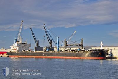
The vessel COMMON ATLAS (IMO: 9669378, MMSI: 538009334) is a Cargo It's sailing under the flag of [MH] Marshall Is.
In this page you can find informations about the vessels current position, last detected port calls, and current voyage information. If the vessels is not in coverage by AIS you will find the latest position.
The current position of COMMON ATLAS is detected by our AIS receivers and we are not responsible for the reliability of the data. The last position was recorded while the vessel was in Coverage by the Ais receivers of our vessel tracking app.
The current draught of COMMON ATLAS as reported by AIS is 12.3 meters
Weather
| Temperature | 22.7°C / 72.86°F |
|---|---|
| Wind Speed | 7 knots |
| Direction | 41° NE |
| Pressure | 1014.1 hPa |
| Humidity | 61.5 % |
| Cloud Coverage | --- |
Featured Company
Events
| Tijd | Evenement | Details | Positie / Bestemming | Info |
|---|---|---|---|---|
| 2024-06-05 18:03 | Status Changed | Default Under way using engine |
-31.19144 / 34.28271
KRISHNAPATNAM
|
Snelheid: 11.4 kn Koers: 66.3° |
| 2024-06-05 17:56 | Buitenbereik |
-31.20001 / 34.26202
Indian Ocean
KRISHNAPATNAM
|
Snelheid: 11.4 kn Koers: 66.3° |
|
| 2024-06-05 16:49 | Destination Changed | KRISHNAPATNAM SINGAPORE |
-31.29565 / 34.03288
KRISHNAPATNAM
|
Snelheid: 11.6 kn Koers: 64° |
| 2024-06-05 16:49 | ETA Changed | 2024/06/20 11:00 2024/06/21 10:00 |
-31.29565 / 34.03288
KRISHNAPATNAM
|
Snelheid: 11.6 kn Koers: 64° |
| 2024-06-05 16:02 | Gevonden in zee | South African part of the Indian Ocean |
-31.36123 / 33.87440
Indian Ocean
SINGAPORE
|
Snelheid: 11.8 kn Koers: 62.8° |
| 2024-06-05 16:00 | Status Changed | Under way using engine Default |
-31.36431 / 33.86697
SINGAPORE
|
Snelheid: 11.5 kn Koers: 61° |
| 2024-06-05 16:00 | Binnenbereik |
-31.36123 / 33.87440
Indian Ocean
SINGAPORE
|
Snelheid: 11.8 kn Koers: 62.8° |
|
| 2024-06-01 10:27 | Status Changed | Default Under way using engine |
-34.75633 / 19.20435
SINGAPORE
|
Snelheid: 11.4 kn Koers: 106.9° |
| 2024-06-01 10:23 | Buitenbereik |
-34.75198 / 19.19066
South Atlantic Ocean
SINGAPORE
|
Snelheid: 11.4 kn Koers: 106.9° |
|
| 2024-06-01 10:16 | Status Changed | Under way using engine Default |
-34.74367 / 19.16472
SINGAPORE
|
Snelheid: 11.4 kn Koers: 112° |