
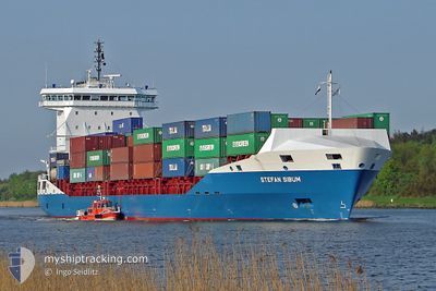
CMA CGM DAKHLA
Container Ship
Current Trip
| Time Travelled | 6 h, 6 mins |
|---|---|
| Remaining Time | 6 h, 19 mins |
| Distance Travelled | 89.43 nm |
| Remaining Distance | 101.98 nm |
| AVG Speed | 14.5 Knopen |
| MAX Speed | 17.8 Knopen |
| AVG Wind | 2.2 knots |
| MAX Wind | 4.7 knots |
| MIN Temp | 16°C / 60.8°F |
| MAX Temp | 18.1°C / 64.58°F |
| Diepgang | 8.2 M |
| Positie ontvangen | 4 h, 5 m geleden |
Current Position
| Lengtegraad | --- |
|---|---|
| Breedtegraat | --- |
| Status | Under way using engine |
| Snelheid | 14.9 Knopen |
| Koers | 228.5° |
| Gebied | North Atlantic Ocean |
| Station | T-AIS |
| Positie ontvangen | 4 h, 5 m geleden |
Info
Information
The current position of CMA CGM DAKHLA is in North Atlantic Ocean with coordinates 35.90848° / -6.04709° as reported on 2025-12-08 14:02 by AIS to our vessel tracker app. The vessel's current speed is 14.9 Knopen and is heading at the port of CASABLANCA. The estimated time of arrival as calculated by MyShipTracking vessel tracking app is 2025-12-09 01:26 LT
The vessel CMA CGM DAKHLA (IMO: 9461594, MMSI: 242377400) is a Container Ship that was built in 2008 ( 17 Jaar oud ). It's sailing under the flag of [MA] Morocco.
In this page you can find informations about the vessels current position, last detected port calls, and current voyage information. If the vessels is not in coverage by AIS you will find the latest position.
The current position of CMA CGM DAKHLA is detected by our AIS receivers and we are not responsible for the reliability of the data. The last position was recorded while the vessel was in Coverage by the Ais receivers of our vessel tracking app.
The current draught of CMA CGM DAKHLA as reported by AIS is 8.2 meters
Weather
| Temperature | 18.1°C / 64.58°F |
|---|---|
| Wind Speed | 5 knots |
| Direction | 5° N |
| Pressure | 1021.2 hPa |
| Humidity | 58.9 % |
| Cloud Coverage | 11 % |
Featured Company
Last Port Calls
| Port | Arrival | Departure | Time In Port |
|---|---|---|---|
| 2025-12-07 02:16 | 2025-12-08 13:01 | 1 d | |
| 2025-12-03 00:43 | 2025-12-04 11:23 | 1 d | |
| 2025-11-26 12:06 | 2025-11-27 15:35 | 1 d | |
| 2025-11-23 21:38 | 2025-11-24 19:04 | 21 h | |
| 2025-11-23 08:10 | 2025-11-23 16:01 | 7 h | |
| 2025-11-18 04:02 | 2025-11-20 05:10 | 2 d | |
| 2025-11-15 14:34 | 2025-11-16 21:51 | 1 d | |
| 2025-11-11 00:08 | 2025-11-12 07:41 | 1 d | |
| 2025-11-04 20:28 | 2025-11-05 15:07 | 18 h | |
| 2025-11-01 16:58 | 2025-11-02 15:46 | 22 h |
Most Visited Ports (Last year)
| Port | Arrivals | |
|---|---|---|
| 33 | ||
| 29 | ||
| 28 | ||
| 12 | ||
| 1 | ||
| 1 |
Last Trips
| Origin | Departure | Destination | Arrival | Distance | |
|---|---|---|---|---|---|
| 2025-12-04 11:23 | 2025-12-07 02:16 | 616.49 nm | |||
| 2025-11-27 15:35 | 2025-12-03 00:43 | 296.77 nm | |||
| 2025-11-24 19:04 | 2025-11-26 12:06 | 228.21 nm | |||
| 2025-11-23 16:01 | 2025-11-23 21:38 | 44.21 nm | |||
| 2025-11-20 05:10 | 2025-11-23 08:10 | 569.58 nm | |||
| 2025-11-16 21:51 | 2025-11-18 04:02 | 280.05 nm | |||
| 2025-11-12 07:41 | 2025-11-15 14:34 | 219.63 nm | |||
| 2025-11-05 15:07 | 2025-11-11 00:08 | 740.74 nm | |||
| 2025-11-02 15:46 | 2025-11-04 20:28 | 281.82 nm | |||
| 2025-11-01 03:51 | 2025-11-01 16:58 | 189.76 nm |
Events
| Tijd | Evenement | Details | Positie / Bestemming | Info |
|---|---|---|---|---|
| 2025-12-08 14:07 | Status Changed | Default Under way using engine |
35.89129 / -6.05743
MACAS
|
Snelheid: 14.9 kn Koers: 228.5° |
| 2025-12-08 14:02 | Buitenbereik |
35.90848 / -6.04709
North Atlantic Ocean
MACAS
|
Snelheid: 14.9 kn Koers: 228.5° |
|
| 2025-12-08 13:47 | Wijzig zee gebeid | Moroccan part of the North Atlantic Ocean Moroccan part of the Strait of Gibraltar |
35.91983 / -5.96723
North Atlantic Ocean
MACAS
|
Snelheid: 15.6 kn Koers: 263.6° |
| 2025-12-08 13:38 | Status Changed | Under way using engine Default |
35.92460 / -5.92047
MACAS
|
Snelheid: 15.2 kn Koers: 266° |
| 2025-12-08 13:35 | Status Changed | Default Under way using engine |
35.92581 / -5.90703
MACAS
|
Snelheid: 15.2 kn Koers: 262.3° |
| 2025-12-08 13:18 | Wijzig zee gebeid | Moroccan part of the Strait of Gibraltar Spanish part of the Strait of Gibraltar |
35.93620 / -5.81754
Strait of Gibraltar
MACAS
|
Snelheid: 16 kn Koers: 260° |
| 2025-12-08 13:18 | Status Changed | Under way using engine Default |
35.93620 / -5.81754
MACAS
|
Snelheid: 15.5 kn Koers: 259° |
| 2025-12-08 13:15 | Status Changed | Default Under way using engine |
35.93845 / -5.80375
MACAS
|
Snelheid: 17.8 kn Koers: 268.3° |
| 2025-12-08 12:22 | Wijzig zee gebeid | Spanish part of the Strait of Gibraltar Moroccan part of the Strait of Gibraltar |
35.95476 / -5.54294
Strait of Gibraltar
MACAS
|
Snelheid: 12.7 kn Koers: 281.4° |
| 2025-12-08 12:01 | Vertrekhaven |
|
35.90189 / -5.49220
MACAS
|
Snelheid: 8 kn Koers: 4° |