
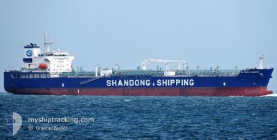
CL EMILY BRONTE
Tanker
Current Trip
| Time Travelled | 13 days |
|---|---|
| Remaining Time | --- |
| Distance Travelled | 4024.93 nm |
| Remaining Distance | --- |
| AVG Speed | 12.4 Knopen |
| MAX Speed | 15.6 Knopen |
| AVG Wind | 12.4 knots |
| MAX Wind | 18.6 knots |
| MIN Temp | 25°C / 77°F |
| MAX Temp | 30.3°C / 86.54°F |
| Diepgang | 12.6 M |
| Positie ontvangen | 8 d geleden |
Current Position
| Lengtegraad | -66.71458° |
|---|---|
| Breedtegraat | 19.77361° |
| Status | Under way using engine |
| Snelheid | 12.6 Knopen |
| Koers | 90.8° |
| Gebied | North Atlantic Ocean |
| Station | T-AIS |
| Positie ontvangen | 8 d geleden |
Info
Information
The current position of CL EMILY BRONTE is in North Atlantic Ocean with coordinates 19.77361° / -66.71458° as reported on 2024-06-08 23:40 by AIS to our vessel tracker app. The vessel's current speed is 12.6 Knopen and is heading at the port of KWINANA. The estimated time of arrival as calculated by MyShipTracking vessel tracking app is 2024-07-13 10:00 LT
The vessel CL EMILY BRONTE (IMO: 9943322, MMSI: 636022160) is a Tanker It's sailing under the flag of [LR] Liberia.
In this page you can find informations about the vessels current position, last detected port calls, and current voyage information. If the vessels is not in coverage by AIS you will find the latest position.
The current position of CL EMILY BRONTE is detected by our AIS receivers and we are not responsible for the reliability of the data. The last position was recorded while the vessel was in Coverage by the Ais receivers of our vessel tracking app.
The current draught of CL EMILY BRONTE as reported by AIS is 12.6 meters
Weather
| Temperature | 27.2°C / 80.96°F |
|---|---|
| Wind Speed | 17 knots |
| Direction | 113° ESE |
| Pressure | 1011.4 hPa |
| Humidity | 73.2 % |
| Cloud Coverage | 6 % |
Featured Company
Last Port Calls
| Port | Arrival | Departure | Time In Port |
|---|---|---|---|
| 2024-06-03 18:41 | 2024-06-03 22:09 | 3 h | |
| 2024-05-31 15:39 | 2024-06-01 12:36 | 20 h | |
| 2024-05-21 19:26 | 2024-05-22 16:02 | 20 h | |
| 2024-04-30 09:13 | 2024-05-05 21:00 | 5 d | |
| 2024-04-24 23:20 | 2024-04-28 00:01 | 3 d | |
| 2024-04-13 06:22 | 2024-04-14 17:26 | 1 d | |
| 2024-04-06 17:18 | 2024-04-09 06:53 | 2 d | |
| 2024-04-01 13:33 |
Most Visited Ports (Last year)
| Port | Arrivals | |
|---|---|---|
| 2 | ||
| 2 | ||
| 1 | ||
| 1 | ||
| 1 | ||
| 1 |
Last Trips
| Origin | Departure | Destination | Arrival | Distance | |
|---|---|---|---|---|---|
| 2024-06-01 07:36 | 2024-06-03 13:41 | 88.17 nm | |||
| 2024-05-22 12:02 | 2024-05-31 10:39 | 2169.83 nm | |||
| 2024-05-05 23:00 | 2024-05-21 15:26 | 3498.31 nm | |||
| 2024-04-28 02:01 | 2024-04-30 11:13 | 213.07 nm | |||
| 2024-04-14 19:26 | 2024-04-25 01:20 | 2512.09 nm | |||
| 2024-04-09 08:53 | 2024-04-13 08:22 | 842.61 nm | |||
| 2024-04-01 15:33 | 2024-04-06 19:18 | 849.05 nm |
Events
| Tijd | Evenement | Details | Positie / Bestemming | Info |
|---|---|---|---|---|
| 2024-06-08 23:46 | Status Changed | Default Under way using engine |
19.77325 / -66.69301
AU KWI
|
Snelheid: 12.6 kn Koers: 90.8° |
| 2024-06-08 23:40 | Buitenbereik |
19.77361 / -66.71458
North Atlantic Ocean
|
Snelheid: 12.6 kn Koers: 90.8° |
|
| 2024-06-08 23:35 | Status Changed | Under way using engine Default |
19.77390 / -66.73563
AU KWI
|
Snelheid: 12.6 kn Koers: 91° |
| 2024-06-08 23:24 | Status Changed | Default Under way using engine |
19.77447 / -66.77527
AU KWI
|
Snelheid: 12.5 kn Koers: 90.4° |
| 2024-06-08 23:22 | Status Changed | Under way using engine Default |
19.77452 / -66.78143
AU KWI
|
Snelheid: 12.5 kn Koers: 91° |
| 2024-06-08 23:22 | Gevonden in zee | Puerto Rican part of the North Atlantic Ocean |
19.77452 / -66.78143
North Atlantic Ocean
|
Snelheid: 12.5 kn Koers: 90.4° |
| 2024-06-08 23:05 | Binnenbereik |
19.77452 / -66.78143
North Atlantic Ocean
|
Snelheid: 12.5 kn Koers: 90.4° |