
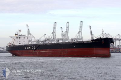
CIELO D'ITALIA
Cargo
Current Trip
| Time Travelled | 21 days |
|---|---|
| Remaining Time | --- |
| Distance Travelled | 3613.59 nm |
| Remaining Distance | --- |
| AVG Speed | 9.9 Knopen |
| MAX Speed | 13.8 Knopen |
| AVG Wind | 11.2 knots |
| MAX Wind | 25.4 knots |
| MIN Temp | 13.7°C / 56.66°F |
| MAX Temp | 30.4°C / 86.72°F |
| Diepgang | 15.6 M |
| Positie ontvangen | 20 d geleden |
Current Position
| Lengtegraad | 117.82084° |
|---|---|
| Breedtegraat | -17.38838° |
| Status | Under way using engine |
| Snelheid | 10.3 Knopen |
| Koers | 344.3° |
| Gebied | Indian Ocean |
| Station | T-AIS |
| Positie ontvangen | 20 d geleden |
Info
Information
The current position of CIELO D'ITALIA is in Indian Ocean with coordinates -17.38838° / 117.82084° as reported on 2024-04-28 17:16 by AIS to our vessel tracker app. The vessel's current speed is 10.3 Knopen and is heading at the port of QINGDAO. The estimated time of arrival as calculated by MyShipTracking vessel tracking app is 2024-05-12 20:00 LT
The vessel CIELO D'ITALIA (IMO: 9539274, MMSI: 636019932) is a Cargo It's sailing under the flag of [LR] Liberia.
In this page you can find informations about the vessels current position, last detected port calls, and current voyage information. If the vessels is not in coverage by AIS you will find the latest position.
The current position of CIELO D'ITALIA is detected by our AIS receivers and we are not responsible for the reliability of the data. The last position was recorded while the vessel was in Coverage by the Ais receivers of our vessel tracking app.
The current draught of CIELO D'ITALIA as reported by AIS is 15.6 meters
Weather
| Temperature | 24.7°C / 76.46°F |
|---|---|
| Wind Speed | 12 knots |
| Direction | 103° ESE |
| Pressure | 1009.6 hPa |
| Humidity | 55.8 % |
| Cloud Coverage | 100 % |
Featured Company
Last Port Calls
| Port | Arrival | Departure | Time In Port |
|---|---|---|---|
| 2024-04-26 16:03 | 2024-04-28 08:20 | 1 d | |
| 2024-04-07 11:51 | 2024-04-10 19:12 | 3 d | |
| 2024-03-22 15:26 | 2024-03-23 23:35 | 1 d | |
| 2024-03-02 10:12 |
Most Visited Ports (Last year)
| Port | Arrivals | |
|---|---|---|
| 2 | ||
| 2 | ||
| 1 | ||
| 1 | ||
| 1 | ||
| 1 |
Last Trips
| Origin | Departure | Destination | Arrival | Distance | |
|---|---|---|---|---|---|
| 2024-04-10 19:12 | 2024-04-26 16:03 | 2913.46 nm | |||
| 2024-03-23 23:35 | 2024-04-07 11:51 | 2873.74 nm | |||
| 2024-02-18 07:15 | 2024-03-02 10:12 | 20.21 nm |
Events
| Tijd | Evenement | Details | Positie / Bestemming | Info |
|---|---|---|---|---|
| 2024-05-19 10:48 | Stop beweging | 0.78 nm, South East of JIANGSU HANTONG |
32.11326 / 119.91283
CNQDG
|
Snelheid: 0.2 kn Koers: 355° |
| 2024-05-19 08:24 | Start beweging | 10.68 nm, South West of GAOGANG |
32.21048 / 119.66484
CNQDG
|
Snelheid: 6.3 kn Koers: 23° |
| 2024-05-17 05:24 | Stop beweging | 10.84 nm, South West of GAOGANG |
32.20462 / 119.66481
CNQDG
|
Snelheid: 0.2 kn Koers: 228° |
| 2024-05-16 02:41 | Start beweging |
31.18765 / 122.74428
CNQDG
|
Snelheid: 6.5 kn Koers: 159° |
|
| 2024-05-15 21:17 | Stop beweging |
31.20333 / 122.73666
CNQDG
|
Snelheid: Koers: -1° |
|
| 2024-05-15 08:36 | Start beweging |
29.75226 / 122.91070
CNQDG
|
Snelheid: 4 kn Koers: 11° |
|
| 2024-05-15 06:35 | Stop beweging |
29.74833 / 122.90667
CNQDG
|
Snelheid: Koers: -1° |
|
| 2024-05-15 01:24 | Start beweging | 7.46 nm, South West of ZHOUSHAN |
29.89795 / 122.08074
CNQDG
|
Snelheid: 4.1 kn Koers: 20° |
| 2024-05-12 02:36 | Stop beweging | 7.83 nm, South West of ZHOUSHAN |
29.89346 / 122.07565
CNQDG
|
Snelheid: 0.1 kn Koers: 80° |
| 2024-05-11 19:36 | Start beweging |
29.78166 / 122.73825
CNQDG
|
Snelheid: 3.5 kn Koers: 254° |