
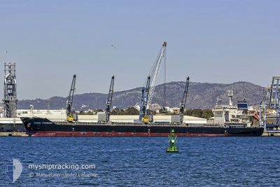
CHIOS FREEDOM
Cargo
Current Trip
| Trip Time | 22 days |
|---|---|
| Trip Distance | 3645.18 nm |
| AVG Speed | 11.5 Knopen |
| MAX Speed | 14.1 Knopen |
| Diepgang | 10.1 M |
| AVG Wind | 10 knots |
| MAX Wind | 21.8 knots |
| MIN Temp | 15.8°C / 60.44°F |
| MAX Temp | 33.7°C / 92.66°F |
| Positie ontvangen | 1 d geleden |
Current Position
| Lengtegraad | -96.03409° |
|---|---|
| Breedtegraat | 19.13670° |
| Status | At anchor |
| Snelheid | |
| Koers | 80° |
| Gebied | Gulf of Mexico |
| Station | T-AIS |
| Positie ontvangen | 1 d geleden |
Info
Information
The current position of CHIOS FREEDOM is in Gulf of Mexico with coordinates 19.13670° / -96.03409° as reported on 2024-05-11 07:56 by AIS to our vessel tracker app. The vessel's current speed is 0 Knopen and is currently inside the port of VERACRUZ.
The vessel CHIOS FREEDOM (IMO: 9680255, MMSI: 538008925) is a Cargo It's sailing under the flag of [MH] Marshall Is.
In this page you can find informations about the vessels current position, last detected port calls, and current voyage information. If the vessels is not in coverage by AIS you will find the latest position.
The current position of CHIOS FREEDOM is detected by our AIS receivers and we are not responsible for the reliability of the data. The last position was recorded while the vessel was in Coverage by the Ais receivers of our vessel tracking app.
The current draught of CHIOS FREEDOM as reported by AIS is 10.1 meters
Weather
| Temperature | 28.7°C / 83.66°F |
|---|---|
| Wind Speed | 2 knots |
| Direction | 98° E |
| Pressure | 1002.8 hPa |
| Humidity | 68.8 % |
| Cloud Coverage | 100 % |
Featured Company
Last Trips
| Origin | Departure | Destination | Arrival | Distance | |
|---|---|---|---|---|---|
| 2024-04-20 11:40 | 2024-05-12 13:29 | 3645.18 nm | |||
| 2024-03-29 06:05 | 2024-04-16 15:42 | 418.04 nm | |||
| 2024-03-22 09:54 | 2024-03-25 08:11 | 719.70 nm | |||
| 2024-02-22 01:54 | 2024-03-18 19:31 | 5642.58 nm |
Events
| Tijd | Evenement | Details | Positie / Bestemming | Info |
|---|---|---|---|---|
| 2024-05-12 19:02 | Stop beweging |
19.21020 / -96.13351
[MX] VERACRUZ
|
Snelheid: 0.1 kn Koers: 332° |
|
| 2024-05-12 18:29 | Aankomsthaven |
|
19.20333 / -96.12666
[MX] VERACRUZ
|
Snelheid: 6.5 kn Koers: 277° |
| 2024-05-12 17:17 | Start beweging | 4.82 nm, North East of BOCA DEL RIO |
19.14188 / -96.03110
VERACRUZ
|
Snelheid: 3.5 kn Koers: 350° |
| 2024-05-11 08:05 | Status Changed | Default At anchor |
19.13667 / -96.03333
VERACRUZ
|
Snelheid: Koers: 80° |
| 2024-05-11 07:56 | Binnenbereik |
19.13670 / -96.03409
Gulf of Mexico
|
Snelheid: Koers: 87.1° |
|
| 2024-05-11 07:56 | Buitenbereik |
19.13670 / -96.03409
Gulf of Mexico
|
Snelheid: Koers: 87.1° |
|
| 2024-05-11 07:53 | Status Changed | At anchor Default |
19.13671 / -96.03406
VERACRUZ
|
Snelheid: Koers: -1° |
| 2024-05-10 03:31 | Stop beweging | 4.61 nm, North East of BOCA DEL RIO |
19.13754 / -96.03284
VERACRUZ
|
Snelheid: 0.3 kn Koers: 127° |
| 2024-05-10 01:00 | Status Changed | Default Under way using engine |
19.24442 / -95.75829
VERACRUZ
|
Snelheid: 12.1 kn Koers: 272.2° |
| 2024-05-10 00:56 | Buitenbereik |
19.24425 / -95.74146
Gulf of Mexico
VERACRUZ
|
Snelheid: 12.1 kn Koers: 272.2° |